Loading...
Searching...
No Matches
◆ geography_dwithin()
| Datum geography_dwithin | ( | PG_FUNCTION_ARGS | ) |
Definition at line 275 of file geography_measurement.c.
276{
277 GSERIALIZED *g1 = PG_GETARG_GSERIALIZED_P(0);
278 GSERIALIZED *g2 = PG_GETARG_GSERIALIZED_P(1);
280 double tolerance = 0.0;
281 bool use_spheroid = true;
284
285 gserialized_error_if_srid_mismatch(g1, g2, __func__);
286
287 /* Read our tolerance value. */
288 if ( PG_NARGS() > 2 && ! PG_ARGISNULL(2) )
289 tolerance = PG_GETARG_FLOAT8(2);
290
291 /* Read our calculation type. */
292 if ( PG_NARGS() > 3 && ! PG_ARGISNULL(3) )
293 use_spheroid = PG_GETARG_BOOL(3);
294
295 /* Initialize spheroid */
297
298 /* Set to sphere if requested */
299 if ( ! use_spheroid )
301
302 /* Return FALSE on empty arguments. */
304 PG_RETURN_BOOL(false);
305
306 /* Do the brute force calculation if the cached calculation doesn't tick over */
308 {
312 /* Something went wrong... */
314 elog(ERROR, "lwgeom_distance_spheroid returned negative!");
315 dwithin = (distance <= tolerance);
316 lwgeom_free(lwgeom1);
317 lwgeom_free(lwgeom2);
318 }
319
320 PG_FREE_IF_COPY(g1, 0);
321 PG_FREE_IF_COPY(g2, 1);
322 PG_RETURN_BOOL(dwithin);
323}
int geography_dwithin_cache(FunctionCallInfo fcinfo, const GSERIALIZED *g1, const GSERIALIZED *g2, const SPHEROID *s, double tolerance, int *dwithin)
Definition geography_measurement_trees.c:262
void gserialized_error_if_srid_mismatch(const GSERIALIZED *g1, const GSERIALIZED *g2, const char *funcname)
Definition gserialized.c:404
int32_t gserialized_get_srid(const GSERIALIZED *g)
Extract the SRID from the serialized form (it is packed into three bytes so this is a handy function)...
Definition gserialized.c:126
LWGEOM * lwgeom_from_gserialized(const GSERIALIZED *g)
Allocate a new LWGEOM from a GSERIALIZED.
Definition gserialized.c:239
int gserialized_is_empty(const GSERIALIZED *g)
Check if a GSERIALIZED is empty without deserializing first.
Definition gserialized.c:152
double lwgeom_distance_spheroid(const LWGEOM *lwgeom1, const LWGEOM *lwgeom2, const SPHEROID *spheroid, double tolerance)
Calculate the geodetic distance from lwgeom1 to lwgeom2 on the spheroid.
Definition lwgeodetic.c:2187
Definition liblwgeom.h:429
Definition liblwgeom.h:443
Definition liblwgeom.h:360
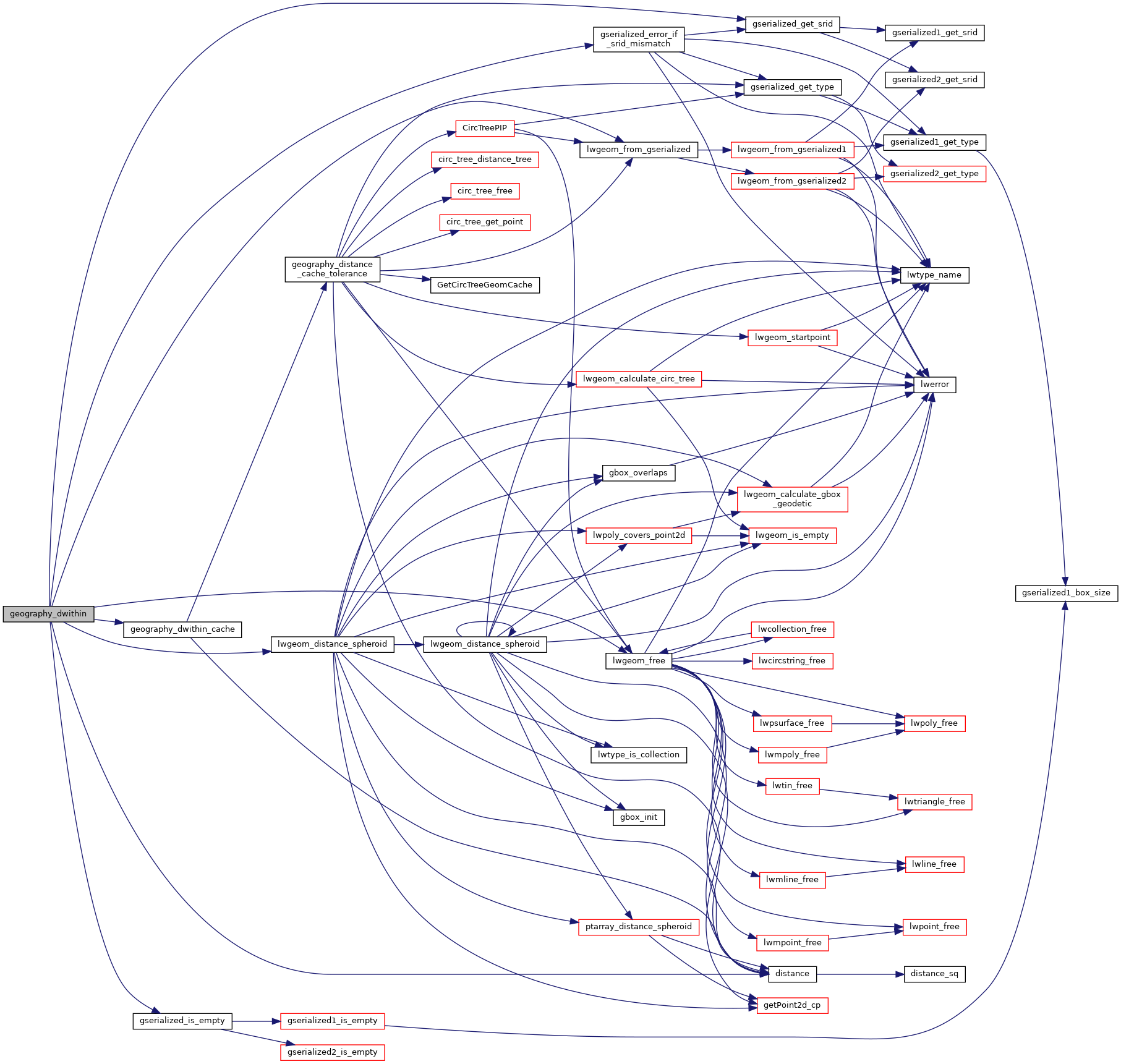
References distance(), geography_dwithin_cache(), gserialized_error_if_srid_mismatch(), gserialized_get_srid(), gserialized_is_empty(), LW_FAILURE, LW_FALSE, lwgeom_distance_spheroid(), lwgeom_free(), lwgeom_from_gserialized(), and s.
Referenced by geography_intersects().
Here is the call graph for this function:
Here is the caller graph for this function: