◆ gserialized_get_type()
| uint32_t gserialized_get_type | ( | const GSERIALIZED * | g | ) |
Extract the geometry type from the serialized form (it hides in the anonymous data area, so this is a handy function).
Definition at line 89 of file gserialized.c.
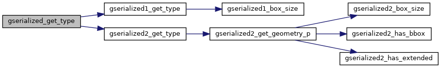
References GSERIALIZED::gflags, GFLAGS_GET_VERSION, gserialized1_get_type(), and gserialized2_get_type().
Referenced by CircTreePIP(), contains(), coveredby(), covers(), geography_azimuth(), geography_distance_cache_tolerance(), geography_perimeter(), geography_project(), geography_segmentize(), geometry_distance_spheroid(), geometry_geometrytype(), geometry_to_path(), geometry_to_point(), geometry_to_polygon(), gserialized_error_if_srid_mismatch(), is_point(), is_poly(), LWGEOM_addpoint(), LWGEOM_angle(), LWGEOM_ChaikinSmoothing(), LWGEOM_collect(), LWGEOM_collect_garray(), LWGEOM_dump_rings(), LWGEOM_exteriorring_polygon(), LWGEOM_force_collection(), LWGEOM_force_multi(), LWGEOM_geometryn_collection(), LWGEOM_getTYPE(), LWGEOM_interiorringn_polygon(), LWGEOM_line_from_mpoint(), LWGEOM_line_interpolate_point(), LWGEOM_line_locate_point(), LWGEOM_line_substring(), LWGEOM_locate_between_m(), LWGEOM_m_point(), LWGEOM_makeline(), LWGEOM_makeline_garray(), LWGEOM_makepoly(), LWGEOM_numinteriorrings_polygon(), LWGEOM_removepoint(), LWGEOM_segmentize2d(), LWGEOM_SetEffectiveArea(), LWGEOM_simplify2d(), LWGEOM_to_latlon(), LWGEOM_x_point(), LWGEOM_y_point(), LWGEOM_z_point(), pgis_union_geometry_array(), polyhedralsurface_parse(), postgis_valid_typmod(), RASTER_nearestValue(), RASTER_setPixelValuesGeomval(), ST_3DLineInterpolatePoint(), ST_AddMeasure(), ST_AsMVTGeom(), ST_InterpolatePoint(), ST_Intersects(), ST_IsCollection(), ST_LineCrossingDirection(), ST_RemoveRepeatedPoints(), test_gserialized_from_lwgeom(), tin_parse(), and triangle_parse().