Loading...
Searching...
No Matches
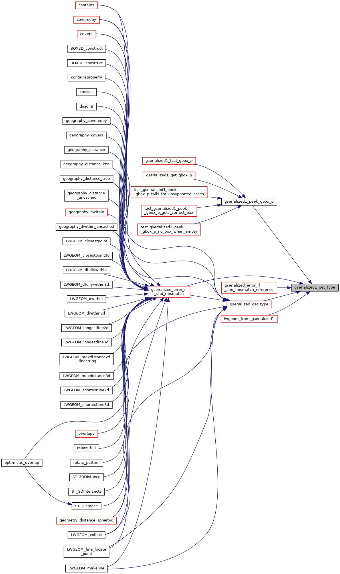
◆ gserialized1_get_type()
| uint32_t gserialized1_get_type | ( | const GSERIALIZED * | g | ) |
Extract the geometry type from the serialized form (it hides in the anonymous data area, so this is a handy function).
Definition at line 131 of file gserialized1.c.
132{
133 uint32_t *ptr;
134 ptr = (uint32_t*)(g->data);
136 {
138 }
139 return *ptr;
140}
static size_t gserialized1_box_size(const GSERIALIZED *g)
Definition gserialized1.c:63
References GSERIALIZED::data, G1FLAGS_GET_BBOX, GSERIALIZED::gflags, and gserialized1_box_size().
Referenced by gserialized1_peek_gbox_p(), gserialized_error_if_srid_mismatch(), gserialized_error_if_srid_mismatch_reference(), gserialized_get_type(), and lwgeom_from_gserialized1().
Here is the call graph for this function:

Here is the caller graph for this function: