Loading...
Searching...
No Matches
◆ geography_segmentize()
| Datum geography_segmentize | ( | PG_FUNCTION_ARGS | ) |
Definition at line 1118 of file geography_measurement.c.
1119{
1120 LWGEOM *lwgeom1 = NULL;
1121 LWGEOM *lwgeom2 = NULL;
1122 GSERIALIZED *g1 = NULL;
1123 GSERIALIZED *g2 = NULL;
1124 double max_seg_length;
1125 uint32_t type1;
1126
1127 /* Get our geometry object loaded into memory. */
1128 g1 = PG_GETARG_GSERIALIZED_P(0);
1129 type1 = gserialized_get_type(g1);
1130
1131 /* Convert max_seg_length from metric units to radians */
1132 max_seg_length = PG_GETARG_FLOAT8(1) / WGS84_RADIUS;
1133
1134 /* We can't densify points or points, reflect them back */
1136 PG_RETURN_POINTER(g1);
1137
1138 /* Deserialize */
1139 lwgeom1 = lwgeom_from_gserialized(g1);
1140
1141 /* Calculate the densified geometry */
1142 lwgeom2 = lwgeom_segmentize_sphere(lwgeom1, max_seg_length);
1143
1144 /*
1145 ** Set the geodetic flag so subsequent
1146 ** functions do the right thing.
1147 */
1149
1150 /* Recalculate the boxes after re-setting the geodetic bit */
1151 lwgeom_drop_bbox(lwgeom2);
1152
1153 /* We are trusting geography_serialize will add a box if needed */
1154 g2 = geography_serialize(lwgeom2);
1155
1156 /* Clean up */
1157 lwgeom_free(lwgeom1);
1158 lwgeom_free(lwgeom2);
1159 PG_FREE_IF_COPY(g1, 0);
1160
1161 PG_RETURN_POINTER(g2);
1162}
LWGEOM * lwgeom_from_gserialized(const GSERIALIZED *g)
Allocate a new LWGEOM from a GSERIALIZED.
Definition gserialized.c:239
int gserialized_is_empty(const GSERIALIZED *g)
Check if a GSERIALIZED is empty without deserializing first.
Definition gserialized.c:152
uint32_t gserialized_get_type(const GSERIALIZED *g)
Extract the geometry type from the serialized form (it hides in the anonymous data area,...
Definition gserialized.c:89
void lwgeom_set_geodetic(LWGEOM *geom, int value)
Set the FLAGS geodetic bit on geometry an all sub-geometries and pointlists.
Definition lwgeom.c:946
void lwgeom_drop_bbox(LWGEOM *lwgeom)
Call this function to drop BBOX and SRID from LWGEOM.
Definition lwgeom.c:664
LWGEOM * lwgeom_segmentize_sphere(const LWGEOM *lwg_in, double max_seg_length)
Derive a new geometry with vertices added to ensure no vertex is more than max_seg_length (in radians...
Definition lwgeodetic.c:1743
Definition liblwgeom.h:429
Definition liblwgeom.h:443
References gserialized_get_type(), gserialized_is_empty(), lwgeom_drop_bbox(), lwgeom_free(), lwgeom_from_gserialized(), lwgeom_segmentize_sphere(), lwgeom_set_geodetic(), MULTIPOINTTYPE, POINTTYPE, and WGS84_RADIUS.
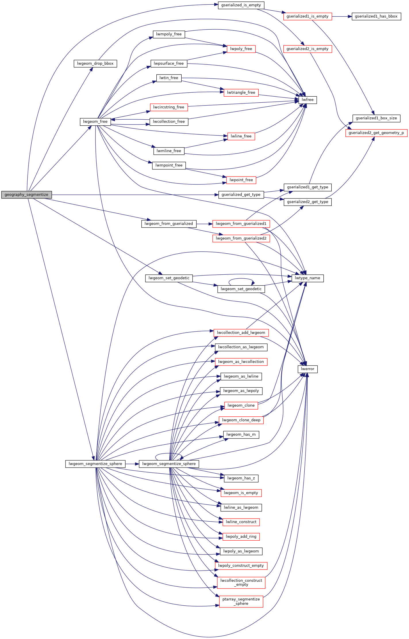
Here is the call graph for this function:
