◆ lwgeom_set_geodetic()
| void lwgeom_set_geodetic | ( | LWGEOM * | geom, |
| int | value | ||
| ) |
Set the FLAGS geodetic bit on geometry an all sub-geometries and pointlists.
Definition at line 946 of file lwgeom.c.
References LWGEOM::bbox, COLLECTIONTYPE, GBOX::flags, POINTARRAY::flags, LWGEOM::flags, FLAGS_SET_GEODETIC, LWCOLLECTION::geoms, LINETYPE, lwerror(), lwgeom_set_geodetic(), lwtype_name(), MULTILINETYPE, MULTIPOINTTYPE, MULTIPOLYGONTYPE, LWCOLLECTION::ngeoms, LWPOLY::nrings, LWPOINT::point, LWLINE::points, POINTTYPE, POLYGONTYPE, LWPOLY::rings, LWGEOM::type, and genraster::value.
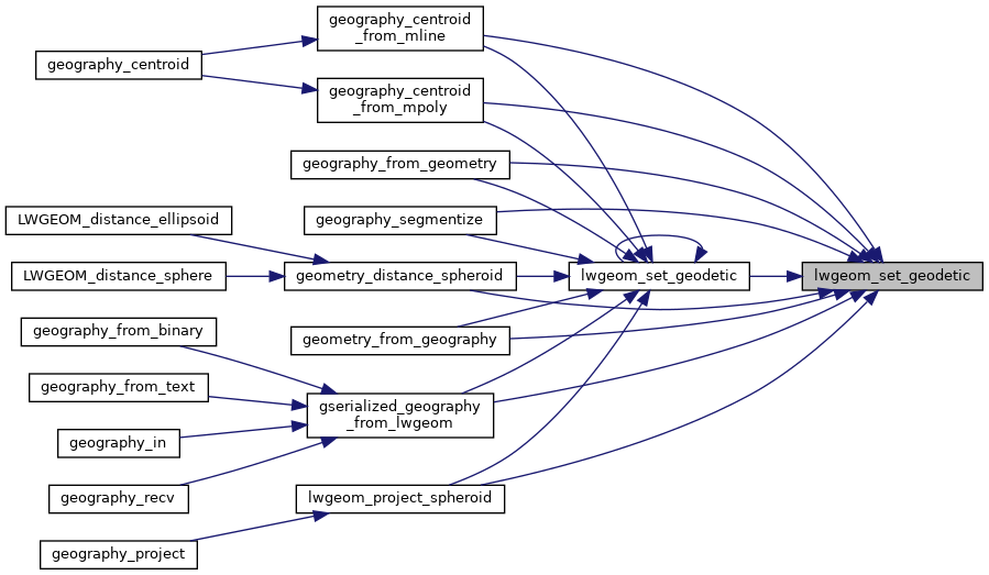
Referenced by geography_centroid_from_mline(), geography_centroid_from_mpoly(), geography_from_geometry(), geography_segmentize(), geometry_distance_spheroid(), geometry_from_geography(), gserialized_geography_from_lwgeom(), lwgeom_project_spheroid(), and lwgeom_set_geodetic().

