Walk the tree and count intersections between the stab line and the edges.
odd => containment, even => no containment. KNOWN PROBLEM: Grazings (think of a sharp point, just touching the stabline) will be counted for one, which will throw off the count.
Definition at line 494 of file lwgeodetic_tree.c.
495{
499 double d;
500 uint32_t i, c;
501
502
507
508 LWDEBUGF(3,
"%*s entered", level,
"");
509
510
511
512
513
514
515 LWDEBUGF(3,
"%*s :working on node %p, edge_num %d, radius %g, center POINT(%.12g %.12g)", level,
"", node, node->
edge_num, node->
radius,
rad2deg(node->
center.
lon),
rad2deg(node->
center.
lat));
517 LWDEBUGF(3,
"%*s :edge_distance_to_point=%g, node_radius=%g", level,
"", d, node->
radius);
519 {
520 LWDEBUGF(3,
"%*s :entering this branch (%p)", level,
"", node);
521
522
524 {
525 int inter;
526 LWDEBUGF(3,
"%*s :leaf node calculation (edge %d)", level,
"", node->
edge_num);
531
533 LWDEBUGF(3,
"%*s :inter = %d", level,
"", inter);
534
536 {
537 LWDEBUGF(3,
"%*s ::got stab line edge_intersection with this edge!", level,
"");
538
539
542
543 LWDEBUGF(3,
"%*s LINESTRING(%.15g %.15g,%.15g %.15g)", level,
"",
545 pt_outside->
x, pt_outside->
y
546 );
547
548 LWDEBUGF(3,
"%*s LINESTRING(%.15g %.15g,%.15g %.15g)", level,
"",
551 );
552
554 {
555 LWDEBUGF(3,
"%*s ::rejecting stab line grazing by left-side edge", level,
"");
556 return 0;
557 }
558 else
559 {
560 LWDEBUGF(3,
"%*s ::accepting stab line intersection", level,
"");
561 return 1;
562 }
563 }
564 else
565 {
566 LWDEBUGF(3,
"%*s edge does not intersect", level,
"");
567 }
568 }
569
570 else
571 {
572 c = 0;
574 {
575 LWDEBUGF(3,
"%*s calling circ_tree_contains_point on child %d!", level,
"", i);
577 }
578 return c % 2;
579 }
580 }
581 else
582 {
583 LWDEBUGF(3,
"%*s skipping this branch (%p)", level,
"", node);
584 }
585 return 0;
586}
void cart2geog(const POINT3D *p, GEOGRAPHIC_POINT *g)
Convert cartesian coordinates on unit sphere to spherical coordinates.
void geographic_point_init(double lon, double lat, GEOGRAPHIC_POINT *g)
Initialize a geographic point.
uint32_t edge_intersects(const POINT3D *A1, const POINT3D *A2, const POINT3D *B1, const POINT3D *B2)
Returns non-zero if edges A and B interact.
double edge_distance_to_point(const GEOGRAPHIC_EDGE *e, const GEOGRAPHIC_POINT *gp, GEOGRAPHIC_POINT *closest)
void geog2cart(const GEOGRAPHIC_POINT *g, POINT3D *p)
Convert spherical coordinates to cartesian coordinates on unit sphere.
#define PIR_B_TOUCH_RIGHT
static int circ_node_is_leaf(const CIRC_NODE *node)
Internal nodes have their point references set to NULL.
int circ_tree_contains_point(const CIRC_NODE *node, const POINT2D *pt, const POINT2D *pt_outside, int level, int *on_boundary)
Walk the tree and count intersections between the stab line and the edges.
#define LWDEBUGF(level, msg,...)
Two-point great circle segment from a to b.
Point in spherical coordinates on the world.
struct circ_node ** nodes
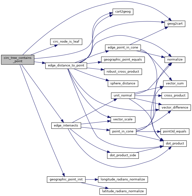
References cart2geog(), circ_node::center, circ_node_is_leaf(), circ_tree_contains_point(), edge_distance_to_point(), edge_intersects(), circ_node::edge_num, GEOGRAPHIC_EDGE::end, FP_LTEQ, geog2cart(), geographic_point_init(), GEOGRAPHIC_POINT::lat, GEOGRAPHIC_POINT::lon, LWDEBUGF, circ_node::nodes, circ_node::num_nodes, circ_node::p1, circ_node::p2, PIR_B_TOUCH_RIGHT, PIR_COLINEAR, PIR_INTERSECTS, rad2deg, circ_node::radius, GEOGRAPHIC_EDGE::start, POINT2D::x, and POINT2D::y.
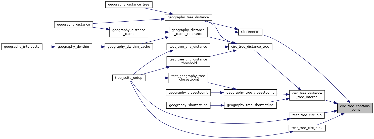
Referenced by circ_tree_contains_point(), circ_tree_distance_tree_internal(), CircTreePIP(), test_tree_circ_pip(), and test_tree_circ_pip2().