Loading...
Searching...
No Matches
◆ rt_util_gdal_supported_sr()
| int rt_util_gdal_supported_sr | ( | const char * | srs | ) |
Definition at line 353 of file rt_util.c.
353 {
354 OGRSpatialReferenceH hsrs;
355 OGRErr rtn = OGRERR_NONE;
356
357 assert(srs != NULL);
358
359 hsrs = OSRNewSpatialReference(NULL);
360 rtn = OSRSetFromUserInput(hsrs, srs);
361 OSRDestroySpatialReference(hsrs);
362
363 if (rtn == OGRERR_NONE)
364 return 1;
365 else
366 return 0;
367}
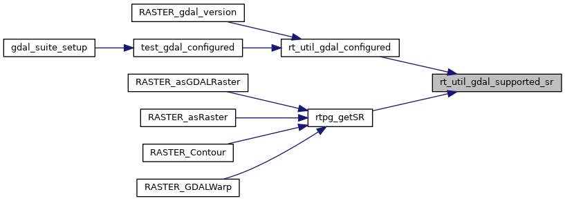
Referenced by rt_util_gdal_configured(), and rtpg_getSR().
Here is the caller graph for this function: