PostGIS  3.7.0dev-r@@SVN_REVISION@@

◆ test_geography_substring()

static void test_geography_substring ( void  )
static

Definition at line 1597 of file cu_geodetic.c.

1598 {
1599  LWGEOM *lwg;
1600  LWGEOM *result;
1601  double length;
1602  SPHEROID s;
1603 
1604  /* Init to Sphere */
1606  s.a = s.b = s.radius;
1607 
1608  /*
1609  * geography_substring(
1610  * const LWLINE *lwline,
1611  * const SPHEROID *s,
1612  * double from, double to, double tolerance
1613  */
1614 
1615  lwg = lwgeom_from_wkt("LINESTRING(2 48, 2 49, 2 50)", LW_PARSER_CHECK_NONE);
1616  length = lwgeom_length(lwg);
1617  CU_ASSERT_DOUBLE_EQUAL(length, 2.0, 0.001);
1618  result = geography_substring((LWLINE*)lwg, &s, 0.0, 1.0, 0.01);
1619  length = lwgeom_length(result);
1620  CU_ASSERT_DOUBLE_EQUAL(length, 2.0, 0.001);
1621  lwgeom_free(lwg);
1623 
1624  lwg = lwgeom_from_wkt("LINESTRING(2 48, 2 49)", LW_PARSER_CHECK_NONE);
1625  length = lwgeom_length(lwg);
1626  CU_ASSERT_DOUBLE_EQUAL(length, 1.0, 0.001);
1627  result = geography_substring((LWLINE*)lwg, &s, 0.0, 1.0, 0.01);
1628  length = lwgeom_length(result);
1629  CU_ASSERT_DOUBLE_EQUAL(length, 1.0, 0.001);
1630  lwgeom_free(lwg);
1632 
1633  lwg = lwgeom_from_wkt("LINESTRING(2 48)", LW_PARSER_CHECK_NONE);
1634  length = lwgeom_length(lwg);
1635  CU_ASSERT_DOUBLE_EQUAL(length, 0.0, 0.001);
1636  result = geography_substring((LWLINE*)lwg, &s, 0.0, 1.0, 0.01);
1637  length = lwgeom_length(result);
1638  CU_ASSERT_DOUBLE_EQUAL(length, 0.0, 0.001);
1639  lwgeom_free(lwg);
1641 }
char * s
Definition: cu_in_wkt.c:23
char result[OUT_DOUBLE_BUFFER_SIZE]
Definition: cu_print.c:267
void lwgeom_free(LWGEOM *geom)
Definition: lwgeom.c:1218
#define LW_PARSER_CHECK_NONE
Definition: liblwgeom.h:2146
#define WGS84_RADIUS
Definition: liblwgeom.h:148
double lwgeom_length(const LWGEOM *geom)
Definition: lwgeom.c:2038
LWGEOM * geography_substring(const LWLINE *line, const SPHEROID *s, double from, double to, double tolerance)
Return the part of a line between two fractional locations.
void spheroid_init(SPHEROID *s, double a, double b)
Initialize a spheroid object for use in geodetic functions.
Definition: lwspheroid.c:39
LWGEOM * lwgeom_from_wkt(const char *wkt, const char check)
Definition: lwin_wkt.c:940

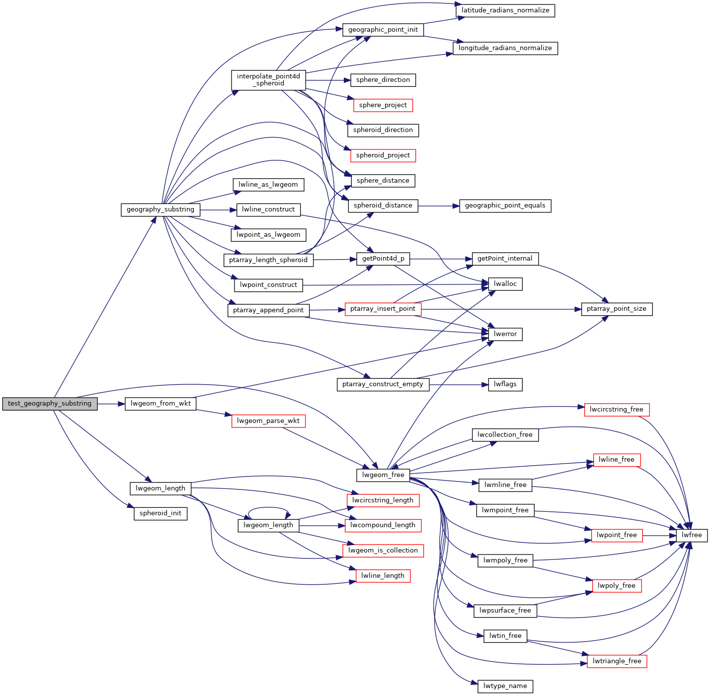
References geography_substring(), LW_PARSER_CHECK_NONE, lwgeom_free(), lwgeom_from_wkt(), lwgeom_length(), result, s, spheroid_init(), and WGS84_RADIUS.

Referenced by geodetic_suite_setup().

Here is the call graph for this function:
Here is the caller graph for this function: