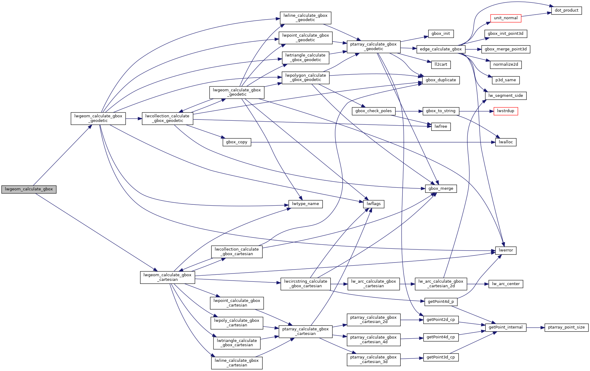
◆ lwgeom_calculate_gbox()
Calculate the gbox for this geometry, a cartesian box or geodetic box, depending on how it is flagged.
Calculate bounding box of a geometry, automatically taking into account whether it is cartesian or geodetic.
Definition at line 755 of file lwgeom.c.
References GBOX::flags, LWGEOM::flags, FLAGS_GET_GEODETIC, lwgeom_calculate_gbox_cartesian(), and lwgeom_calculate_gbox_geodetic().
Referenced by BOX3D_combine(), create_v_line(), geometry_to_polygon(), gserialized1_get_gbox_p(), gserialized2_get_gbox_p(), lw_dist2d_check_overlap(), lwgeom_add_bbox(), lwgeom_add_bbox_deep(), lwgeom_cpa_within(), LWGEOM_envelope(), LWGEOM_expand(), lwgeom_from_gserialized1(), lwgeom_from_gserialized2(), lwgeom_tcpa(), LWGEOM_to_BOX(), LWGEOM_to_BOX2D(), LWGEOM_to_BOX3D(), lwgeom_to_marc21(), lwpoly_to_points(), mvt_clip_and_validate(), mvt_unsafe_clip_by_box(), ST_BoundingDiagonal(), ST_TileEnvelope(), test_gserialized1_peek_gbox_p_gets_correct_box(), test_gserialized2_peek_gbox_p_gets_correct_box(), and test_gserialized_get_gbox_geocentric().