◆ ptarray_length_2d()
| double ptarray_length_2d | ( | const POINTARRAY * | pts | ) |
Find the 2d length of the given POINTARRAY (even if it's 3d)
Definition at line 2099 of file ptarray.c.
static const POINT2D * getPoint2d_cp(const POINTARRAY *pa, uint32_t n)
Returns a POINT2D pointer into the POINTARRAY serialized_ptlist, suitable for reading from.
Definition: lwinline.h:101
Definition: liblwgeom.h:404
References getPoint2d_cp(), POINTARRAY::npoints, POINT2D::x, and POINT2D::y.
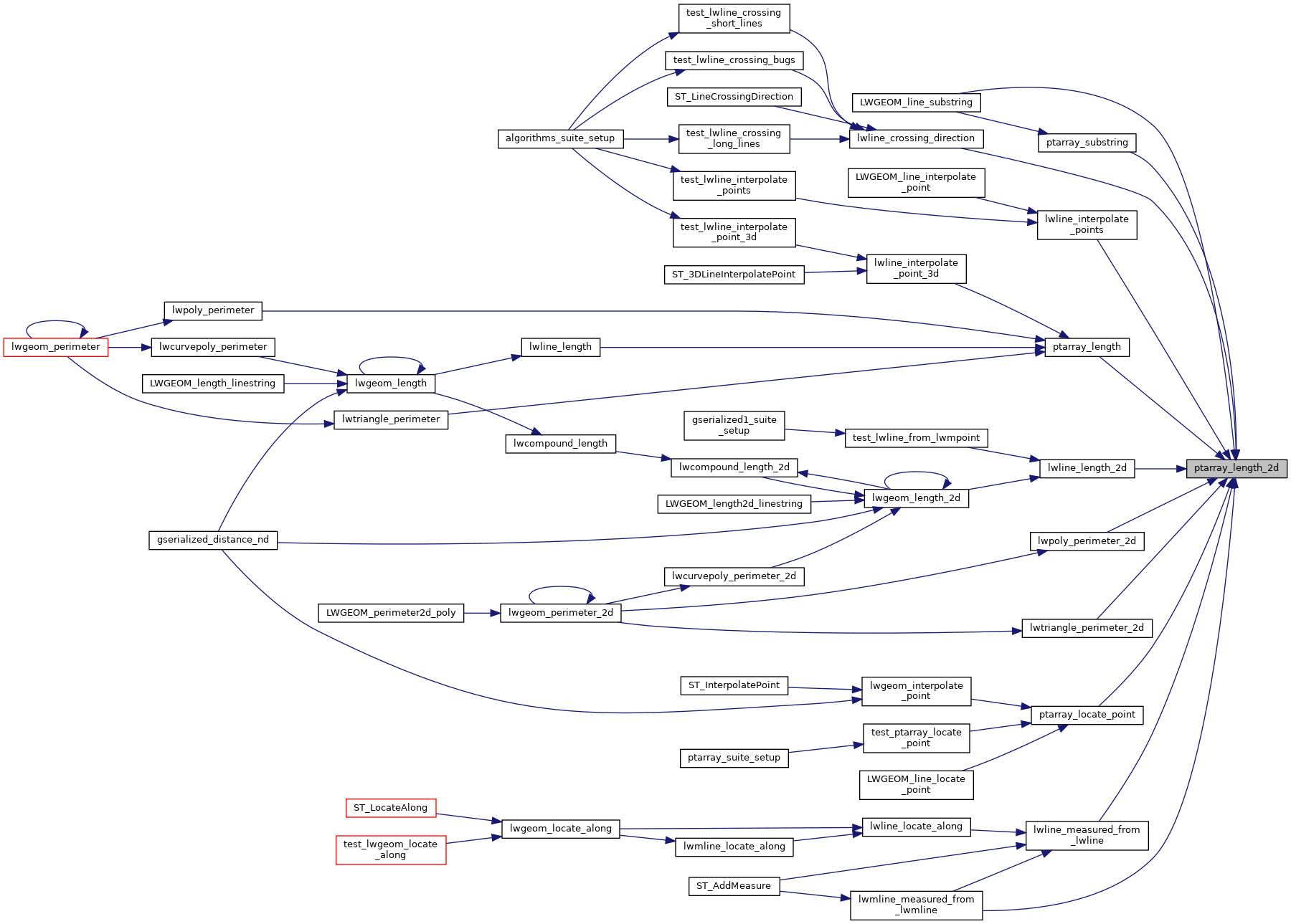
Referenced by LWGEOM_line_substring(), lwline_crossing_direction(), lwline_interpolate_points(), lwline_length_2d(), lwline_measured_from_lwline(), lwmline_measured_from_lwmline(), lwpoly_perimeter_2d(), lwtriangle_perimeter_2d(), ptarray_length(), ptarray_locate_point(), and ptarray_substring().
Here is the call graph for this function:

Here is the caller graph for this function: