PostGIS  3.0.6dev-r@@SVN_REVISION@@

◆ gserialized_gist_distance_2d()

Datum gserialized_gist_distance_2d ( PG_FUNCTION_ARGS  )

Definition at line 1065 of file gserialized_gist_2d.c.

1066 {
1067  GISTENTRY *entry = (GISTENTRY*) PG_GETARG_POINTER(0);
1068  BOX2DF query_box;
1069  BOX2DF *entry_box;
1070  StrategyNumber strategy = (StrategyNumber) PG_GETARG_UINT16(2);
1071  double distance;
1072  bool *recheck = (bool *) PG_GETARG_POINTER(4);
1073 
1074  POSTGIS_DEBUG(4, "[GIST] 'distance' function called");
1075 
1076  /* We are using '13' as the gist true-distance <-> strategy number
1077  * and '14' as the gist distance-between-boxes <#> strategy number */
1078  if ( strategy != 13 && strategy != 14 ) {
1079  elog(ERROR, "unrecognized strategy number: %d", strategy);
1080  PG_RETURN_FLOAT8(FLT_MAX);
1081  }
1082 
1083  /* Null box should never make this far. */
1084  if ( gserialized_datum_get_box2df_p(PG_GETARG_DATUM(1), &query_box) == LW_FAILURE )
1085  {
1086  POSTGIS_DEBUG(4, "[GIST] null query_gbox_index!");
1087  PG_RETURN_FLOAT8(FLT_MAX);
1088  }
1089 
1090  /* Get the entry box */
1091  entry_box = (BOX2DF*)DatumGetPointer(entry->key);
1092 
1093  /* Box-style distance test */
1094  if ( strategy == 14 ) /* operator <#> */
1095  {
1096  distance = box2df_distance(entry_box, &query_box);
1097  }
1098  /* True distance test (formerly centroid distance) */
1099  else if ( strategy == 13 ) /* operator <-> */
1100  {
1101  /* In all cases, since we only have keys (boxes) we'll return */
1102  /* the minimum possible distance, which is the box2df_distance */
1103  /* and let the recheck sort things out in the case of leaves */
1104  distance = box2df_distance(entry_box, &query_box);
1105 
1106  if (GIST_LEAF(entry))
1107  *recheck = true;
1108  }
1109  else
1110  {
1111  elog(ERROR, "%s: reached unreachable code", __func__);
1112  PG_RETURN_NULL();
1113  }
1114 
1115  PG_RETURN_FLOAT8(distance);
1116 }
static double box2df_distance(const BOX2DF *a, const BOX2DF *b)
Calculate the box->box distance.
int gserialized_datum_get_box2df_p(Datum gsdatum, BOX2DF *box2df)
Peak into a GSERIALIZED datum to find the bounding box.
#define LW_FAILURE
Definition: liblwgeom.h:110
static double distance(double x1, double y1, double x2, double y2)
Definition: lwtree.c:1032

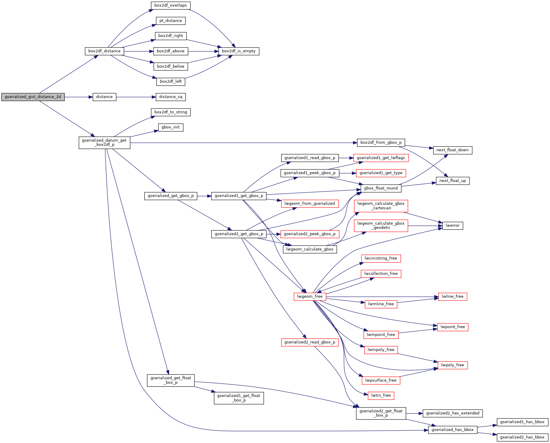
References box2df_distance(), distance(), gserialized_datum_get_box2df_p(), and LW_FAILURE.

Here is the call graph for this function: