◆ test_lwgeom_check_geodetic()
|
static |
Definition at line 806 of file cu_geodetic.c.
815 "SRID=1;MULTILINESTRING((-1 -1,-1 2.5,2 2,2 -1),(-1 -1,-1 2.5,2 2,2 -1),(-1 -1,-1 2.5,2 2,2 -1),(-1 -1,-1 2.5,2 2,2 -1))",
817 "SRID=4326;MULTIPOLYGON(((-1 -1,-1 2.5,2 2,2 -1,-1 -1),(0 0,0 1,1 1,1 0,0 0),(-0.5 -0.5,-0.5 -0.4,-0.4 -0.4,-0.4 -0.5,-0.5 -0.5)),((-1 -1,-1 2.5,2 2,2 -1,-1 -1),(0 0,0 1,1 1,1 0,0 0),(-0.5 -0.5,-0.5 -0.4,-0.4 -0.4,-0.4 -0.5,-0.5 -0.5)))",
818 "SRID=4326;GEOMETRYCOLLECTION(POINT(0 1),POLYGON((-1 -1,-1 2.5,2 2,2 -1,-1 -1),(0 0,0 1,1 1,1 0,0 0)),MULTIPOLYGON(((-1 -1,-1 2.5,2 2,2 -1,-1 -1),(0 0,0 1,1 1,1 0,0 0),(-0.5 -0.5,-0.5 -0.4,-0.4 -0.4,-0.4 -0.5,-0.5 -0.5))))",
821 "SRID=1;MULTILINESTRING((-1 -131,-1 2.5,2 2,2 -1),(-1 -1,-1 2.5,2 2,2 -1),(-1 -1,-1 2.5,2 2,2 -1),(-1 -1,-1 2.5,2 2,2 -1))",
823 "SRID=4326;MULTIPOLYGON(((-1 -1,-1 2.5,211 2,2 -1,-1 -1),(0 0,0 1,1 1,1 0,0 0),(-0.5 -0.5,-0.5 -0.4,-0.4 -0.4,-0.4 -0.5,-0.5 -0.5)),((-1 -1,-1 2.5,2 2,2 -1,-1 -1),(0 0,0 1,1 1,1 0,0 0),(-0.5 -0.5,-0.5 -0.4,-0.4 -0.4,-0.4 -0.5,-0.5 -0.5)))",
824 "SRID=4326;GEOMETRYCOLLECTION(POINT(0 1),POLYGON((-1 -1,-1111 2.5,2 2,2 -1,-1 -1),(0 0,0 1,1 1,1 0,0 0)),MULTIPOLYGON(((-1 -1,-1 2.5,2 2,2 -1,-1 -1),(0 0,0 1,1 1,1 0,0 0),(-0.5 -0.5,-0.5 -0.4,-0.4 -0.4,-0.4 -0.5,-0.5 -0.5))))",
static LWGEOM * lwgeom_over_gserialized(char *wkt, GSERIALIZED **g)
Definition: cu_geodetic.c:795
int lwgeom_check_geodetic(const LWGEOM *geom)
Check that coordinates of LWGEOM are all within the geodetic range (-180, -90, 180,...
Definition: lwgeodetic.c:3131
Definition: liblwgeom.h:429
Definition: liblwgeom.h:443
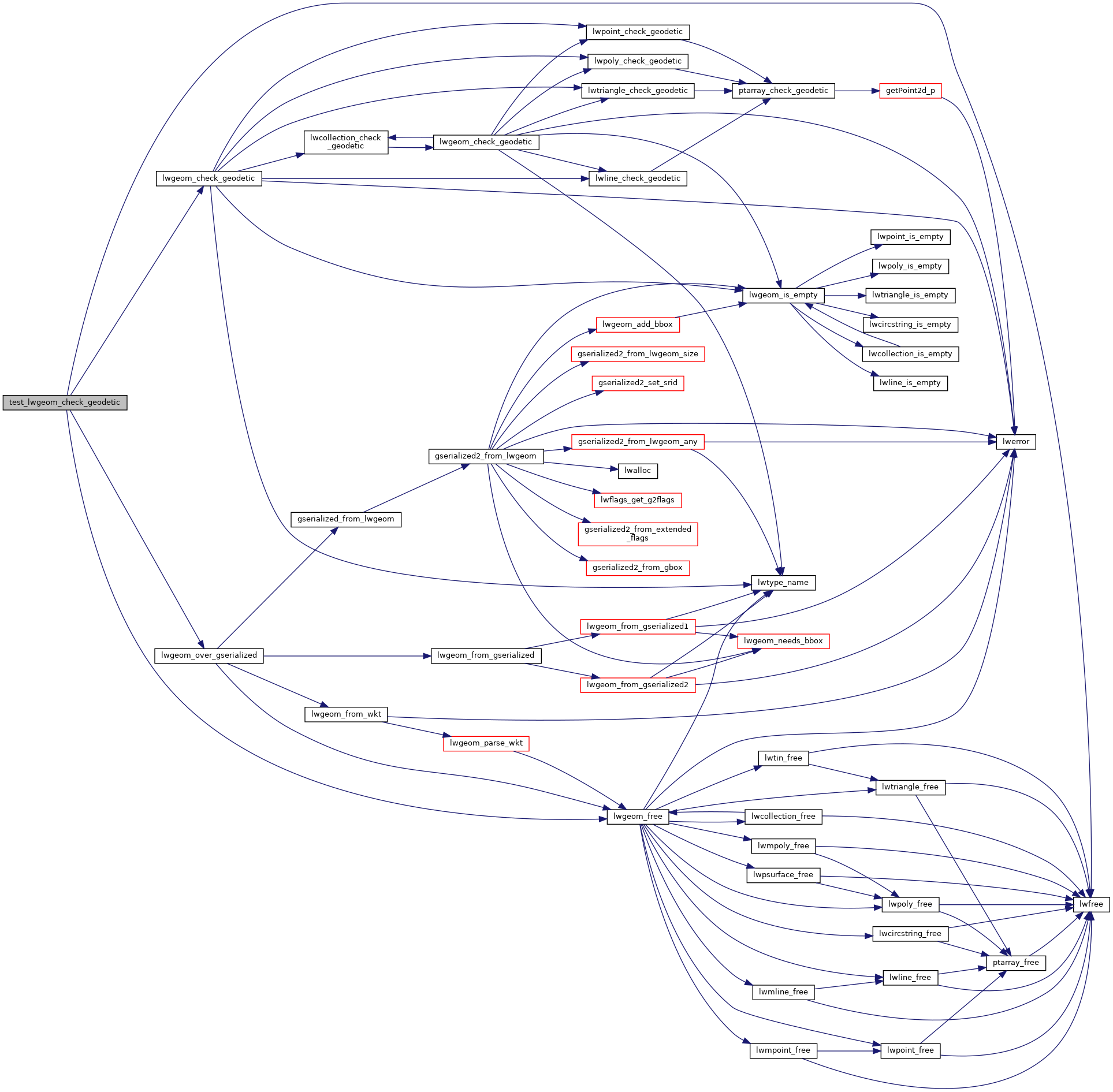
References LW_FALSE, LW_TRUE, lwfree(), lwgeom_check_geodetic(), lwgeom_free(), and lwgeom_over_gserialized().
Referenced by geodetic_suite_setup().
Here is the call graph for this function:

Here is the caller graph for this function:
