Loading...
Searching...
No Matches
◆ ptarray_signed_area()
| double ptarray_signed_area | ( | const POINTARRAY * | pa | ) |
Returns the area in cartesian units.
Area is negative if ring is oriented CCW, positive if it is oriented CW and zero if the ring is degenerate or flat. http://en.wikipedia.org/wiki/Shoelace_formula
Definition at line 1003 of file ptarray.c.
1004{
1008 double sum = 0.0;
1010 uint32_t i;
1011
1013 return 0.0;
1014
1015 P1 = getPoint2d_cp(pa, 0);
1016 P2 = getPoint2d_cp(pa, 1);
1017 x0 = P1->x;
1019 {
1020 P3 = getPoint2d_cp(pa, i);
1022 y1 = P3->y;
1023 y2 = P1->y;
1024 sum += x * (y2-y1);
1025
1026 /* Move forwards! */
1027 P1 = P2;
1028 P2 = P3;
1029 }
1030 return sum / 2.0;
1031}
static const POINT2D * getPoint2d_cp(const POINTARRAY *pa, uint32_t n)
Returns a POINT2D pointer into the POINTARRAY serialized_ptlist, suitable for reading from.
Definition lwinline.h:91
Definition liblwgeom.h:375
References getPoint2d_cp(), POINTARRAY::npoints, POINT2D::x, and POINT2D::y.
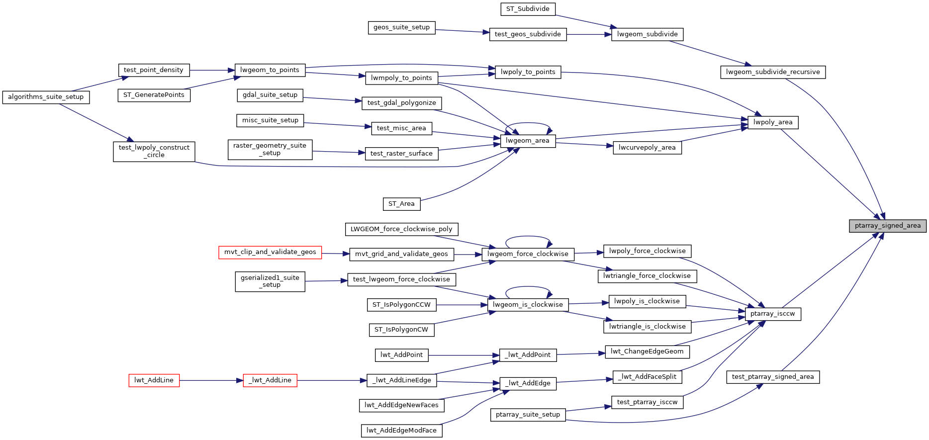
Referenced by lwgeom_subdivide_recursive(), lwpoly_area(), ptarray_isccw(), and test_ptarray_signed_area().
Here is the call graph for this function:

Here is the caller graph for this function: