12. Spatial Relationships Exercises
Here’s a reminder of the functions we saw in the last section. They should be useful for the exercises!
sum(expression) aggregate to return a sum for a set of records
count(expression) aggregate to return the size of a set of records
ST_Contains(geometry A, geometry B) returns true if geometry A contains geometry B
ST_Crosses(geometry A, geometry B) returns true if geometry A crosses geometry B
ST_Disjoint(geometry A , geometry B) returns true if the geometries do not 《spatially intersect》
ST_Distance(geometry A, geometry B) returns the minimum distance between geometry A and geometry B
ST_DWithin(geometry A, geometry B, radius) returns true if geometry A is radius distance or less from geometry B
ST_Equals(geometry A, geometry B) returns true if geometry A is the same as geometry B
ST_Intersects(geometry A, geometry B) returns true if geometry A intersects geometry B
ST_Overlaps(geometry A, geometry B) returns true if geometry A and geometry B share space, but are not completely contained by each other.
ST_Touches(geometry A, geometry B) returns true if the boundary of geometry A touches geometry B
ST_Within(geometry A, geometry B) returns true if geometry A is within geometry B
Also remember the tables we have available:
nyc_census_blocksblkid, popn_total, boroname, geom
nyc_streetsname, type, geom
nyc_subway_stationsname, geom
nyc_neighborhoodsname, boroname, geom
12.1. Exercises
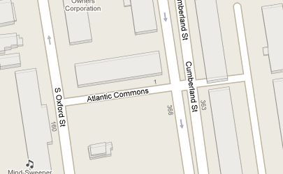
What is the geometry value for the street named 〈Atlantic Commons〉?
SELECT ST_AsText(geom)
  FROM nyc_streets
  WHERE name = 'Atlantic Commons';
MULTILINESTRING((586781.701577724 4504202.15314339,586863.51964484 4504215.9881701))
What neighborhood and borough is Atlantic Commons in?
SELECT name, boroname
FROM nyc_neighborhoods
WHERE ST_Intersects(
  geom,
  ST_GeomFromText('LINESTRING(586782 4504202,586864 4504216)', 26918)
);
    name    | boroname
------------+----------
 Fort Green | Brooklyn
참고
《Hey, why did you change from a 〈MULTILINESTRING〉 to a 〈LINESTRING〉?》 Spatially they describe the same shape, so going from a single-item multi-geometry to a singleton saves a few keystrokes.
More importantly, we also rounded the coordinates to make them easier to read, which does actually change results: we couldn’t use the ST_Touches() predicate to find out which roads join Atlantic Commons, because the coordinates are not exactly the same anymore.
What streets does Atlantic Commons join with?
SELECT name
FROM nyc_streets
WHERE ST_DWithin(
  geom,
  ST_GeomFromText('LINESTRING(586782 4504202,586864 4504216)', 26918),
  0.1
);
     name
------------------
 Cumberland St
 Atlantic Commons

Approximately how many people live on (within 50 meters of) Atlantic Commons?
SELECT Sum(popn_total)
  FROM nyc_census_blocks
  WHERE ST_DWithin(
   geom,
   ST_GeomFromText('LINESTRING(586782 4504202,586864 4504216)', 26918),
   50
  );
1438

