名称
ST_Transform — 使用指定的重采样算法将已知空间参考系统中的栅格重新投影到另一个已知空间参考系统。 选项有 NearestNeighbor、Bilinear、Cubic、CubicSpline、Lanczos(默认为 NearestNeighbor)。
大纲
raster ST_Transform(raster rast, integer srid, text algorithm=NearestNeighbor, double precision maxerr=0.125, double precision scalex, double precision scaley);
raster ST_Transform(raster rast, integer srid, double precision scalex, double precision scaley, text algorithm=NearestNeighbor, double precision maxerr=0.125);
raster ST_Transform(raster rast, raster alignto, text algorithm=NearestNeighbor, double precision maxerr=0.125);
Description
使用指定的像素扭曲算法将已知空间参考系统中的栅格重新投影到另一个已知空间参考系统。 如果未指定算法,则使用“NearestNeighbor”;如果未指定 maxerr,则使用 0.125 的 maxerror 百分比。
算法选项有:“NearestNeighbor”、“Bilinear”、“Cubic”、“CubicSpline”和“Lanczos”。 有关更多详细信息,请参阅:GDAL Warp 重采样方法。
ST_Transform 经常与 ST_SetSRID() 混淆。 ST_Transform 实际上将栅格的坐标从一种空间参考系统更改为另一种空间参考系统(并对像素值进行重新采样),而 ST_SetSRID() 只是更改栅格的 SRID 标识符。
与其他变体不同,变体 3 需要参考栅格作为alignto。 转换后的栅格将转换为参考栅格的空间参考系统 (SRID),并与参考栅格对齐 (ST_SameAlignment = TRUE)。
![[注意]](../images/note.png)
|
|
|
如果发现坐标转换功能异常,可能需要设置环境变量 PROJSO,指向 PostGIS 使用的投影库文件名。例如在 Windows 中,可以在 “控制面板 -> 系统 -> 环境变量” 中新增系统变量 |
![[警告]](../images/warning.png)
|
|
|
在转换图块覆盖范围时,您几乎总是希望使用参考栅格来确保图块中的对齐方式相同并且没有间隙,如示例所示:变体 3。 |
可用性:2.0.0 需要 GDAL 1.6.1+
增强:2.1.0 添加 ST_Transform(rast,alignto) 变体
示例
Compare a source raster with nearest-neighbor and bilinear reprojections. The diagonal bands make the resampling behavior visible: nearest-neighbor keeps hard pixel steps, while bilinear smooths values between pixels. All three figures are generated from this query at manual build time.
WITH rows AS (
    SELECT
        y,
        array_agg(
            ((
                    x * 3 + y * 5
                    + CASE WHEN (x + y) % 8 < 4 THEN 80 ELSE 0 END
                ) % 255)::double precision
            ORDER BY x
        ) AS row_values
    FROM generate_series(1, 80) AS y
    CROSS JOIN generate_series(1, 80) AS x
    GROUP BY y
), source AS (
    SELECT ST_SetValues(
        ST_AddBand(
            ST_MakeEmptyRaster(
                80, 80,
                -500000, 600000,
                2500, -2500,
                0, 0,
                2163
            ),
            1, '8BUI', 0, NULL
        ),
        1, 1, 1,
        array_agg(row_values ORDER BY y)::double precision[][]
    ) AS rast
    FROM rows
), transformed AS (
    SELECT
        rast,
        ST_Transform(rast, 4326, 'NearestNeighbor') AS nearest,
        ST_Transform(rast, 4326, 'Bilinear') AS bilinear
    FROM source
)
SELECT
    ST_AsPNG(rast) AS "source (EPSG:2163)",
    ST_AsPNG(nearest) AS "nearest (EPSG:4326)",
    ST_AsPNG(bilinear) AS "bilinear (EPSG:4326)"
FROM transformed;
PNG image, 80 x 80 pixels | PNG image, 98 x 64 pixels | PNG image, 98 x 64 pixels
Raster reprojection and resampling.
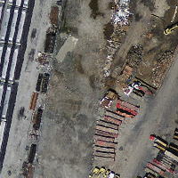
Massachusetts State Plane source |
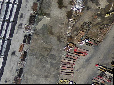
WGS 84 nearest-neighbor |
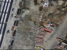
WGS 84 bilinear |
Variant 3.
下面展示了使用 ST_Transform(raster, srid) 和 ST_Transform(raster,alignto) 之间的区别
WITH foo AS (
    SELECT 0 AS rid, ST_AddBand(ST_MakeEmptyRaster(2, 2, -500000, 600000, 100, -100, 0, 0, 2163), 1, '16BUI', 1, 0) AS rast UNION ALL
    SELECT 1, ST_AddBand(ST_MakeEmptyRaster(2, 2, -499800, 600000, 100, -100, 0, 0, 2163), 1, '16BUI', 2, 0) AS rast UNION ALL
    SELECT 2, ST_AddBand(ST_MakeEmptyRaster(2, 2, -499600, 600000, 100, -100, 0, 0, 2163), 1, '16BUI', 3, 0) AS rast UNION ALL

    SELECT 3, ST_AddBand(ST_MakeEmptyRaster(2, 2, -500000, 599800, 100, -100, 0, 0, 2163), 1, '16BUI', 10, 0) AS rast UNION ALL
    SELECT 4, ST_AddBand(ST_MakeEmptyRaster(2, 2, -499800, 599800, 100, -100, 0, 0, 2163), 1, '16BUI', 20, 0) AS rast UNION ALL
    SELECT 5, ST_AddBand(ST_MakeEmptyRaster(2, 2, -499600, 599800, 100, -100, 0, 0, 2163), 1, '16BUI', 30, 0) AS rast UNION ALL

    SELECT 6, ST_AddBand(ST_MakeEmptyRaster(2, 2, -500000, 599600, 100, -100, 0, 0, 2163), 1, '16BUI', 100, 0) AS rast UNION ALL
    SELECT 7, ST_AddBand(ST_MakeEmptyRaster(2, 2, -499800, 599600, 100, -100, 0, 0, 2163), 1, '16BUI', 200, 0) AS rast UNION ALL
    SELECT 8, ST_AddBand(ST_MakeEmptyRaster(2, 2, -499600, 599600, 100, -100, 0, 0, 2163), 1, '16BUI', 300, 0) AS rast
), bar AS (
    SELECT
        ST_Transform(rast, 4269) AS alignto
    FROM foo
    LIMIT 1
), baz AS (
    SELECT
        rid,
        rast,
        ST_Transform(rast, 4269) AS not_aligned,
        ST_Transform(rast, alignto) AS aligned
    FROM foo
    CROSS JOIN bar
)
SELECT
    ST_Collect(ST_ConvexHull(not_aligned) ORDER BY rid) AS not_aligned,
    ST_Collect(ST_ConvexHull(aligned) ORDER BY rid) AS aligned
FROM baz
MULTIPOLYGON(((-107.007 50.2,-107.005 50.2,-107.005 50.198,-107.007 50.198,-107.007 50.2)),((-107.004 50.201,-107.002 50.201,-107.002 50.198,-107.004 50.198,-107.004 50.201)),((-107.001 50.201,-106.999 50.201,-106.999 50.198,-107.001 50.198,-107.001 50.201)),((-107.007 50.199,-107.004 50.199,-107.004 50.196,-107.007 50.196,-107.007 50.199)),((-107.004 50.199,-107.001 50.199,-107.001 50.196,-107.004 50.196,-107.004 50.199)),((-107.001 50.199,-106.999 50.199,-106.999 50.196,-107.001 50.196,-107.001 50.199)),((-107.006 50.197,-107.004 50.197,-107.004 50.194,-107.006 50.194,-107.006 50.197)),((-107.004 50.197,-107.001 50.197,-107.001 50.194,-107.004 50.194,-107.004 50.197)),((-107.001 50.197,-106.998 50.197,-106.998 50.195,-107.001 50.195,-107.001 50.197))) | MULTIPOLYGON(((-107.007 50.2,-107.005 50.2,-107.005 50.198,-107.007 50.198,-107.007 50.2)),((-107.005 50.202,-107.001 50.202,-107.001 50.198,-107.005 50.198,-107.005 50.202)),((-107.002 50.202,-106.998 50.202,-106.998 50.198,-107.002 50.198,-107.002 50.202)),((-107.007 50.199,-107.003 50.199,-107.003 50.195,-107.007 50.195,-107.007 50.199)),((-107.005 50.199,-107.001 50.199,-107.001 50.195,-107.005 50.195,-107.005 50.199)),((-107.002 50.199,-106.998 50.199,-106.998 50.195,-107.002 50.195,-107.002 50.199)),((-107.007 50.198,-107.003 50.198,-107.003 50.194,-107.007 50.194,-107.007 50.198)),((-107.005 50.198,-107.001 50.198,-107.001 50.194,-107.005 50.194,-107.005 50.198)),((-107.002 50.198,-106.998 50.198,-106.998 50.194,-107.002 50.194,-107.002 50.198)))