Nom
ST_Transform — Reprojette un raster depuis un système de référence spatial vers un autre, en utilisant l'algorithme de rééchantillonnage spécifié. Les algorithmes possibles sont NearestNeighbor (plus proche voisin), Bilinear (Bilinéaire), Cubic (Cubique), CubicSpline (Cubique Spline) ou Lanczos. La valeur par défaut est NearestNeighbor.
Synopsis
raster ST_Transform(raster rast, integer srid, text algorithm=NearestNeighbor, double precision maxerr=0.125, double precision scalex, double precision scaley);
raster ST_Transform(raster rast, integer srid, double precision scalex, double precision scaley, text algorithm=NearestNeighbor, double precision maxerr=0.125);
raster ST_Transform(raster rast, raster alignto, text algorithm=NearestNeighbor, double precision maxerr=0.125);
Description
Reprojette un raster depuis un système de référence spatial vers un autre, en utilisant l'algorithme de rééchantillonnage spécifié. L'algorithme utilisé par défaut est NearestNeighbor si aucun n'est spécifié. Le pourcentage d'erreur maximal est 0.125 si maxerr n'est pas spécifié.
Les algorithmes disponibles sont : 'NearestNeighbor' (plus proche voisin), 'Bilinear' (Bilinéaire), 'Cubic' (Cubique), 'CubicSpline' (Cubique Spline) et 'Lanczos'. Voir GDAL Warp resampling methods pour plus de détails.
ST_Transform est souvent confondu avec ST_SetSRID(). ST_Transform modifie réellement les coordonnées du raster (et rééchantillonne les valeurs des pixels) d'un système de référence spatial vers un autre, alors que ST_SetSRID() change uniquement l'identifiant SRID du raster.
Contrairement aux autres variantes, la variante 3 nécessite un raster de référence alignto. Le raster de sortie sera transformé dans le système de référence spatial (SRID) du raster de référence et sera aligné (ST_SameAlignment = TRUE) avec le raster de référence.
![[Note]](../images/note.png)
|
|
|
If you find your transformation support is not working right, you may need to set the environment variable PROJSO to the projection library your PostGIS build is using. This just needs to have the name of the file. So for example on windows, you would in Control Panel -> System -> Environment Variables add a system variable called |
![[Avertissement]](../images/warning.png)
|
|
|
Lors de la transformation d'une couverture tuilée, vous voudrez en général utiliser un raster de référence pour garantir le même alignement et sans lacunes dans les tuiles, comme le montre l'exemple Variante 3. |
Disponibilité : 2.0.0 Nécessite GDAL 1.6.1+
Amélioration : 2.1.0 Ajout de la variante ST_Transform(rast, alignto)
Exemples
Compare a source raster with nearest-neighbor and bilinear reprojections. The diagonal bands make the resampling behavior visible: nearest-neighbor keeps hard pixel steps, while bilinear smooths values between pixels. All three figures are generated from this query at manual build time.
WITH rows AS (
    SELECT
        y,
        array_agg(
            ((
                    x * 3 + y * 5
                    + CASE WHEN (x + y) % 8 < 4 THEN 80 ELSE 0 END
                ) % 255)::double precision
            ORDER BY x
        ) AS row_values
    FROM generate_series(1, 80) AS y
    CROSS JOIN generate_series(1, 80) AS x
    GROUP BY y
), source AS (
    SELECT ST_SetValues(
        ST_AddBand(
            ST_MakeEmptyRaster(
                80, 80,
                -500000, 600000,
                2500, -2500,
                0, 0,
                2163
            ),
            1, '8BUI', 0, NULL
        ),
        1, 1, 1,
        array_agg(row_values ORDER BY y)::double precision[][]
    ) AS rast
    FROM rows
), transformed AS (
    SELECT
        rast,
        ST_Transform(rast, 4326, 'NearestNeighbor') AS nearest,
        ST_Transform(rast, 4326, 'Bilinear') AS bilinear
    FROM source
)
SELECT
    ST_AsPNG(rast) AS "source (EPSG:2163)",
    ST_AsPNG(nearest) AS "nearest (EPSG:4326)",
    ST_AsPNG(bilinear) AS "bilinear (EPSG:4326)"
FROM transformed;
PNG image, 80 x 80 pixels | PNG image, 98 x 64 pixels | PNG image, 98 x 64 pixels
Raster reprojection and resampling.
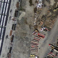
Massachusetts State Plane source |
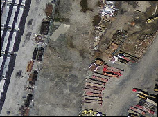
WGS 84 nearest-neighbor |
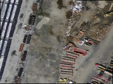
WGS 84 bilinear |
Variant 3.
L'exemple suivant montre la différence entre ST_Transform(raster, srid) et ST_Transform(raster, alignto)
WITH foo AS (
    SELECT 0 AS rid, ST_AddBand(ST_MakeEmptyRaster(2, 2, -500000, 600000, 100, -100, 0, 0, 2163), 1, '16BUI', 1, 0) AS rast UNION ALL
    SELECT 1, ST_AddBand(ST_MakeEmptyRaster(2, 2, -499800, 600000, 100, -100, 0, 0, 2163), 1, '16BUI', 2, 0) AS rast UNION ALL
    SELECT 2, ST_AddBand(ST_MakeEmptyRaster(2, 2, -499600, 600000, 100, -100, 0, 0, 2163), 1, '16BUI', 3, 0) AS rast UNION ALL

    SELECT 3, ST_AddBand(ST_MakeEmptyRaster(2, 2, -500000, 599800, 100, -100, 0, 0, 2163), 1, '16BUI', 10, 0) AS rast UNION ALL
    SELECT 4, ST_AddBand(ST_MakeEmptyRaster(2, 2, -499800, 599800, 100, -100, 0, 0, 2163), 1, '16BUI', 20, 0) AS rast UNION ALL
    SELECT 5, ST_AddBand(ST_MakeEmptyRaster(2, 2, -499600, 599800, 100, -100, 0, 0, 2163), 1, '16BUI', 30, 0) AS rast UNION ALL

    SELECT 6, ST_AddBand(ST_MakeEmptyRaster(2, 2, -500000, 599600, 100, -100, 0, 0, 2163), 1, '16BUI', 100, 0) AS rast UNION ALL
    SELECT 7, ST_AddBand(ST_MakeEmptyRaster(2, 2, -499800, 599600, 100, -100, 0, 0, 2163), 1, '16BUI', 200, 0) AS rast UNION ALL
    SELECT 8, ST_AddBand(ST_MakeEmptyRaster(2, 2, -499600, 599600, 100, -100, 0, 0, 2163), 1, '16BUI', 300, 0) AS rast
), bar AS (
    SELECT
        ST_Transform(rast, 4269) AS alignto
    FROM foo
    LIMIT 1
), baz AS (
    SELECT
        rid,
        rast,
        ST_Transform(rast, 4269) AS not_aligned,
        ST_Transform(rast, alignto) AS aligned
    FROM foo
    CROSS JOIN bar
)
SELECT
    ST_Collect(ST_ConvexHull(not_aligned) ORDER BY rid) AS not_aligned,
    ST_Collect(ST_ConvexHull(aligned) ORDER BY rid) AS aligned
FROM baz
MULTIPOLYGON(((-107.007 50.2,-107.005 50.2,-107.005 50.198,-107.007 50.198,-107.007 50.2)),((-107.004 50.201,-107.002 50.201,-107.002 50.198,-107.004 50.198,-107.004 50.201)),((-107.001 50.201,-106.999 50.201,-106.999 50.198,-107.001 50.198,-107.001 50.201)),((-107.007 50.199,-107.004 50.199,-107.004 50.196,-107.007 50.196,-107.007 50.199)),((-107.004 50.199,-107.001 50.199,-107.001 50.196,-107.004 50.196,-107.004 50.199)),((-107.001 50.199,-106.999 50.199,-106.999 50.196,-107.001 50.196,-107.001 50.199)),((-107.006 50.197,-107.004 50.197,-107.004 50.194,-107.006 50.194,-107.006 50.197)),((-107.004 50.197,-107.001 50.197,-107.001 50.194,-107.004 50.194,-107.004 50.197)),((-107.001 50.197,-106.998 50.197,-106.998 50.195,-107.001 50.195,-107.001 50.197))) | MULTIPOLYGON(((-107.007 50.2,-107.005 50.2,-107.005 50.198,-107.007 50.198,-107.007 50.2)),((-107.005 50.202,-107.001 50.202,-107.001 50.198,-107.005 50.198,-107.005 50.202)),((-107.002 50.202,-106.998 50.202,-106.998 50.198,-107.002 50.198,-107.002 50.202)),((-107.007 50.199,-107.003 50.199,-107.003 50.195,-107.007 50.195,-107.007 50.199)),((-107.005 50.199,-107.001 50.199,-107.001 50.195,-107.005 50.195,-107.005 50.199)),((-107.002 50.199,-106.998 50.199,-106.998 50.195,-107.002 50.195,-107.002 50.199)),((-107.007 50.198,-107.003 50.198,-107.003 50.194,-107.007 50.194,-107.007 50.198)),((-107.005 50.198,-107.001 50.198,-107.001 50.194,-107.005 50.194,-107.005 50.198)),((-107.002 50.198,-106.998 50.198,-106.998 50.194,-107.002 50.194,-107.002 50.198)))