Nome
ST_Clip — Returns the raster clipped by the input geometry. If band number is not specified, all bands are processed. If crop is not specified or TRUE, the output raster is cropped. If touched is set to TRUE, then touched pixels are included, otherwise only if the center of the pixel is in the geometry it is included.
Sinopse
raster ST_Clip(raster rast, integer[] nband, geometry geom, double precision[] nodataval=NULL, boolean crop=TRUE, boolean touched=FALSE);
raster ST_Clip(raster rast, integer nband, geometry geom, double precision nodataval, boolean crop=TRUE, boolean touched=FALSE);
raster ST_Clip(raster rast, integer nband, geometry geom, boolean crop, boolean touched=FALSE);
raster ST_Clip(raster rast, geometry geom, double precision[] nodataval=NULL, boolean crop=TRUE, boolean touched=FALSE);
raster ST_Clip(raster rast, geometry geom, double precision nodataval, boolean crop=TRUE, boolean touched=FALSE);
raster ST_Clip(raster rast, geometry geom, boolean crop, boolean touched=FALSE);
Description
Retorna um raster que é suprimido pela geometria de entrada geom. Se o índice de banda não for especificado, todas as bandas são processadas.
Os rasters resultantes da ST_Clip devem ter o valor nodata designado para as áreas suprimidas, um para cada banda. Se nenhum for promovido e o raster de entrada não tiver nenhum valor nodata definido, os valore nodata do raster resultante são ST_MinPossibleValue(ST_BandPixelType(rast, band)). Quando o número de valor nodata no arranjo é menor qua o número de banda, o último no arranjo é usado para as bandas que sobraram. Se o número de valor nodata for maior que o número de banda, os valores extras serão ignorados. Todas as variantes que aceitam um arranjo de valores nodata também aceitam um valor único, que pode ser designado para cada banda.
If crop is not specified, true is assumed meaning the output raster is cropped to the intersection of the geomand rast extents. If crop is set to false, the new raster gets the same extent as rast. If touched is set to true, then all pixels in the rast that intersect the geometry are selected.
![[Nota]](../images/note.png)
|
|
|
The default behavior is touched=false, which will only select pixels where the center of the pixel is covered by the geometry. |
Enhanced: 3.5.0 - touched argument added.
Disponibilidade: 2.0.0
Melhorias: 2.1.0 Reescrito em C
Examples here use Massachusetts aerial data available on MassGIS site MassGIS Aerial Orthos.
Exemplos
Comparing selecting all touched vs. not all touched.
WITH source AS (
    SELECT rast, geom
    FROM ST_AsRaster(ST_Letters('R'), scalex =
> 1.0, scaley =
> -1.0) AS r(rast)
    INNER JOIN ST_GeomFromText('LINESTRING(0 1,5 6,10 10)') AS g(geom)
        ON ST_Intersects(r.rast, g.geom)
), clipped AS (
    SELECT rast,
        ST_Clip(rast, geom, touched =
> true) AS rast_touched,
        ST_Clip(rast, geom, touched =
> false) AS rast_not_touched
    FROM source
), variants AS (
    SELECT 'original' AS title, ST_Count(rast) AS pixel_count, rast AS rendered
    FROM clipped
    UNION ALL
    SELECT 'all touched', ST_Count(rast_touched), rast_touched
    FROM clipped
    UNION ALL
    SELECT 'default clip', ST_Count(rast_not_touched), rast_not_touched
    FROM clipped
)
SELECT title, pixel_count, ST_AsPNG(rendered) AS image
FROM variants
ORDER BY CASE title
    WHEN 'original' THEN 1
    WHEN 'all touched' THEN 2
    ELSE 3
END;
title        | pixel_count | image
--------------+-------------+----------------------------
 original     |        2605 | PNG image, 48 x 74 pixels
 all touched  |          16 | PNG image, 11 x 11 pixels
 default clip |          10 | PNG image, 11 x 11 pixels
(3 rows)
The following self-contained example uses three simple shapes as RGB bands. It compares cropping band 1, clipping band 1 without cropping and then restoring bands 2 and 3, and clipping every band without cropping.
WITH canvas AS (
    SELECT ST_AddBand(
        ST_AddBand(
            ST_AddBand(
                ST_MakeEmptyRaster(128, 128, 0, 128, 1, -1, 0, 0, 0),
                '8BUI'::text, 0::double precision, 0::double precision
            ),
            '8BUI'::text, 0::double precision, 0::double precision
        ),
        '8BUI'::text, 0::double precision, 0::double precision
    ) AS rast
), source AS (
    SELECT ST_SetValue(
        ST_SetValue(
            ST_SetValue(rast, 1, ST_Buffer('POINT(32 96)'::geometry, 22), 220),
            2, ST_Buffer('LINESTRING(18 20,110 110)'::geometry, 6,
                         'endcap=flat join=bevel'), 210
        ),
        3, ST_Buffer('LINESTRING(10 48,118 48)'::geometry, 7,
                     'endcap=flat'), 180
    ) AS rast,
    ST_Buffer('POINT(64 64)'::geometry, 34) AS clipper
    FROM canvas
), variants AS (
    SELECT 'original RGB' AS title, rast AS rendered FROM source
    UNION ALL
    SELECT 'band 1 cropped', ST_Clip(rast, 1, clipper, true) FROM source
    UNION ALL
    SELECT
        'band 1 only',
        ST_AddBand(
            ST_Clip(rast, 1, clipper, false),
            ARRAY[ST_Band(rast, 2), ST_Band(rast, 3)]
        )
    FROM source
    UNION ALL
    SELECT 'all bands clipped', ST_Clip(rast, clipper, false) FROM source
)
SELECT title, ST_AsPNG(rendered) AS image
FROM variants
ORDER BY CASE title
    WHEN 'original RGB' THEN 1
    WHEN 'band 1 cropped' THEN 2
    WHEN 'band 1 only' THEN 3
    ELSE 4
END;
title             | image
-------------------+-----------------------------
 original RGB      | PNG image, 128 x 128 pixels
 band 1 cropped    | PNG image, 68 x 68 pixels
 band 1 only       | PNG image, 128 x 128 pixels
 all bands clipped | PNG image, 128 x 128 pixels
(4 rows)
Crop, single-band clipping, and all-band clipping.
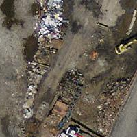
Source tile |
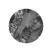
Cropped |
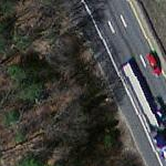
One-band source |
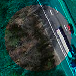
One-band clip |
|
All-band source |
All-band clip |