Name
ST_Transform — Reprojeta um raster em um sistema de referência espacial conhecido para outro usando um algorítimo resampling especificado. As opções são NearestNeighbor, Bilinear, Cubic, CubicSpline, Lanczos com o padrão sendo NearestNeighbor.
Synopsis
raster ST_Transform(raster rast, integer srid, text algorithm=NearestNeighbor, double precision maxerr=0.125, double precision scalex, double precision scaley);
raster ST_Transform(raster rast, integer srid, double precision scalex, double precision scaley, text algorithm=NearestNeighbor, double precision maxerr=0.125);
raster ST_Transform(raster rast, raster alignto, text algorithm=NearestNeighbor, double precision maxerr=0.125);
Descrição
Reprojeta um raster em um sistema de referência espacial conhecido para outro usando um algorítimo pixel warping especificado. Usa "NearestNeighbor" se nenhum algorítimo for especificado e a porcentagem maxerror de 0.125 se nenhum maxerr for especificado.
As opções de algorítimo são: 'NearestNeighbor', 'Bilinear', 'Cubic', 'CubicSpline', e 'Lanczos'. Recorra a: GDAL Warp resampling methods para mais detalhes.
Geralmente, aST_Transform confundida com a ST_SetSRID(). Na verdade, a ST_Transform modifica as coordenadas de um raster (e resample os valores do pixel) de um sistema de referência espacial para outro, enquanto a ST_SetSRID() só altera o identificador de SRID do raster.
Diferente das outras variantes, a 3 requer um raster referência como alignto. O raster transformado será alterado para o sistema de referência espacial (SRID) do raster referência e será alinhado (ST_SameAlignment = VERDADE) ao raster referência.
![[Note]](../images/note.png) | |
Se achar que seu suporte de transformação não estiver funcionando corretamente, talvez precise colocar a variável de ambiente PROJSO na biblioteca de projeção .so ou .dll que seu PostGIS está usando. Isto só precisará ter o mesmo nome do arquivo, Então, por exemplo, no Windows, você iria em Painel de Controle -> Sitema -> Variáveis de Ambiente adicionar um sistema variável chamado |
![[Warning]](../images/warning.png) | |
When transforming a coverage of tiles, you almost always want to use a reference raster to insure same alignment and no gaps in your tiles as demonstrated in example: Variant 3. |
Disponibilidade: 2.0.0 Requer GDAL 1.6.1+
Melhorias: 2.1.0 Adição da variante ST_Transform(rast, alignto)
Exemplos
SELECT ST_Width(mass_stm) As w_before, ST_Width(wgs_84) As w_after,
  ST_Height(mass_stm) As h_before, ST_Height(wgs_84) As h_after
    FROM
    ( SELECT rast As mass_stm, ST_Transform(rast,4326) As wgs_84
  ,  ST_Transform(rast,4326, 'Bilinear') AS wgs_84_bilin
        FROM aerials.o_2_boston
            WHERE ST_Intersects(rast,
                ST_Transform(ST_MakeEnvelope(-71.128, 42.2392,-71.1277, 42.2397, 4326),26986) )
        LIMIT 1) As foo;

 w_before | w_after | h_before | h_after
----------+---------+----------+---------
      200 |     228 |      200 |     170
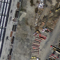 original mass state plane meters (mass_stm) | 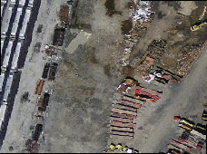 Depois transforma para wgs 84 long lat (wgs_84) | 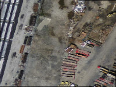 Depois transforma para wgs 84 long lat algorítimo bilinear em vez do padrão NN (wgs_84_bilin) |
Exemplos: Variante 3
A seguir está a diferença entre usar ST_Transform(raster, srid) e ST_Transform(raster, alignto)
WITH foo AS (
    SELECT 0 AS rid, ST_AddBand(ST_MakeEmptyRaster(2, 2, -500000, 600000, 100, -100, 0, 0, 2163), 1, '16BUI', 1, 0) AS rast UNION ALL
    SELECT 1, ST_AddBand(ST_MakeEmptyRaster(2, 2, -499800, 600000, 100, -100, 0, 0, 2163), 1, '16BUI', 2, 0) AS rast UNION ALL
    SELECT 2, ST_AddBand(ST_MakeEmptyRaster(2, 2, -499600, 600000, 100, -100, 0, 0, 2163), 1, '16BUI', 3, 0) AS rast UNION ALL

    SELECT 3, ST_AddBand(ST_MakeEmptyRaster(2, 2, -500000, 599800, 100, -100, 0, 0, 2163), 1, '16BUI', 10, 0) AS rast UNION ALL
    SELECT 4, ST_AddBand(ST_MakeEmptyRaster(2, 2, -499800, 599800, 100, -100, 0, 0, 2163), 1, '16BUI', 20, 0) AS rast UNION ALL
    SELECT 5, ST_AddBand(ST_MakeEmptyRaster(2, 2, -499600, 599800, 100, -100, 0, 0, 2163), 1, '16BUI', 30, 0) AS rast UNION ALL

    SELECT 6, ST_AddBand(ST_MakeEmptyRaster(2, 2, -500000, 599600, 100, -100, 0, 0, 2163), 1, '16BUI', 100, 0) AS rast UNION ALL
    SELECT 7, ST_AddBand(ST_MakeEmptyRaster(2, 2, -499800, 599600, 100, -100, 0, 0, 2163), 1, '16BUI', 200, 0) AS rast UNION ALL
    SELECT 8, ST_AddBand(ST_MakeEmptyRaster(2, 2, -499600, 599600, 100, -100, 0, 0, 2163), 1, '16BUI', 300, 0) AS rast
), bar AS (
    SELECT
        ST_Transform(rast, 4269) AS alignto
    FROM foo
    LIMIT 1
), baz AS (
    SELECT
        rid,
        rast,
        ST_Transform(rast, 4269) AS not_aligned,
        ST_Transform(rast, alignto) AS aligned
    FROM foo
    CROSS JOIN bar
)
SELECT
    ST_SameAlignment(rast) AS rast,
    ST_SameAlignment(not_aligned) AS not_aligned,
    ST_SameAlignment(aligned) AS aligned
FROM baz

 rast | not_aligned | aligned
------+-------------+---------
 t    | f           | t
 not_aligned
|  aligned
|