Loading...
Searching...
No Matches
◆ lwgeom_geohash_precision()
Definition at line 781 of file lwalgorithm.c.
782{
783 double minx, miny, maxx, maxy;
784 double latmax, latmin, lonmax, lonmin;
785 double lonwidth, latwidth;
786 double latmaxadjust, lonmaxadjust, latminadjust, lonminadjust;
788
789 /* Get the bounding box, return error if things don't work out. */
790 minx = bbox.xmin;
791 miny = bbox.ymin;
792 maxx = bbox.xmax;
793 maxy = bbox.ymax;
794
795 if ( minx == maxx && miny == maxy )
796 {
797 /* It's a point. Doubles have 51 bits of precision.
798 ** 2 * 51 / 5 == 20 */
799 return 20;
800 }
801
802 lonmin = -180.0;
803 latmin = -90.0;
804 lonmax = 180.0;
805 latmax = 90.0;
806
807 /* Shrink a world bounding box until one of the edges interferes with the
808 ** bounds of our rectangle. */
809 while ( 1 )
810 {
811 lonwidth = lonmax - lonmin;
812 latwidth = latmax - latmin;
813 latmaxadjust = lonmaxadjust = latminadjust = lonminadjust = 0.0;
814
815 if ( minx > lonmin + lonwidth / 2.0 )
816 {
817 lonminadjust = lonwidth / 2.0;
818 }
819 else if ( maxx < lonmax - lonwidth / 2.0 )
820 {
821 lonmaxadjust = -1 * lonwidth / 2.0;
822 }
823 if ( lonminadjust || lonmaxadjust )
824 {
825 lonmin += lonminadjust;
826 lonmax += lonmaxadjust;
827 /* Each adjustment cycle corresponds to 2 bits of storage in the
828 ** geohash. */
829 precision++;
830 }
831 else
832 {
833 break;
834 }
835
836 if ( miny > latmin + latwidth / 2.0 )
837 {
838 latminadjust = latwidth / 2.0;
839 }
840 else if (maxy < latmax - latwidth / 2.0 )
841 {
842 latmaxadjust = -1 * latwidth / 2.0;
843 }
844 /* Only adjust if adjustments are legal (we haven't crossed any edges). */
845 if ( latminadjust || latmaxadjust )
846 {
847 latmin += latminadjust;
848 latmax += latmaxadjust;
849 /* Each adjustment cycle corresponds to 2 bits of storage in the
850 ** geohash. */
851 precision++;
852 }
853 else
854 {
855 break;
856 }
857 }
858
859 /* Save the edges of our bounds, in case someone cares later. */
860 bounds->xmin = lonmin;
861 bounds->xmax = lonmax;
862 bounds->ymin = latmin;
863 bounds->ymax = latmax;
864
865 /* Each geohash character (base32) can contain 5 bits of information.
866 ** We are returning the precision in characters, so here we divide. */
868}
References precision, GBOX::xmax, GBOX::xmin, GBOX::ymax, and GBOX::ymin.
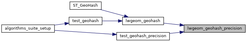
Referenced by lwgeom_geohash(), and test_geohash_precision().
Here is the caller graph for this function: