Loading...
Searching...
No Matches
◆ getTableInfo()
|
static |
Definition at line 866 of file pgsql2shp-core.c.
867{
868
869 /* Get some more information from the table:
870 - count = total number of geometries/geographies in the table
871
872 and if we have found a suitable geometry column:
873
874 - max = maximum number of dimensions within the geometry/geography column
875 - geometrytype = string representing the geometry/geography type, e.g. POINT
876
877 Since max/geometrytype already require a sequential scan of the table, we may as
878 well get the row count too.
879 */
880
881 PGresult *res;
882 char *query;
883 int tmpint;
884
885
887 {
888 /* Include geometry information */
890 {
891 query = core_asprintf(
892 "SELECT count(1), max(ST_zmflag(\"%s\"::geometry)), geometrytype(\"%s\"::geometry) FROM \"%s\".\"%s\" GROUP BY 3",
894 }
895 else
896 {
897 query = core_asprintf(
898 "SELECT count(1), max(ST_zmflag(\"%s\"::geometry)), geometrytype(\"%s\"::geometry) FROM \"%s\" GROUP BY 3",
900 }
901 }
902 else
903 {
904 /* Otherwise... just a row count will do */
906 {
907 query = core_asprintf(
908 "SELECT count(1) FROM \"%s\".\"%s\"",
910 }
911 else
912 {
913 query = core_asprintf(
914 "SELECT count(1) FROM \"%s\"",
915 state->table);
916 }
917 }
918
920
922 free(query);
923
924 if (PQresultStatus(res) != PGRES_TUPLES_OK)
925 {
926 snprintf(state->message, SHPDUMPERMSGLEN, _("ERROR: Could not execute table metadata query: %s"), PQresultErrorMessage(res));
927 PQclear(res);
929 }
930
931 /* Make sure we error if the table is empty */
932 if (PQntuples(res) == 0)
933 {
934 snprintf(state->message, SHPDUMPERMSGLEN, _("ERROR: Could not determine table metadata (empty table)"));
935 PQclear(res);
937 }
938
939 /* If we have a geo* column, get the dimension, type and count information */
941 {
942 /* If a table has a geometry column containing mixed types then
943 the metadata query will return multiple rows. We need to cycle
944 through all rows to determine if the type combinations are valid.
945
946 Note that if we find a combination of a MULTI and non-MULTI geometry
947 of the same type, we always choose MULTI to ensure that everything
948 gets output correctly. The create_* conversion functions are clever
949 enough to up-convert the non-MULTI geometry to a MULTI in this case. */
950
951 int dummy, i;
952 uint8_t type = 0;
953 int typefound = 0, typemismatch = 0;
954
955 state->rowcount = 0;
956
957 for (i = 0; i < PQntuples(res); i++)
958 {
959 /* skip null geometries */
960 if (PQgetisnull(res, i, 2))
961 {
962 state->rowcount += atoi(PQgetvalue(res, i, 0));
963 continue;
964 }
965
966 geometry_type_from_string(PQgetvalue(res, i, 2), &type, &dummy, &dummy);
967
968 /* We can always set typefound to that of the first column found */
969 if (!typefound)
970 typefound = type;
971
972 switch (type)
973 {
976 typemismatch = 1;
977 else
978 typefound = MULTIPOINTTYPE;
979 break;
980
983 typemismatch = 1;
984 else
985 typefound = MULTILINETYPE;
986 break;
987
990 typemismatch = 1;
991 else
992 typefound = MULTIPOLYGONTYPE;
993 break;
994
997 typemismatch = 1;
999 typefound = POINTTYPE;
1000 break;
1001
1004 typemismatch = 1;
1006 typefound = LINETYPE;
1007 break;
1008
1011 typemismatch = 1;
1013 typefound = POLYGONTYPE;
1014 break;
1015 }
1016
1017 /* Update the rowcount for each type */
1018 state->rowcount += atoi(PQgetvalue(res, i, 0));
1019
1020 /* Set up the dimension output type (note: regardless of how many rows
1021 the table metadata query returns, this value will be the same. But
1022 we'll choose to use the first value anyway) */
1023 tmpint = atoi(PQgetvalue(res, i, 1));
1024 switch (tmpint)
1025 {
1026 case 0:
1028 break;
1029 case 1:
1031 break;
1032 default:
1034 break;
1035 }
1036
1037 }
1038
1039 /* Flag an error if the table contains incompatible geometry combinations */
1040 if (typemismatch)
1041 {
1042 snprintf(state->message, SHPDUMPERMSGLEN, _("ERROR: Incompatible mixed geometry types in table"));
1043 PQclear(res);
1045 }
1046
1047 /* Set up the shapefile output type based upon the dimension information */
1048 switch (typefound)
1049 {
1052 {
1053 case 'z':
1055 break;
1056
1057 case 'm':
1059 break;
1060
1061 default:
1063 }
1064 break;
1065
1068 {
1069 case 'z':
1071 break;
1072
1073 case 'm':
1075 break;
1076
1077 default:
1079 }
1080 break;
1081
1085 {
1086 case 'z':
1088 break;
1089
1090 case 'm':
1092 break;
1093
1094 default:
1096 }
1097 break;
1098
1102 {
1103 case 'z':
1105 break;
1106
1107 case 'm':
1109 break;
1110
1111 default:
1113 }
1114 break;
1115 }
1116 }
1117 else
1118 {
1119 /* Without a geo* column the total is simply the first (COUNT) column */
1120 state->rowcount = atoi(PQgetvalue(res, 0, 0));
1121 }
1122
1123 /* Dispose of the result set */
1124 PQclear(res);
1125
1127}
int lwtype_is_collection(uint8_t type)
Determine whether a type number is a collection or not.
Definition lwgeom.c:1196
int geometry_type_from_string(const char *str, uint8_t *type, int *z, int *m)
Utility function to get type number from string.
Definition lwutil.c:495
void free(void *)
static char * core_asprintf(const char *format,...) __attribute__((format(printf
Definition pgsql2shp-core.c:77
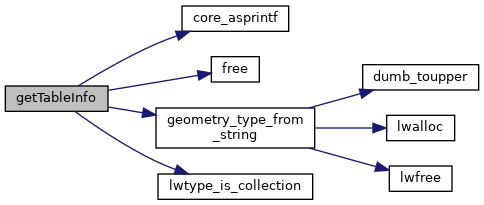
References _, shp_dumper_state::conn, core_asprintf(), free(), shp_dumper_state::geo_col_name, geometry_type_from_string(), LINETYPE, LWDEBUGF, lwtype_is_collection(), shp_dumper_state::message, MULTILINETYPE, MULTIPOINTTYPE, MULTIPOLYGONTYPE, shp_dumper_state::outshptype, shp_dumper_state::outtype, POINTTYPE, POLYGONTYPE, shp_dumper_state::rowcount, shp_dumper_state::schema, SHPDUMPERERR, SHPDUMPERMSGLEN, SHPDUMPEROK, SHPT_ARC, SHPT_ARCM, SHPT_ARCZ, SHPT_MULTIPOINT, SHPT_MULTIPOINTM, SHPT_MULTIPOINTZ, SHPT_POINT, SHPT_POINTM, SHPT_POINTZ, SHPT_POLYGON, SHPT_POLYGONM, SHPT_POLYGONZ, and shp_dumper_state::table.
Referenced by ShpDumperOpenTable().
Here is the call graph for this function:
Here is the caller graph for this function: