Loading...
Searching...
No Matches
◆ lwgeom_mindistance2d_tolerance()
|
extern |
Function handling min distance calculations and dwithin calculations.
The difference is just the tolerance.
Definition at line 222 of file measures.c.
223{
224 DISTPTS thedl;
227 thedl.distance = FLT_MAX;
228 thedl.tolerance = tolerance;
231 /*should never get here. all cases ought to be error handled earlier*/
233 return FLT_MAX;
234}
void void lwerror(const char *fmt,...) __attribute__((format(printf
Write a notice out to the error handler.
int lw_dist2d_comp(const LWGEOM *lw1, const LWGEOM *lw2, DISTPTS *dl)
This function just deserializes geometries Bboxes is not checked here since it is the subgeometries b...
Definition measures.c:251
References DIST_MIN, DISTPTS::distance, lw_dist2d_comp(), LWDEBUG, lwerror(), DISTPTS::mode, and DISTPTS::tolerance.
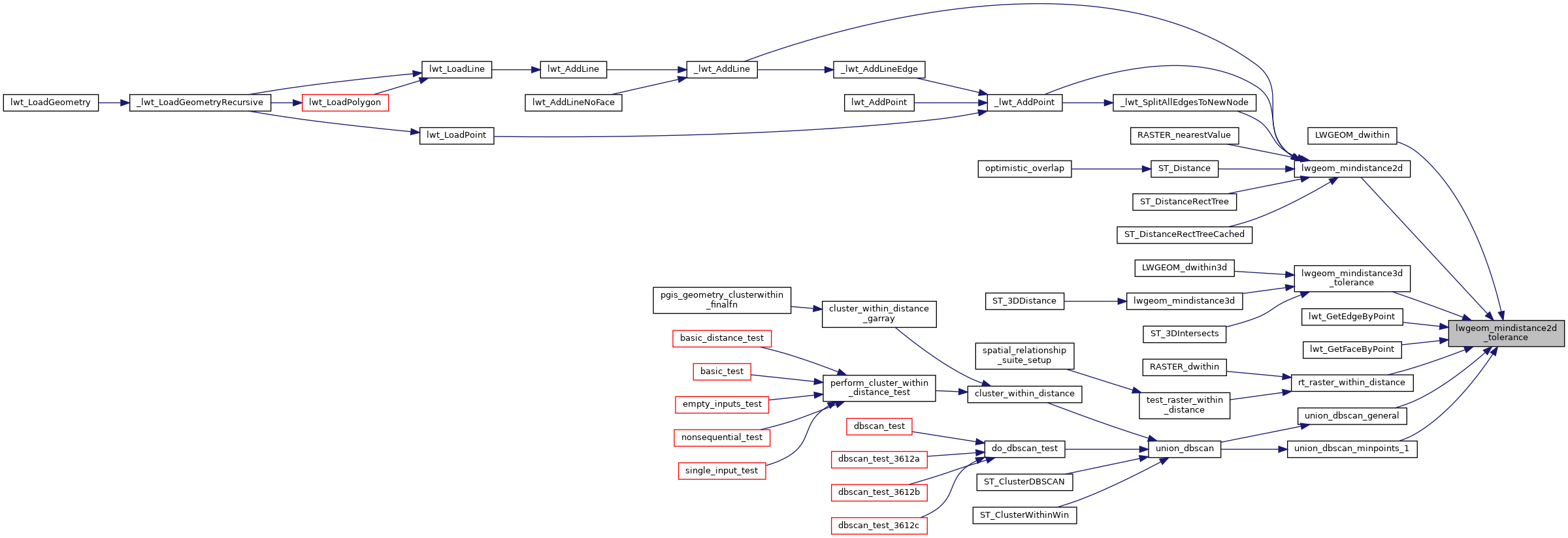
Referenced by LWGEOM_dwithin(), lwgeom_mindistance2d(), lwgeom_mindistance3d_tolerance(), lwt_GetEdgeByPoint(), lwt_GetFaceByPoint(), rt_raster_within_distance(), union_dbscan_general(), and union_dbscan_minpoints_1().
Here is the call graph for this function:
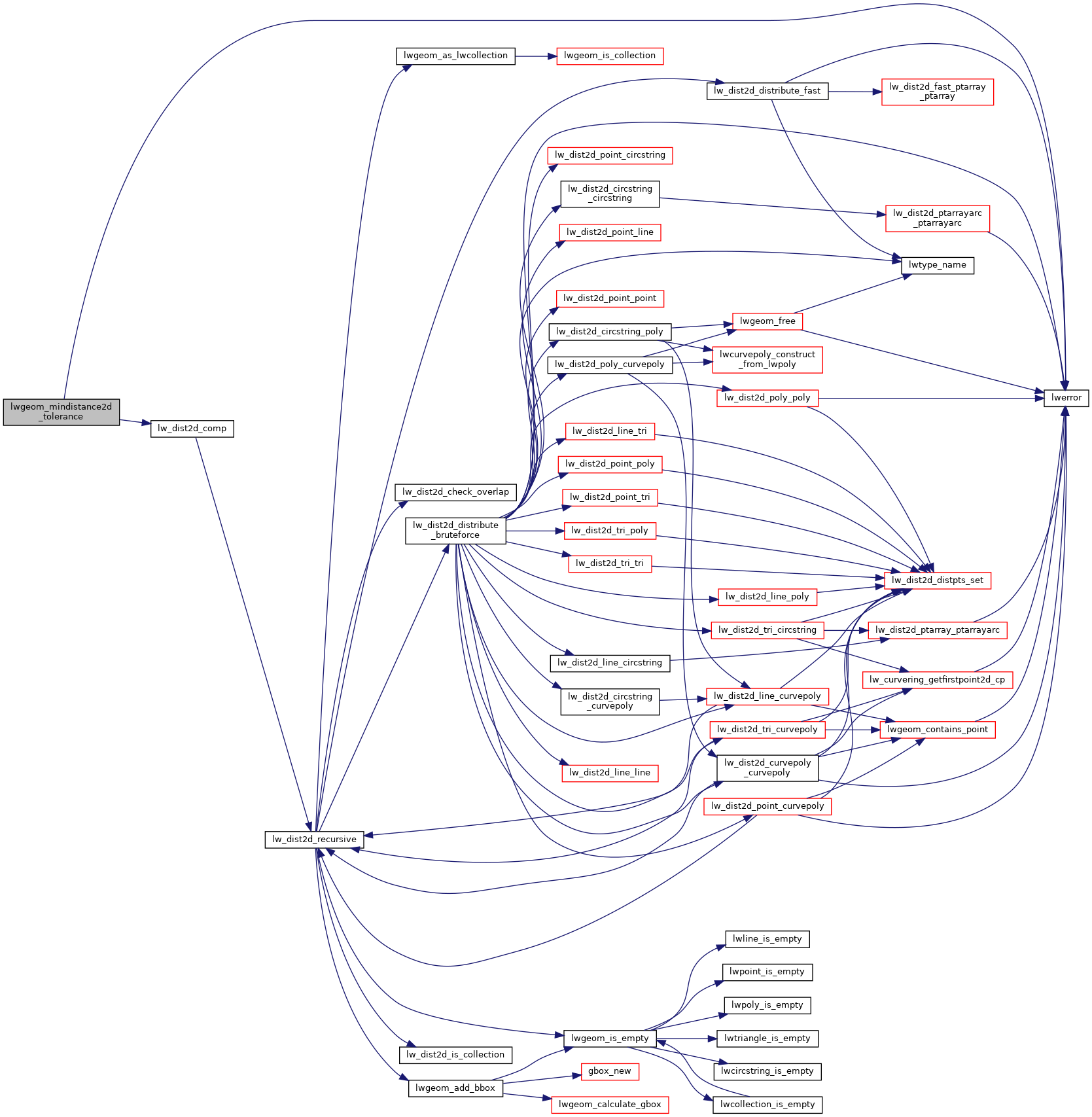
Here is the caller graph for this function: