Loading...
Searching...
No Matches
◆ covers()
| Datum covers | ( | PG_FUNCTION_ARGS | ) |
Definition at line 722 of file lwgeom_geos_predicates.c.
723{
724 SHARED_GSERIALIZED *shared_geom1 = ToastCacheGetGeometry(fcinfo, 0);
725 SHARED_GSERIALIZED *shared_geom2 = ToastCacheGetGeometry(fcinfo, 1);
729 GBOX box1, box2;
730 PrepGeomCache *prep_cache;
731
732 POSTGIS_DEBUGF(3, "Covers: type1: %d, type2: %d", gserialized_get_type(geom1), gserialized_get_type(geom2));
733
734 /* A.Covers(Empty) == FALSE */
736 PG_RETURN_BOOL(false);
737
738 gserialized_error_if_srid_mismatch(geom1, geom2, __func__);
739
740 /*
741 * Short-circuit 1: if geom2 bounding box is not completely inside
742 * geom1 bounding box we can return FALSE.
743 */
745 gserialized_get_gbox_p(geom2, &box2) )
746 {
748 {
749 PG_RETURN_BOOL(false);
750 }
751 }
752 /*
753 * Short-circuit 2: if geom2 is a point and geom1 is a polygon
754 * call the point-in-polygon function.
755 */
757 {
762 lwgeom_free(lwpt);
763 PG_RETURN_BOOL(result);
764 }
765
766 initGEOS(lwpgnotice, lwgeom_geos_error);
767
768 prep_cache = GetPrepGeomCache(fcinfo, shared_geom1, 0);
770 {
771 GEOSGeometry *g1 = POSTGIS2GEOS(geom2);
774 GEOSGeom_destroy(g1);
775 }
776 else
777 {
778 GEOSGeometry *g1, *g2;
779
780 g1 = POSTGIS2GEOS(geom1);
782 g2 = POSTGIS2GEOS(geom2);
783 if (!g2)
784 {
785 GEOSGeom_destroy(g1);
787 }
789 GEOSGeom_destroy(g1);
790 GEOSGeom_destroy(g2);
791 }
792
794
795 PG_RETURN_BOOL(result);
796}
int gbox_contains_2d(const GBOX *g1, const GBOX *g2)
Return LW_TRUE if the first GBOX contains the second on the 2d plane, LW_FALSE otherwise.
Definition gbox.c:339
void gserialized_error_if_srid_mismatch(const GSERIALIZED *g1, const GSERIALIZED *g2, const char *funcname)
Definition gserialized.c:432
LWGEOM * lwgeom_from_gserialized(const GSERIALIZED *g)
Allocate a new LWGEOM from a GSERIALIZED.
Definition gserialized.c:268
int gserialized_get_gbox_p(const GSERIALIZED *g, GBOX *gbox)
Read the box from the GSERIALIZED or calculate it if necessary.
Definition gserialized.c:94
int gserialized_is_empty(const GSERIALIZED *g)
Check if a GSERIALIZED is empty without deserializing first.
Definition gserialized.c:181
uint32_t gserialized_get_type(const GSERIALIZED *g)
Extract the geometry type from the serialized form (it hides in the anonymous data area,...
Definition gserialized.c:118
PrepGeomCache * GetPrepGeomCache(FunctionCallInfo fcinfo, SHARED_GSERIALIZED *g1, SHARED_GSERIALIZED *g2)
Given a couple potential geometries and a function call context, return a prepared structure for one ...
Definition lwgeom_geos_prepared.c:369
IntervalTree * GetIntervalTree(FunctionCallInfo fcinfo, SHARED_GSERIALIZED *g1)
Checks for a cache hit against the provided geometry and returns a pre-built index structure (RTREE_P...
Definition lwgeom_itree.c:114
bool itree_pip_covers(const IntervalTree *itree, const LWGEOM *lwpoints)
Definition lwgeom_itree.c:185
GEOSGeometry * POSTGIS2GEOS(const GSERIALIZED *pglwgeom)
Definition postgis/lwgeom_geos.c:1823
Definition liblwgeom.h:352
Definition liblwgeom.h:443
Definition intervaltree.h:57
Definition liblwgeom.h:457
const GEOSPreparedGeometry * prepared_geom
Definition lwgeom_geos_prepared.h:54
Definition lwgeom_geos_prepared.h:50
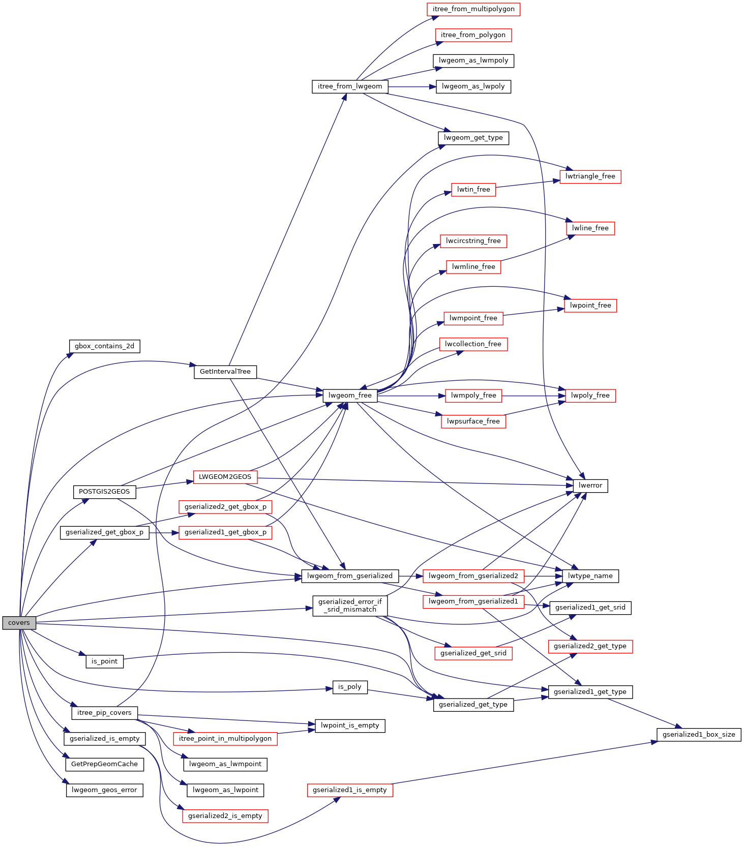
References gbox_contains_2d(), PrepGeomCache::gcache, GetIntervalTree(), GetPrepGeomCache(), gserialized_error_if_srid_mismatch(), gserialized_get_gbox_p(), gserialized_get_type(), gserialized_is_empty(), HANDLE_GEOS_ERROR, is_point(), is_poly(), itree_pip_covers(), lwgeom_free(), lwgeom_from_gserialized(), lwgeom_geos_error(), POSTGIS2GEOS(), PrepGeomCache::prepared_geom, and result.
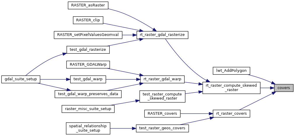
Referenced by lwt_AddPolygon(), rt_raster_compute_skewed_raster(), and rt_raster_covers().
Here is the call graph for this function:
Here is the caller graph for this function: