Loading...
Searching...
No Matches
◆ contains()
| Datum contains | ( | PG_FUNCTION_ARGS | ) |
Definition at line 496 of file lwgeom_geos_predicates.c.
497{
498 SHARED_GSERIALIZED *shared_geom1 = ToastCacheGetGeometry(fcinfo, 0);
499 SHARED_GSERIALIZED *shared_geom2 = ToastCacheGetGeometry(fcinfo, 1);
503 GEOSGeometry *g1, *g2;
504 GBOX box1, box2;
505 PrepGeomCache *prep_cache;
506
507 gserialized_error_if_srid_mismatch(geom1, geom2, __func__);
508
509 /* A.Contains(Empty) == FALSE */
511 PG_RETURN_BOOL(false);
512
513 POSTGIS_DEBUGF(3, "Contains: type1: %d, type2: %d", gserialized_get_type(geom1), gserialized_get_type(geom2));
514
515 /*
516 ** Short-circuit 1: if geom2 bounding box is not completely inside
517 ** geom1 bounding box we can return FALSE.
518 */
520 gserialized_get_gbox_p(geom2, &box2))
521 {
523 PG_RETURN_BOOL(false);
524 }
525
526 /*
527 ** Short-circuit 2: if geom2 is a point and geom1 is a polygon
528 ** call the point-in-polygon function.
529 */
531 {
536 lwgeom_free(lwpt);
537 PG_RETURN_BOOL(result);
538 }
539
540 initGEOS(lwpgnotice, lwgeom_geos_error);
541
542 prep_cache = GetPrepGeomCache(fcinfo, shared_geom1, NULL);
544 {
545 g1 = POSTGIS2GEOS(geom2);
546 if (!g1)
548
550 GEOSGeom_destroy(g1);
551 }
552 else
553 {
554 g1 = POSTGIS2GEOS(geom1);
556 g2 = POSTGIS2GEOS(geom2);
557 if (!g2)
558 {
560 GEOSGeom_destroy(g1);
561 }
562 result = GEOSContains( g1, g2);
563 GEOSGeom_destroy(g1);
564 GEOSGeom_destroy(g2);
565 }
566
568
569 PG_RETURN_BOOL(result > 0);
570}
int gbox_contains_2d(const GBOX *g1, const GBOX *g2)
Return LW_TRUE if the first GBOX contains the second on the 2d plane, LW_FALSE otherwise.
Definition gbox.c:339
void gserialized_error_if_srid_mismatch(const GSERIALIZED *g1, const GSERIALIZED *g2, const char *funcname)
Definition gserialized.c:432
LWGEOM * lwgeom_from_gserialized(const GSERIALIZED *g)
Allocate a new LWGEOM from a GSERIALIZED.
Definition gserialized.c:268
int gserialized_get_gbox_p(const GSERIALIZED *g, GBOX *gbox)
Read the box from the GSERIALIZED or calculate it if necessary.
Definition gserialized.c:94
int gserialized_is_empty(const GSERIALIZED *g)
Check if a GSERIALIZED is empty without deserializing first.
Definition gserialized.c:181
uint32_t gserialized_get_type(const GSERIALIZED *g)
Extract the geometry type from the serialized form (it hides in the anonymous data area,...
Definition gserialized.c:118
PrepGeomCache * GetPrepGeomCache(FunctionCallInfo fcinfo, SHARED_GSERIALIZED *g1, SHARED_GSERIALIZED *g2)
Given a couple potential geometries and a function call context, return a prepared structure for one ...
Definition lwgeom_geos_prepared.c:369
IntervalTree * GetIntervalTree(FunctionCallInfo fcinfo, SHARED_GSERIALIZED *g1)
Checks for a cache hit against the provided geometry and returns a pre-built index structure (RTREE_P...
Definition lwgeom_itree.c:114
bool itree_pip_contains(const IntervalTree *itree, const LWGEOM *lwpoints)
Definition lwgeom_itree.c:140
GEOSGeometry * POSTGIS2GEOS(const GSERIALIZED *pglwgeom)
Definition postgis/lwgeom_geos.c:1823
Definition liblwgeom.h:352
Definition liblwgeom.h:443
Definition intervaltree.h:57
Definition liblwgeom.h:457
const GEOSPreparedGeometry * prepared_geom
Definition lwgeom_geos_prepared.h:54
Definition lwgeom_geos_prepared.h:50
References gbox_contains_2d(), PrepGeomCache::gcache, GetIntervalTree(), GetPrepGeomCache(), gserialized_error_if_srid_mismatch(), gserialized_get_gbox_p(), gserialized_get_type(), gserialized_is_empty(), HANDLE_GEOS_ERROR, is_point(), is_poly(), itree_pip_contains(), lwgeom_free(), lwgeom_from_gserialized(), lwgeom_geos_error(), POSTGIS2GEOS(), PrepGeomCache::prepared_geom, and result.
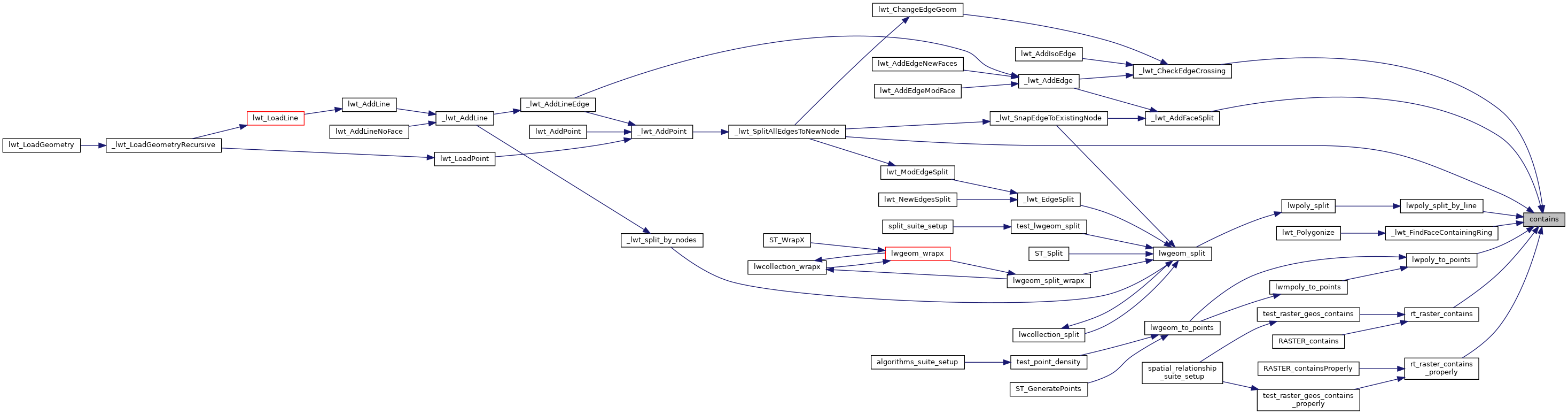
Referenced by _lwt_AddFaceSplit(), _lwt_CheckEdgeCrossing(), _lwt_FindFaceContainingRing(), _lwt_SplitAllEdgesToNewNode(), lwpoly_split_by_line(), lwpoly_to_points(), rt_raster_contains(), and rt_raster_contains_properly().
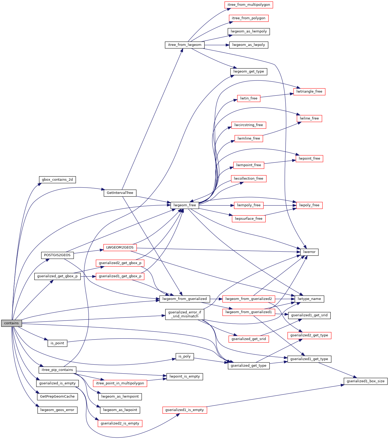
Here is the call graph for this function:
Here is the caller graph for this function: