Loading...
Searching...
No Matches
◆ lonlat_to_cart()
| POINT3D * lonlat_to_cart | ( | const double_t | raw_lon, |
| const double_t | raw_lat | ||
| ) |
Definition at line 208 of file geography_centroid.c.
209{
210 double_t lat, lon;
211 double_t sin_lat;
212
214
215 // prepare coordinate for trigonometric functions from [-90, 90] -> [0, pi]
216 lat = (raw_lat + 90) / 180 * M_PI;
217
218 // prepare coordinate for trigonometric functions from [-180, 180] -> [-pi, pi]
219 lon = raw_lon / 180 * M_PI;
220
221 /* calculate value only once */
222 sin_lat = sinl(lat);
223
224 /* convert to 3D cartesian coordinates */
225 point->x = sin_lat * cosl(lon);
226 point->y = sin_lat * sinl(lon);
227 point->z = cosl(lat);
228
229 return point;
230}
Definition liblwgeom.h:401
References lwalloc(), POINT3D::x, POINT3D::y, and POINT3D::z.
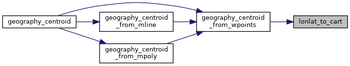
Referenced by geography_centroid_from_wpoints().
Here is the call graph for this function:

Here is the caller graph for this function: