Loading...
Searching...
No Matches
◆ lwpoly_from_gserialized2_buffer()
|
static |
Definition at line 1277 of file gserialized2.c.
1278{
1279 uint8_t *start_ptr = data_ptr;
1280 LWPOLY *poly;
1281 uint8_t *ordinate_ptr;
1282 uint32_t nrings = 0;
1283 uint32_t i = 0;
1284
1285 assert(data_ptr);
1286
1288 poly->srid = srid;
1289 poly->bbox = NULL;
1292
1293 data_ptr += 4; /* Skip past the polygontype. */
1295 poly->nrings = nrings;
1297 data_ptr += 4; /* Skip past the nrings. */
1298
1299 ordinate_ptr = data_ptr; /* Start the ordinate pointer. */
1300 if (nrings > 0)
1301 {
1303 poly->maxrings = nrings;
1304 ordinate_ptr += nrings * 4; /* Move past all the npoints values. */
1305 if (nrings % 2) /* If there is padding, move past that too. */
1306 ordinate_ptr += 4;
1307 }
1308 else /* Empty polygon */
1309 {
1310 poly->rings = NULL;
1311 poly->maxrings = 0;
1312 }
1313
1314 for (i = 0; i < nrings; i++)
1315 {
1316 uint32_t npoints = 0;
1317
1318 /* Read in the number of points. */
1319 npoints = gserialized2_get_uint32_t(data_ptr);
1320 data_ptr += 4;
1321
1322 /* Make a point array for the ring, and move the ordinate pointer past the ring ordinates. */
1323 poly->rings[i] = ptarray_construct_reference_data(FLAGS_GET_Z(lwflags), FLAGS_GET_M(lwflags), npoints, ordinate_ptr);
1324
1326 }
1327
1328 if (size)
1329 *size = ordinate_ptr - start_ptr;
1330
1331 return poly;
1332}
static uint32_t gserialized2_get_uint32_t(const uint8_t *loc)
Definition gserialized2.c:131
POINTARRAY * ptarray_construct_reference_data(char hasz, char hasm, uint32_t npoints, uint8_t *ptlist)
Construct a new POINTARRAY, referencing to the data from ptlist.
Definition ptarray.c:291
lwflags_t lwflags(int hasz, int hasm, int geodetic)
Construct a new flags bitmask.
Definition lwutil.c:477
Definition liblwgeom.h:517
Definition liblwgeom.h:426
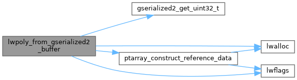
References LWPOLY::bbox, LWPOLY::flags, FLAGS_GET_M, FLAGS_GET_Z, FLAGS_NDIMS, gserialized2_get_uint32_t(), lwalloc(), LWDEBUGF, lwflags(), LWPOLY::maxrings, LWPOLY::nrings, POLYGONTYPE, ptarray_construct_reference_data(), LWPOLY::rings, LWPOLY::srid, and LWPOLY::type.
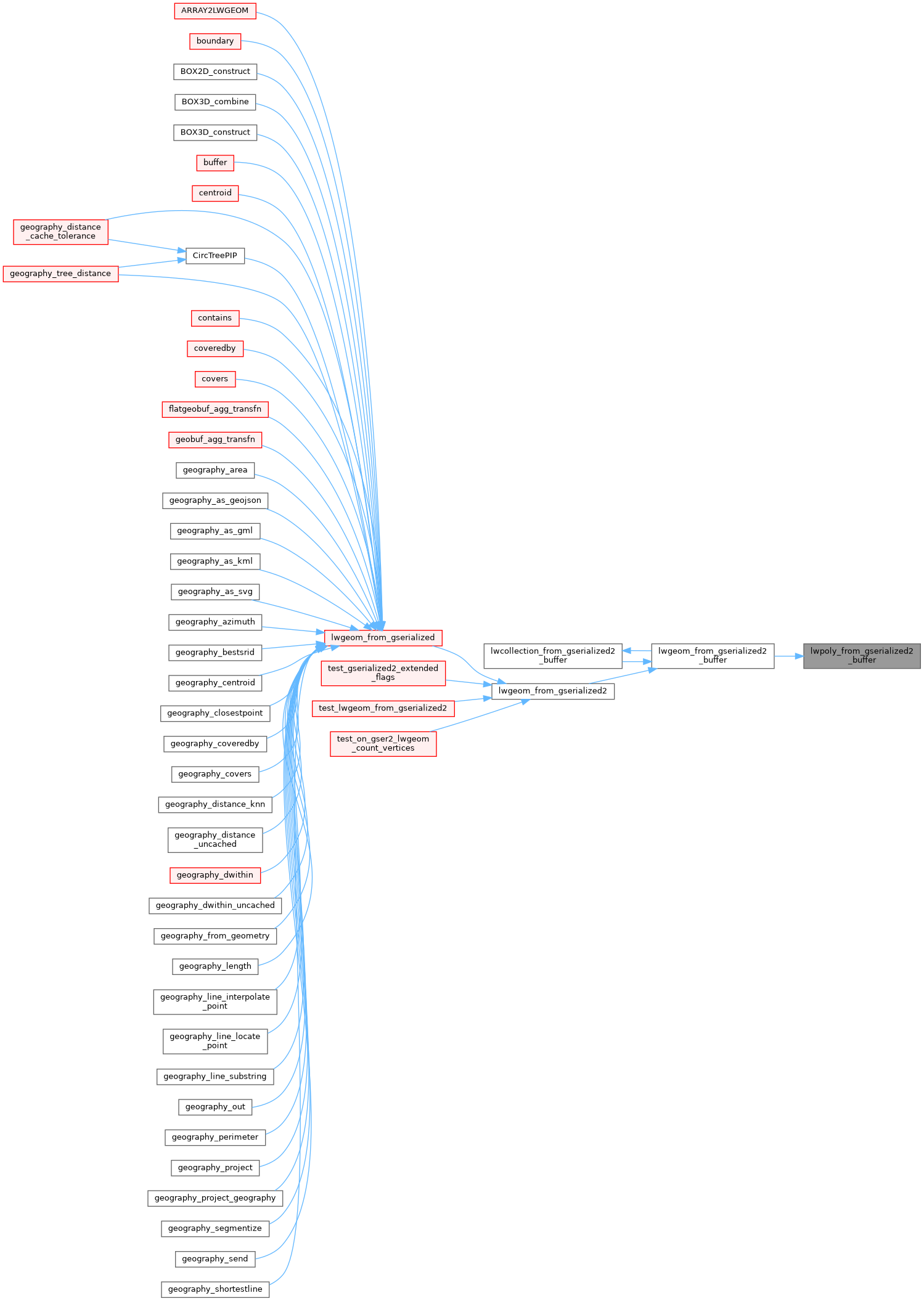
Referenced by lwgeom_from_gserialized2_buffer().
Here is the call graph for this function:
Here is the caller graph for this function: