Loading...
Searching...
No Matches
◆ lwpoint_from_gserialized2_buffer()
|
static |
Definition at line 1212 of file gserialized2.c.
1213{
1214 uint8_t *start_ptr = data_ptr;
1215 LWPOINT *point;
1216 uint32_t npoints = 0;
1217
1218 assert(data_ptr);
1219
1221 point->srid = srid;
1222 point->bbox = NULL;
1225
1226 data_ptr += 4; /* Skip past the type. */
1228 data_ptr += 4; /* Skip past the npoints. */
1229
1230 if (npoints > 0)
1231 point->point = ptarray_construct_reference_data(FLAGS_GET_Z(lwflags), FLAGS_GET_M(lwflags), 1, data_ptr);
1232 else
1233 point->point = ptarray_construct(FLAGS_GET_Z(lwflags), FLAGS_GET_M(lwflags), 0); /* Empty point */
1234
1236
1237 if (size)
1238 *size = data_ptr - start_ptr;
1239
1240 return point;
1241}
static uint32_t gserialized2_get_uint32_t(const uint8_t *loc)
Definition gserialized2.c:131
POINTARRAY * ptarray_construct_reference_data(char hasz, char hasm, uint32_t npoints, uint8_t *ptlist)
Construct a new POINTARRAY, referencing to the data from ptlist.
Definition ptarray.c:291
lwflags_t lwflags(int hasz, int hasm, int geodetic)
Construct a new flags bitmask.
Definition lwutil.c:477
POINTARRAY * ptarray_construct(char hasz, char hasm, uint32_t npoints)
Construct an empty pointarray, allocating storage and setting the npoints, but not filling in any inf...
Definition ptarray.c:51
Definition liblwgeom.h:469
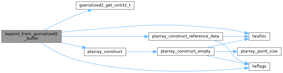
References LWPOINT::bbox, LWPOINT::flags, FLAGS_GET_M, FLAGS_GET_Z, FLAGS_NDIMS, gserialized2_get_uint32_t(), lwalloc(), lwflags(), LWPOINT::point, POINTTYPE, ptarray_construct(), ptarray_construct_reference_data(), LWPOINT::srid, and LWPOINT::type.
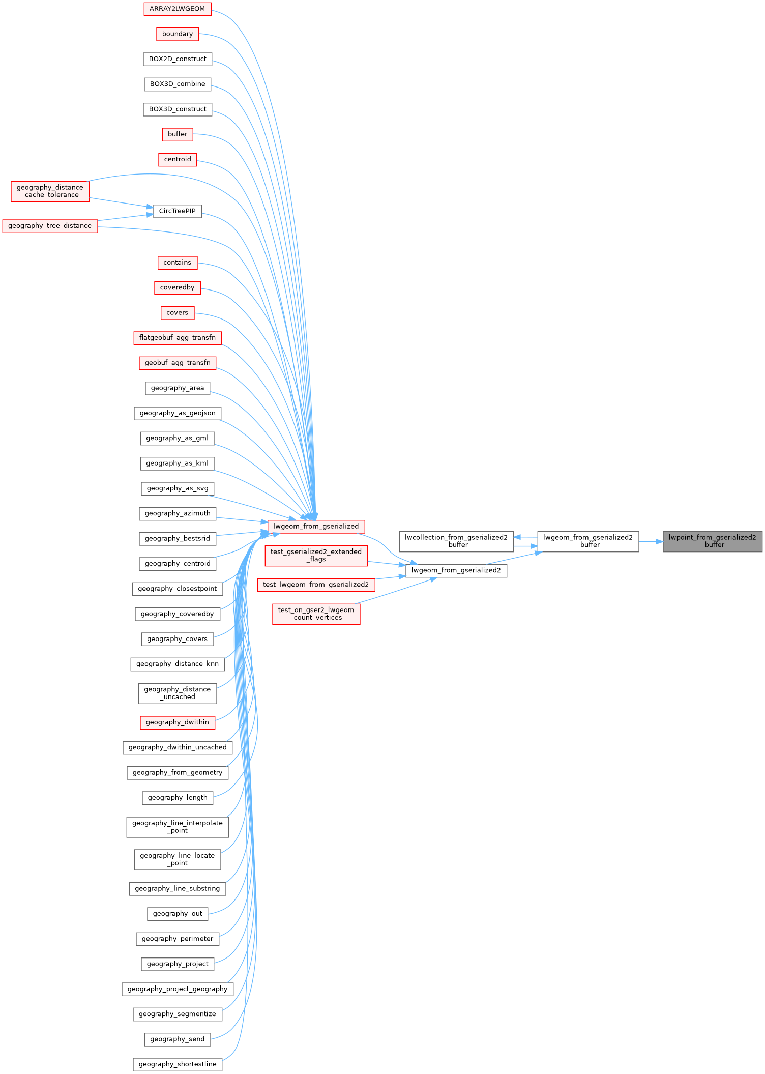
Referenced by lwgeom_from_gserialized2_buffer().
Here is the call graph for this function:
Here is the caller graph for this function: