Loading...
Searching...
No Matches
◆ sphere_project()
| int sphere_project | ( | const GEOGRAPHIC_POINT * | r, |
| double | distance, | ||
| double | azimuth, | ||
| GEOGRAPHIC_POINT * | n | ||
| ) |
Given a starting location r, a distance and an azimuth to the new point, compute the location of the projected point on the unit sphere.
Definition at line 1268 of file lwgeodetic.c.
1269{
1273 double lat2, lon2;
1274
1275 lat2 = asin(sin(lat1)*cos(d) + cos(lat1)*sin(d)*cos(azimuth));
1276
1277 /* If we're going straight up or straight down, we don't need to calculate the longitude */
1278 /* TODO: this isn't quite true, what if we're going over the pole? */
1280 {
1281 lon2 = r->lon;
1282 }
1283 else
1284 {
1285 lon2 = lon1 + atan2(sin(azimuth)*sin(d)*cos(lat1), cos(d)-sin(lat1)*sin(lat2));
1286 }
1287
1288 if ( isnan(lat2) || isnan(lon2) )
1290
1291 n->lat = lat2;
1292 n->lon = lon2;
1293
1295}
References distance(), FP_EQUALS, GEOGRAPHIC_POINT::lat, GEOGRAPHIC_POINT::lon, LW_FAILURE, LW_SUCCESS, and r.
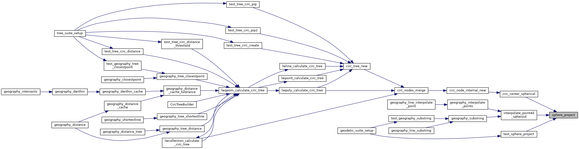
Referenced by circ_center_spherical(), interpolate_point4d_spheroid(), and test_sphere_project().
Here is the call graph for this function:

Here is the caller graph for this function: