Loading...
Searching...
No Matches
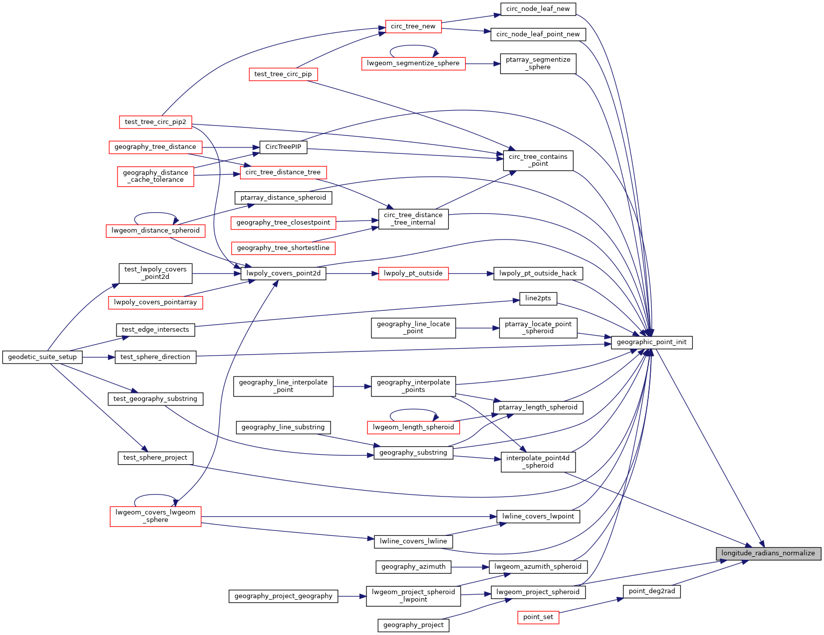
◆ longitude_radians_normalize()
| double longitude_radians_normalize | ( | double | lon | ) |
Convert a longitude to the range of -PI,PI.
Definition at line 50 of file lwgeodetic.c.
51{
52 if ( lon == -1.0 * M_PI )
53 return M_PI;
54 if ( lon == -2.0 * M_PI )
55 return 0.0;
56
57 if ( lon > 2.0 * M_PI )
58 lon = remainder(lon, 2.0 * M_PI);
59
60 if ( lon < -2.0 * M_PI )
61 lon = remainder(lon, -2.0 * M_PI);
62
63 if ( lon > M_PI )
64 lon = -2.0 * M_PI + lon;
65
66 if ( lon < -1.0 * M_PI )
67 lon = 2.0 * M_PI + lon;
68
69 if ( lon == -2.0 * M_PI )
70 lon *= -1.0;
71
72 return lon;
73}
Referenced by geographic_point_init(), interpolate_point4d_spheroid(), lwgeom_project_spheroid(), and point_deg2rad().
Here is the caller graph for this function: