Loading...
Searching...
No Matches
◆ geobuf_agg_finalfn()
| uint8_t * geobuf_agg_finalfn | ( | struct geobuf_agg_context * | ctx | ) |
Finalize aggregation.
Encode into Data message and return it packed as a bytea.
Definition at line 623 of file geobuf.c.
624{
625 size_t i, len;
626 Data *data;
627 Data__FeatureCollection *fc;
628 uint8_t *buf;
629
631 fc = data->feature_collection;
632
633 /* check and set dimensions if not default */
637 }
638
639 /* check and set precision if not default */
644 data->has_precision = 1;
646 }
647
648 for (i = 0; i < fc->n_features; i++)
650
651 len = data__get_packed_size(data);
652 buf = palloc(sizeof(*buf) * (len + VARHDRSZ));
653 data__pack(data, buf + VARHDRSZ);
654
655 SET_VARSIZE(buf, VARHDRSZ + len);
656
657 return buf;
658}
static Data__Geometry * encode_geometry(struct geobuf_agg_context *ctx, LWGEOM *lwgeom)
Definition geobuf.c:424
References geobuf_agg_context::data, geobuf_agg_context::dimensions, geobuf_agg_context::e, encode_geometry(), geobuf_agg_context::has_dimensions, geobuf_agg_context::lwgeoms, MAX_PRECISION, and geobuf_agg_context::precision.
Referenced by pgis_asgeobuf_finalfn().
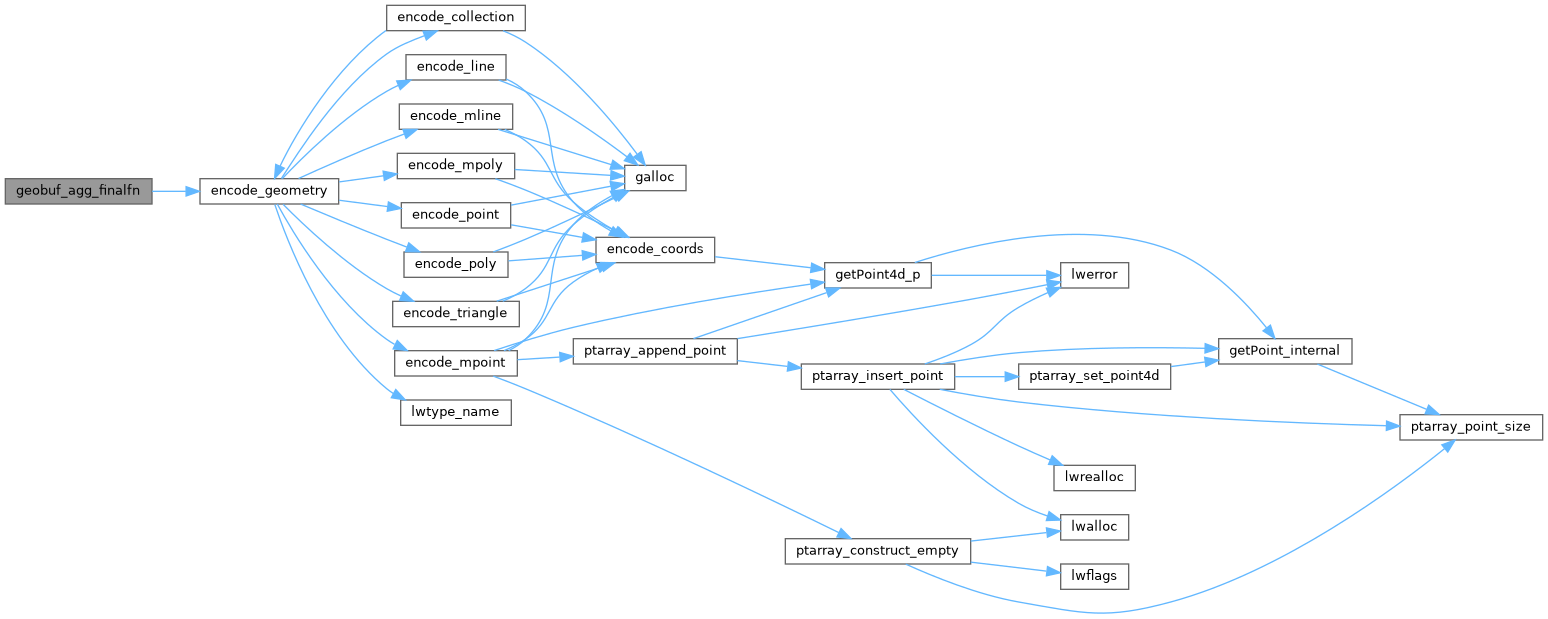
Here is the call graph for this function:
Here is the caller graph for this function:
