Loading...
Searching...
No Matches
◆ test_gdal_warp()
|
static |
Definition at line 500 of file cu_gdal.c.
500 {
503
506 uint32_t x;
507 uint32_t width = 100;
508 uint32_t y;
509 uint32_t height = 100;
511
512 char src_srs[] = "PROJCS[\"unnamed\",GEOGCS[\"unnamed ellipse\",DATUM[\"unknown\",SPHEROID[\"unnamed\",6370997,0]],PRIMEM[\"Greenwich\",0],UNIT[\"degree\",0.0174532925199433]],PROJECTION[\"Lambert_Azimuthal_Equal_Area\"],PARAMETER[\"latitude_of_center\",45],PARAMETER[\"longitude_of_center\",-100],PARAMETER[\"false_easting\",0],PARAMETER[\"false_northing\",0],UNIT[\"Meter\",1],AUTHORITY[\"EPSG\",\"2163\"]]";
513
514 char dst_srs[] = "PROJCS[\"NAD83 / California Albers\",GEOGCS[\"NAD83\",DATUM[\"North_American_Datum_1983\",SPHEROID[\"GRS 1980\",6378137,298.257222101,AUTHORITY[\"EPSG\",\"7019\"]],AUTHORITY[\"EPSG\",\"6269\"]],PRIMEM[\"Greenwich\",0,AUTHORITY[\"EPSG\",\"8901\"]],UNIT[\"degree\",0.01745329251994328,AUTHORITY[\"EPSG\",\"9122\"]],AUTHORITY[\"EPSG\",\"4269\"]],UNIT[\"metre\",1,AUTHORITY[\"EPSG\",\"9001\"]],PROJECTION[\"Albers_Conic_Equal_Area\"],PARAMETER[\"standard_parallel_1\",34],PARAMETER[\"standard_parallel_2\",40.5],PARAMETER[\"latitude_of_center\",0],PARAMETER[\"longitude_of_center\",-120],PARAMETER[\"false_easting\",0],PARAMETER[\"false_northing\",-4000000],AUTHORITY[\"EPSG\",\"3310\"],AXIS[\"X\",EAST],AXIS[\"Y\",NORTH]]";
515
517 CU_ASSERT(raster != NULL); /* or we're out of virtual memory */
518
520 CU_ASSERT(band != NULL);
521
522 rt_raster_set_offsets(raster, -500000, 600000);
523 rt_raster_set_scale(raster, 1000, -1000);
524
528 }
529 }
530
532 raster,
533 src_srs, dst_srs,
534 NULL, NULL,
535 NULL, NULL,
536 NULL, NULL,
537 NULL, NULL,
538 NULL, NULL,
539 GRA_NearestNeighbour, -1
540 );
541 CU_ASSERT(rast != NULL);
542 CU_ASSERT_EQUAL(rt_raster_get_width(rast), 122);
543 CU_ASSERT_EQUAL(rt_raster_get_height(rast), 116);
544 CU_ASSERT_NOT_EQUAL(rt_raster_get_num_bands(rast), 0);
545
547 CU_ASSERT(band != NULL);
548
549 CU_ASSERT(rt_band_get_hasnodata_flag(band));
550 rt_band_get_nodata(band, &value);
551 CU_ASSERT_DOUBLE_EQUAL(value, 0., DBL_EPSILON);
552
554 CU_ASSERT_DOUBLE_EQUAL(value, 0., DBL_EPSILON);
555
556 cu_free_raster(rast);
557 cu_free_raster(raster);
558}
void rt_raster_set_scale(rt_raster raster, double scaleX, double scaleY)
Set scale in projection units.
Definition rt_raster.c:141
rt_errorstate rt_band_get_pixel(rt_band band, int x, int y, double *value, int *nodata)
Get pixel value.
Definition rt_band.c:1551
rt_raster rt_raster_new(uint32_t width, uint32_t height)
Construct a raster with given dimensions.
Definition rt_raster.c:52
rt_errorstate rt_band_set_pixel(rt_band band, int x, int y, double val, int *converted)
Set single pixel's value.
Definition rt_band.c:1140
rt_errorstate rt_band_get_nodata(rt_band band, double *nodata)
Get NODATA value.
Definition rt_band.c:2067
rt_raster rt_raster_gdal_warp(rt_raster raster, const char *src_srs, const char *dst_srs, double *scale_x, double *scale_y, int *width, int *height, double *ul_xw, double *ul_yw, double *grid_xw, double *grid_yw, double *skew_x, double *skew_y, GDALResampleAlg resample_alg, double max_err)
Return a warped raster using GDAL Warp API.
Definition rt_warp.c:177
void rt_raster_set_offsets(rt_raster raster, double x, double y)
Set insertion points in projection units.
Definition rt_raster.c:203
rt_band rt_raster_get_band(rt_raster raster, int bandNum)
Return Nth band, or NULL if unavailable.
Definition rt_raster.c:385
raster
Be careful!! Zeros function's input parameter can be a (height x width) array, not (width x height): ...
Definition rtrowdump.py:125
rt_band cu_add_band(rt_raster raster, rt_pixtype pixtype, int hasnodata, double nodataval)
Definition raster/test/cunit/cu_tester.c:224
Definition librtcore.h:2515
Definition librtcore.h:2486
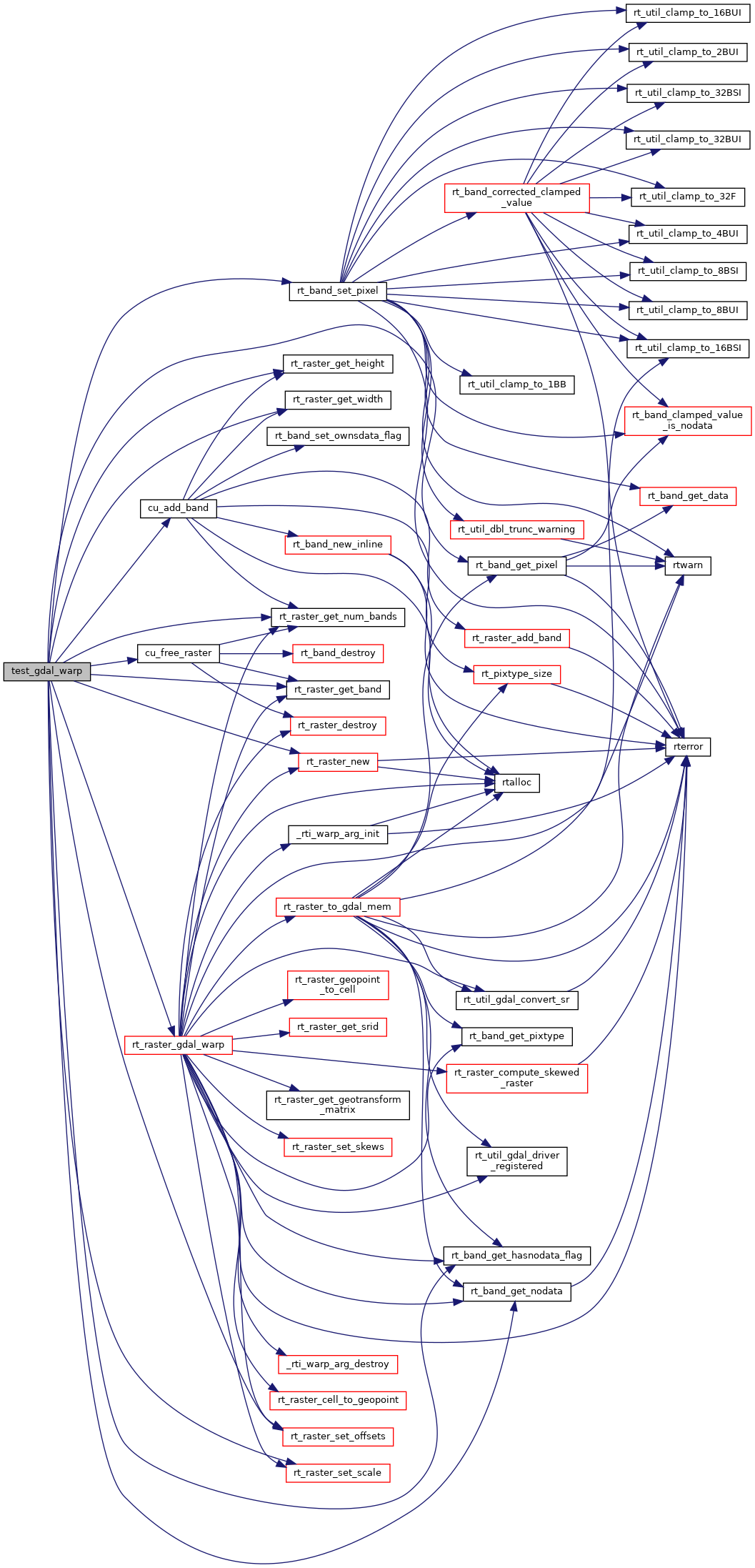
References cu_add_band(), cu_free_raster(), ES_NONE, PT_64BF, rt_band_get_hasnodata_flag(), rt_band_get_nodata(), rt_band_get_pixel(), rt_band_set_pixel(), rt_raster_gdal_warp(), rt_raster_get_band(), rt_raster_get_height(), rt_raster_get_num_bands(), rt_raster_get_width(), rt_raster_new(), rt_raster_set_offsets(), and rt_raster_set_scale().
Referenced by gdal_suite_setup().
Here is the call graph for this function:
Here is the caller graph for this function: