Loading...
Searching...
No Matches
◆ rt_raster_pixel_as_polygon()
Get a raster pixel as a polygon.
The pixel shape is a 4 vertices (5 to be closed) single ring polygon bearing the raster's rotation and using projection coordinates
- Parameters
-
raster : the raster to get pixel from x : the column number y : the row number
- Returns
- the pixel polygon, or NULL on error.
Definition at line 607 of file rt_geometry.c.
608{
609 double scale_x, scale_y;
610 double skew_x, skew_y;
611 double ul_x, ul_y;
612 int32_t srid;
613 POINTARRAY **points;
614 POINT4D p, p0;
615 LWPOLY *poly;
616
617 assert(rast != NULL);
618
619 scale_x = rt_raster_get_x_scale(rast);
620 scale_y = rt_raster_get_y_scale(rast);
621 skew_x = rt_raster_get_x_skew(rast);
622 skew_y = rt_raster_get_y_skew(rast);
623 ul_x = rt_raster_get_x_offset(rast);
624 ul_y = rt_raster_get_y_offset(rast);
625 srid = rt_raster_get_srid(rast);
626
628 points[0] = ptarray_construct(0, 0, 5);
629
632 ptarray_set_point4d(points[0], 0, &p0);
633
636 ptarray_set_point4d(points[0], 1, &p);
637
640 ptarray_set_point4d(points[0], 2, &p);
641
644 ptarray_set_point4d(points[0], 3, &p);
645
646 /* close it */
647 ptarray_set_point4d(points[0], 4, &p0);
648
649 poly = lwpoly_construct(srid, NULL, 1, points);
650
651 return poly;
652}
LWPOLY * lwpoly_construct(int32_t srid, GBOX *bbox, uint32_t nrings, POINTARRAY **points)
Definition lwpoly.c:43
void ptarray_set_point4d(POINTARRAY *pa, uint32_t n, const POINT4D *p4d)
Definition lwgeom_api.c:369
POINTARRAY * ptarray_construct(char hasz, char hasm, uint32_t npoints)
Construct an empty pointarray, allocating storage and setting the npoints, but not filling in any inf...
Definition ptarray.c:51
double rt_raster_get_x_offset(rt_raster raster)
Get raster x offset, in projection units.
Definition rt_raster.c:217
double rt_raster_get_x_scale(rt_raster raster)
Get scale X in projection units.
Definition rt_raster.c:154
double rt_raster_get_y_scale(rt_raster raster)
Get scale Y in projection units.
Definition rt_raster.c:163
double rt_raster_get_y_offset(rt_raster raster)
Get raster y offset, in projection units.
Definition rt_raster.c:226
Definition liblwgeom.h:517
Definition liblwgeom.h:413
Definition liblwgeom.h:426
References lwpoly_construct(), ptarray_construct(), ptarray_set_point4d(), rt_raster_get_srid(), rt_raster_get_x_offset(), rt_raster_get_x_scale(), rt_raster_get_x_skew(), rt_raster_get_y_offset(), rt_raster_get_y_scale(), rt_raster_get_y_skew(), rtalloc(), POINT4D::x, and POINT4D::y.
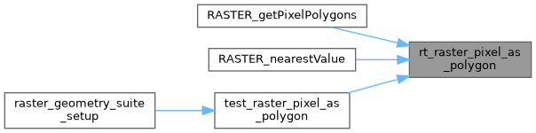
Referenced by RASTER_getPixelPolygons(), RASTER_nearestValue(), and test_raster_pixel_as_polygon().
Here is the call graph for this function:

Here is the caller graph for this function: