PostGIS  3.7.0dev-r@@SVN_REVISION@@

◆ LWGEOM_SetEffectiveArea()

Datum LWGEOM_SetEffectiveArea ( PG_FUNCTION_ARGS  )

Definition at line 90 of file lwgeom_functions_analytic.c.

91 {
92  GSERIALIZED *geom = PG_GETARG_GSERIALIZED_P(0);
94  int type = gserialized_get_type(geom);
95  LWGEOM *in;
96  LWGEOM *out;
97  double area=0;
98  int set_area=0;
99 
100  if ( type == POINTTYPE || type == MULTIPOINTTYPE )
101  PG_RETURN_POINTER(geom);
102 
103  if ( (PG_NARGS()>1) && (!PG_ARGISNULL(1)) )
104  area = PG_GETARG_FLOAT8(1);
105 
106  if ( (PG_NARGS()>2) && (!PG_ARGISNULL(2)) )
107  set_area = PG_GETARG_INT32(2);
108 
109  in = lwgeom_from_gserialized(geom);
110 
111  out = lwgeom_set_effective_area(in,set_area, area);
112  if ( ! out ) PG_RETURN_NULL();
113 
114  /* COMPUTE_BBOX TAINTING */
115  if ( in->bbox ) lwgeom_add_bbox(out);
116 
117  result = geometry_serialize(out);
118  lwgeom_free(out);
119  PG_FREE_IF_COPY(geom, 0);
120  PG_RETURN_POINTER(result);
121 }
char result[OUT_DOUBLE_BUFFER_SIZE]
Definition: cu_print.c:267
LWGEOM * lwgeom_set_effective_area(const LWGEOM *igeom, int set_area, double trshld)
LWGEOM * lwgeom_from_gserialized(const GSERIALIZED *g)
Allocate a new LWGEOM from a GSERIALIZED.
Definition: gserialized.c:268
uint32_t gserialized_get_type(const GSERIALIZED *g)
Extract the geometry type from the serialized form (it hides in the anonymous data area,...
Definition: gserialized.c:118
void lwgeom_free(LWGEOM *geom)
Definition: lwgeom.c:1218
#define MULTIPOINTTYPE
Definition: liblwgeom.h:105
#define POINTTYPE
LWTYPE numbers, used internally by PostGIS.
Definition: liblwgeom.h:102
void lwgeom_add_bbox(LWGEOM *lwgeom)
Compute a bbox if not already computed.
Definition: lwgeom.c:695
type
Definition: ovdump.py:42
GBOX * bbox
Definition: liblwgeom.h:458

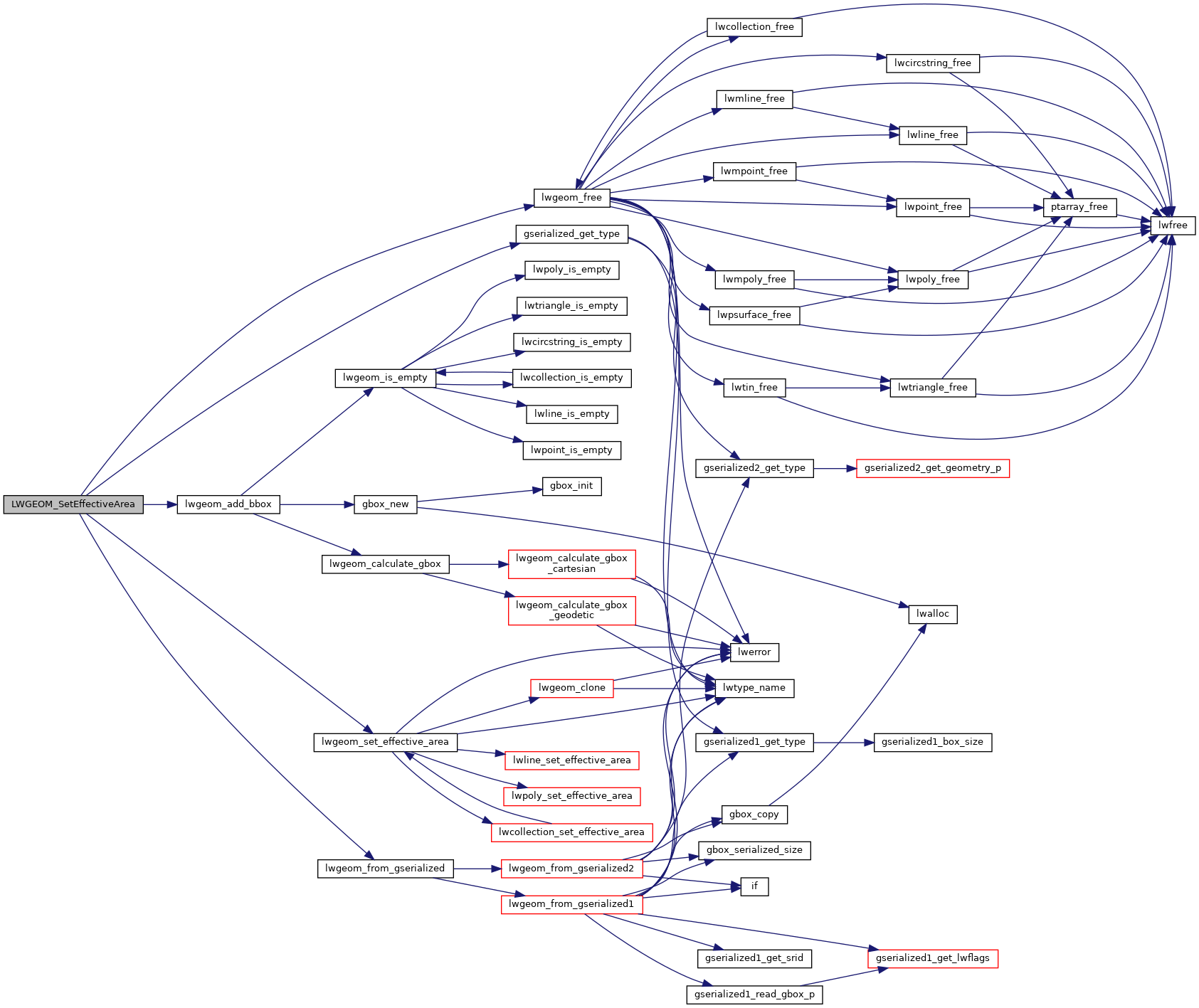
References LWGEOM::bbox, gserialized_get_type(), lwgeom_add_bbox(), lwgeom_free(), lwgeom_from_gserialized(), lwgeom_set_effective_area(), MULTIPOINTTYPE, POINTTYPE, result, and ovdump::type.

Here is the call graph for this function: