PostGIS  3.7.0dev-r@@SVN_REVISION@@

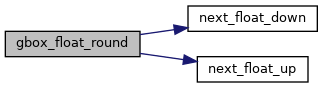
◆ gbox_float_round()

void gbox_float_round ( GBOX gbox)

Round given GBOX to float boundaries.

This turns a GBOX into the version it would become after a serialize/deserialize round trip.

Definition at line 786 of file gbox.c.

787 {
788  gbox->xmin = next_float_down(gbox->xmin);
789  gbox->xmax = next_float_up(gbox->xmax);
790 
791  gbox->ymin = next_float_down(gbox->ymin);
792  gbox->ymax = next_float_up(gbox->ymax);
793 
794  if ( FLAGS_GET_M(gbox->flags) )
795  {
796  gbox->mmin = next_float_down(gbox->mmin);
797  gbox->mmax = next_float_up(gbox->mmax);
798  }
799 
800  if ( FLAGS_GET_Z(gbox->flags) )
801  {
802  gbox->zmin = next_float_down(gbox->zmin);
803  gbox->zmax = next_float_up(gbox->zmax);
804  }
805 }
#define FLAGS_GET_Z(flags)
Definition: liblwgeom.h:165
#define FLAGS_GET_M(flags)
Definition: liblwgeom.h:166
float next_float_up(double d)
Definition: lwgeom_api.c:74
float next_float_down(double d)
Definition: lwgeom_api.c:53
double ymax
Definition: liblwgeom.h:357
double zmax
Definition: liblwgeom.h:359
double xmax
Definition: liblwgeom.h:355
double zmin
Definition: liblwgeom.h:358
double mmax
Definition: liblwgeom.h:361
double ymin
Definition: liblwgeom.h:356
double xmin
Definition: liblwgeom.h:354
double mmin
Definition: liblwgeom.h:360
lwflags_t flags
Definition: liblwgeom.h:353

References GBOX::flags, FLAGS_GET_M, FLAGS_GET_Z, GBOX::mmax, GBOX::mmin, next_float_down(), next_float_up(), GBOX::xmax, GBOX::xmin, GBOX::ymax, GBOX::ymin, GBOX::zmax, and GBOX::zmin.

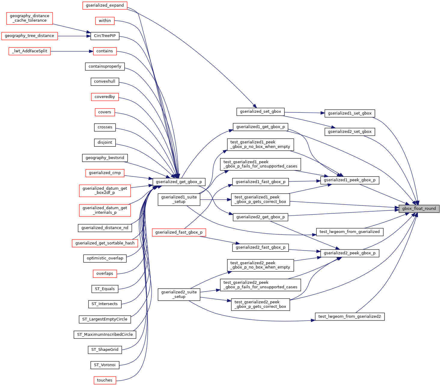
Referenced by gserialized1_get_gbox_p(), gserialized1_peek_gbox_p(), gserialized1_set_gbox(), gserialized2_get_gbox_p(), gserialized2_peek_gbox_p(), gserialized2_set_gbox(), test_gserialized1_peek_gbox_p_gets_correct_box(), test_gserialized2_peek_gbox_p_gets_correct_box(), test_lwgeom_from_gserialized(), and test_lwgeom_from_gserialized2().

Here is the call graph for this function:
Here is the caller graph for this function: