PostGIS  3.4.0dev-r@@SVN_REVISION@@

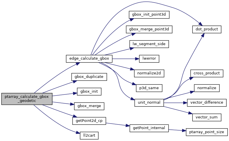
◆ ptarray_calculate_gbox_geodetic()

int ptarray_calculate_gbox_geodetic ( const POINTARRAY pa,
GBOX gbox 
)

Calculate geodetic (x/y/z) box and add values to gbox.

Return LW_SUCCESS on success.

Definition at line 2888 of file lwgeodetic.c.

2889 {
2890  uint32_t i;
2891  int first = LW_TRUE;
2892  const POINT2D *p;
2893  POINT3D A1, A2;
2894  GBOX edge_gbox;
2895 
2896  assert(gbox);
2897  assert(pa);
2898 
2899  gbox_init(&edge_gbox);
2900  edge_gbox.flags = gbox->flags;
2901 
2902  if ( pa->npoints == 0 ) return LW_FAILURE;
2903 
2904  if ( pa->npoints == 1 )
2905  {
2906  p = getPoint2d_cp(pa, 0);
2907  ll2cart(p, &A1);
2908  gbox->xmin = gbox->xmax = A1.x;
2909  gbox->ymin = gbox->ymax = A1.y;
2910  gbox->zmin = gbox->zmax = A1.z;
2911  return LW_SUCCESS;
2912  }
2913 
2914  p = getPoint2d_cp(pa, 0);
2915  ll2cart(p, &A1);
2916 
2917  for ( i = 1; i < pa->npoints; i++ )
2918  {
2919 
2920  p = getPoint2d_cp(pa, i);
2921  ll2cart(p, &A2);
2922 
2923  edge_calculate_gbox(&A1, &A2, &edge_gbox);
2924 
2925  /* Initialize the box */
2926  if ( first )
2927  {
2928  gbox_duplicate(&edge_gbox, gbox);
2929  first = LW_FALSE;
2930  }
2931  /* Expand the box where necessary */
2932  else
2933  {
2934  gbox_merge(&edge_gbox, gbox);
2935  }
2936 
2937  A1 = A2;
2938  }
2939 
2940  return LW_SUCCESS;
2941 }
int gbox_merge(const GBOX *new_box, GBOX *merge_box)
Update the merged GBOX to be large enough to include itself and the new box.
Definition: gbox.c:257
void gbox_duplicate(const GBOX *original, GBOX *duplicate)
Copy the values of original GBOX into duplicate.
Definition: gbox.c:433
void gbox_init(GBOX *gbox)
Zero out all the entries in the GBOX.
Definition: gbox.c:40
#define LW_FALSE
Definition: liblwgeom.h:94
#define LW_FAILURE
Definition: liblwgeom.h:96
#define LW_SUCCESS
Definition: liblwgeom.h:97
#define LW_TRUE
Return types for functions with status returns.
Definition: liblwgeom.h:93
void ll2cart(const POINT2D *g, POINT3D *p)
Convert lon/lat coordinates to cartesian coordinates on unit sphere.
Definition: lwgeodetic.c:423
int edge_calculate_gbox(const POINT3D *A1, const POINT3D *A2, GBOX *gbox)
The magic function, given an edge in spherical coordinates, calculate a 3D bounding box that fully co...
Definition: lwgeodetic.c:1414
static const POINT2D * getPoint2d_cp(const POINTARRAY *pa, uint32_t n)
Returns a POINT2D pointer into the POINTARRAY serialized_ptlist, suitable for reading from.
Definition: lwinline.h:101
double ymax
Definition: liblwgeom.h:357
double zmax
Definition: liblwgeom.h:359
double xmax
Definition: liblwgeom.h:355
double zmin
Definition: liblwgeom.h:358
double ymin
Definition: liblwgeom.h:356
double xmin
Definition: liblwgeom.h:354
lwflags_t flags
Definition: liblwgeom.h:353
double z
Definition: liblwgeom.h:402
double x
Definition: liblwgeom.h:402
double y
Definition: liblwgeom.h:402
uint32_t npoints
Definition: liblwgeom.h:427

References edge_calculate_gbox(), GBOX::flags, gbox_duplicate(), gbox_init(), gbox_merge(), getPoint2d_cp(), ll2cart(), LW_FAILURE, LW_FALSE, LW_SUCCESS, LW_TRUE, POINTARRAY::npoints, POINT3D::x, GBOX::xmax, GBOX::xmin, POINT3D::y, GBOX::ymax, GBOX::ymin, POINT3D::z, GBOX::zmax, and GBOX::zmin.

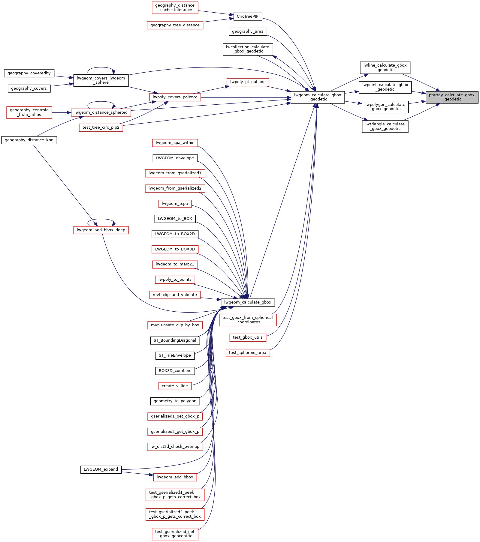
Referenced by lwline_calculate_gbox_geodetic(), lwpoint_calculate_gbox_geodetic(), lwpolygon_calculate_gbox_geodetic(), and lwtriangle_calculate_gbox_geodetic().

Here is the call graph for this function:
Here is the caller graph for this function: