PostGIS  3.4.0dev-r@@SVN_REVISION@@
All Data Structures Namespaces Files Functions Variables Typedefs Enumerations Enumerator Properties Macros Pages

◆ rt_raster_gdal_polygonize()

rt_geomval rt_raster_gdal_polygonize ( rt_raster  raster,
int  nband,
int  exclude_nodata_value,
int *  pnElements 
)

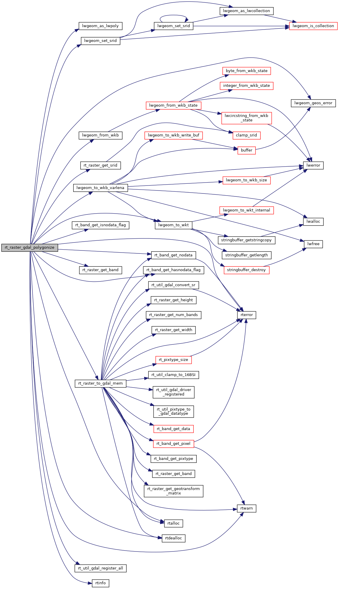
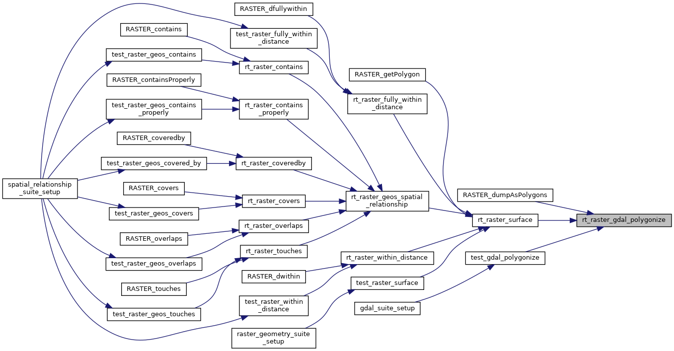
Returns a set of "geomval" value, one for each group of pixel sharing the same value for the provided band.

A "geomval" value is a complex type composed of a geometry in LWPOLY representation (one for each group of pixel sharing the same value) and the value associated with this geometry.

Parameters
raster: the raster to get info from.
nband: the band to polygonize. 0-based
exclude_nodata_value: if non-zero, ignore nodata values to check for pixels with value
Returns
A set of "geomval" values, one for each group of pixels sharing the same value for the provided band. The returned values are LWPOLY geometries.

From GDALPolygonize function header: "Polygon features will be created on the output layer, with polygon geometries representing the polygons". So,the WKB geometry type should be "wkbPolygon"

Create a new field in the layer, to store the px value

Optimization: Apply a OGR SQL filter to the layer to select the features different from NODATA value.

Thanks to David Zwarg.

Definition at line 975 of file rt_geometry.c.

979  {
980  CPLErr cplerr = CE_None;
981  char *pszQuery;
982  long j;
983  OGRSFDriverH ogr_drv = NULL;
984  GDALDriverH gdal_drv = NULL;
985  int destroy_gdal_drv = 0;
986  GDALDatasetH memdataset = NULL;
987  GDALRasterBandH gdal_band = NULL;
988  OGRDataSourceH memdatasource = NULL;
989  rt_geomval pols = NULL;
990  OGRLayerH hLayer = NULL;
991  OGRFeatureH hFeature = NULL;
992  OGRGeometryH hGeom = NULL;
993  OGRFieldDefnH hFldDfn = NULL;
994  unsigned char *wkb = NULL;
995  int wkbsize = 0;
996  LWGEOM *lwgeom = NULL;
997  int nFeatureCount = 0;
998  rt_band band = NULL;
999  int iPixVal = -1;
1000  double dValue = 0.0;
1001  int iBandHasNodataValue = FALSE;
1002  double dBandNoData = 0.0;
1003 
1004  uint32_t bandNums[1] = {nband};
1005  int excludeNodataValues[1] = {exclude_nodata_value};
1006 
1007  /* checks */
1008  assert(NULL != raster);
1009  assert(NULL != pnElements);
1010 
1011  RASTER_DEBUG(2, "In rt_raster_gdal_polygonize");
1012 
1013  *pnElements = 0;
1014 
1015  /*******************************
1016  * Get band
1017  *******************************/
1019  if (NULL == band) {
1020  rterror("rt_raster_gdal_polygonize: Error getting band %d from raster", nband);
1021  return NULL;
1022  }
1023 
1024  if (exclude_nodata_value) {
1025 
1026  /* band is NODATA */
1028  RASTER_DEBUG(3, "Band is NODATA. Returning null");
1029  *pnElements = 0;
1030  return NULL;
1031  }
1032 
1033  iBandHasNodataValue = rt_band_get_hasnodata_flag(band);
1034  if (iBandHasNodataValue)
1035  rt_band_get_nodata(band, &dBandNoData);
1036  else
1037  exclude_nodata_value = FALSE;
1038  }
1039 
1040  /*****************************************************
1041  * Convert raster to GDAL MEM dataset
1042  *****************************************************/
1043  memdataset = rt_raster_to_gdal_mem(raster, NULL, bandNums, excludeNodataValues, 1, &gdal_drv, &destroy_gdal_drv);
1044  if (NULL == memdataset) {
1045  rterror("rt_raster_gdal_polygonize: Couldn't convert raster to GDAL MEM dataset");
1046  return NULL;
1047  }
1048 
1049  /*****************************
1050  * Register ogr mem driver
1051  *****************************/
1052 #ifdef GDAL_DCAP_RASTER
1053  /* in GDAL 2.0, OGRRegisterAll() is an alias to GDALAllRegister() */
1055 #else
1056  OGRRegisterAll();
1057 #endif
1058 
1059  RASTER_DEBUG(3, "creating OGR MEM vector");
1060 
1061  /*****************************************************
1062  * Create an OGR in-memory vector for layers
1063  *****************************************************/
1064  ogr_drv = OGRGetDriverByName("Memory");
1065  memdatasource = OGR_Dr_CreateDataSource(ogr_drv, "", NULL);
1066  if (NULL == memdatasource) {
1067  rterror("rt_raster_gdal_polygonize: Couldn't create a OGR Datasource to store pols");
1068  GDALClose(memdataset);
1069  if (destroy_gdal_drv) GDALDestroyDriver(gdal_drv);
1070  return NULL;
1071  }
1072 
1073  /* Can MEM driver create new layers? */
1074  if (!OGR_DS_TestCapability(memdatasource, ODsCCreateLayer)) {
1075  rterror("rt_raster_gdal_polygonize: MEM driver can't create new layers, aborting");
1076 
1077  /* xxx jorgearevalo: what should we do now? */
1078  GDALClose(memdataset);
1079  if (destroy_gdal_drv) GDALDestroyDriver(gdal_drv);
1080  OGRReleaseDataSource(memdatasource);
1081 
1082  return NULL;
1083  }
1084 
1085  RASTER_DEBUG(3, "polygonizying GDAL MEM raster band");
1086 
1087  /*****************************
1088  * Polygonize the raster band
1089  *****************************/
1090 
1096  hLayer = OGR_DS_CreateLayer(memdatasource, "PolygonizedLayer", NULL, wkbPolygon, NULL);
1097 
1098  if (NULL == hLayer) {
1099  rterror("rt_raster_gdal_polygonize: Couldn't create layer to store polygons");
1100 
1101  GDALClose(memdataset);
1102  if (destroy_gdal_drv) GDALDestroyDriver(gdal_drv);
1103  OGRReleaseDataSource(memdatasource);
1104 
1105  return NULL;
1106  }
1107 
1112  /* First, create a field definition to create the field */
1113  hFldDfn = OGR_Fld_Create("PixelValue", OFTReal);
1114 
1115  /* Second, create the field */
1116  if (OGR_L_CreateField(hLayer, hFldDfn, TRUE) != OGRERR_NONE) {
1117  rtwarn("Couldn't create a field in OGR Layer. The polygons generated won't be able to store the pixel value");
1118  iPixVal = -1;
1119  }
1120  else {
1121  /* Index to the new field created in the layer */
1122  iPixVal = 0;
1123  }
1124 
1125  /* Get GDAL raster band */
1126  gdal_band = GDALGetRasterBand(memdataset, 1);
1127  if (NULL == gdal_band) {
1128  rterror("rt_raster_gdal_polygonize: Couldn't get GDAL band to polygonize");
1129 
1130  GDALClose(memdataset);
1131  if (destroy_gdal_drv) GDALDestroyDriver(gdal_drv);
1132  OGR_Fld_Destroy(hFldDfn);
1133  OGR_DS_DeleteLayer(memdatasource, 0);
1134  OGRReleaseDataSource(memdatasource);
1135 
1136  return NULL;
1137  }
1138 
1139  /* We don't need a raster mask band. Each band has a nodata value. */
1140  cplerr = GDALFPolygonize(gdal_band, NULL, hLayer, iPixVal, NULL, NULL, NULL);
1141 
1142  if (cplerr != CE_None) {
1143  rterror("rt_raster_gdal_polygonize: Could not polygonize GDAL band");
1144 
1145  GDALClose(memdataset);
1146  if (destroy_gdal_drv) GDALDestroyDriver(gdal_drv);
1147  OGR_Fld_Destroy(hFldDfn);
1148  OGR_DS_DeleteLayer(memdatasource, 0);
1149  OGRReleaseDataSource(memdatasource);
1150 
1151  return NULL;
1152  }
1153 
1160  if (iBandHasNodataValue) {
1161  size_t sz = 50 * sizeof (char);
1162  pszQuery = (char *) rtalloc(sz);
1163  snprintf(pszQuery, sz, "PixelValue != %f", dBandNoData );
1164  OGRErr e = OGR_L_SetAttributeFilter(hLayer, pszQuery);
1165  if (e != OGRERR_NONE) {
1166  rtwarn("Error filtering NODATA values for band. All values will be treated as data values");
1167  }
1168  }
1169  else {
1170  pszQuery = NULL;
1171  }
1172 
1173  /*********************************************************************
1174  * Transform OGR layers to WKB polygons
1175  * XXX jorgearevalo: GDALPolygonize does not set the coordinate system
1176  * on the output layer. Application code should do this when the layer
1177  * is created, presumably matching the raster coordinate system.
1178  *********************************************************************/
1179  nFeatureCount = OGR_L_GetFeatureCount(hLayer, TRUE);
1180 
1181  /* Allocate memory for pols */
1182  pols = (rt_geomval) rtalloc(nFeatureCount * sizeof(struct rt_geomval_t));
1183 
1184  if (NULL == pols) {
1185  rterror("rt_raster_gdal_polygonize: Could not allocate memory for geomval set");
1186 
1187  GDALClose(memdataset);
1188  if (destroy_gdal_drv) GDALDestroyDriver(gdal_drv);
1189  OGR_Fld_Destroy(hFldDfn);
1190  OGR_DS_DeleteLayer(memdatasource, 0);
1191  if (NULL != pszQuery)
1192  rtdealloc(pszQuery);
1193  OGRReleaseDataSource(memdatasource);
1194 
1195  return NULL;
1196  }
1197 
1198  /* initialize GEOS */
1199  initGEOS(rtinfo, lwgeom_geos_error);
1200 
1201  RASTER_DEBUGF(3, "storing polygons (%d)", nFeatureCount);
1202 
1203  /* Reset feature reading to start in the first feature */
1204  OGR_L_ResetReading(hLayer);
1205 
1206  for (j = 0; j < nFeatureCount; j++) {
1207  hFeature = OGR_L_GetNextFeature(hLayer);
1208  dValue = OGR_F_GetFieldAsDouble(hFeature, iPixVal);
1209 
1210  hGeom = OGR_F_GetGeometryRef(hFeature);
1211  wkbsize = OGR_G_WkbSize(hGeom);
1212 
1213  /* allocate wkb buffer */
1214  wkb = rtalloc(sizeof(unsigned char) * wkbsize);
1215  if (wkb == NULL) {
1216  rterror("rt_raster_gdal_polygonize: Could not allocate memory for WKB buffer");
1217 
1218  OGR_F_Destroy(hFeature);
1219  GDALClose(memdataset);
1220  if (destroy_gdal_drv) GDALDestroyDriver(gdal_drv);
1221  OGR_Fld_Destroy(hFldDfn);
1222  OGR_DS_DeleteLayer(memdatasource, 0);
1223  if (NULL != pszQuery)
1224  rtdealloc(pszQuery);
1225  OGRReleaseDataSource(memdatasource);
1226 
1227  return NULL;
1228  }
1229 
1230  /* export WKB with LSB byte order */
1231  OGR_G_ExportToWkb(hGeom, wkbNDR, wkb);
1232 
1233  /* convert WKB to LWGEOM */
1234  lwgeom = lwgeom_from_wkb(wkb, wkbsize, LW_PARSER_CHECK_NONE);
1235 
1236 #if POSTGIS_DEBUG_LEVEL > 3
1237  {
1238  char *wkt = NULL;
1239  OGR_G_ExportToWkt(hGeom, &wkt);
1240  RASTER_DEBUGF(4, "GDAL wkt = %s", wkt);
1241  CPLFree(wkt);
1242 
1243  d_print_binary_hex("GDAL wkb", wkb, wkbsize);
1244  }
1245 #endif
1246 
1247  /* cleanup unnecessary stuff */
1248  rtdealloc(wkb);
1249  wkb = NULL;
1250  wkbsize = 0;
1251 
1252  OGR_F_Destroy(hFeature);
1253 
1254  /* specify SRID */
1256 
1257  /* save lwgeom */
1258  pols[j].geom = lwgeom_as_lwpoly(lwgeom);
1259 
1260 #if POSTGIS_DEBUG_LEVEL > 3
1261  {
1262  char *wkt = lwgeom_to_wkt(lwgeom, WKT_ISO, DBL_DIG, NULL);
1263  RASTER_DEBUGF(4, "LWGEOM wkt = %s", wkt);
1264  rtdealloc(wkt);
1265 
1266  lwvarlena_t *lwwkb = lwgeom_to_wkb_varlena(lwgeom, WKB_ISO | WKB_NDR);
1267  size_t lwwkbsize = LWSIZE_GET(lwwkb->size) - LWVARHDRSZ;
1268  if (lwwkbsize) {
1269  d_print_binary_hex("LWGEOM wkb", (const uint8_t *)lwwkb->data, lwwkbsize);
1270  rtdealloc(lwwkb);
1271  }
1272  }
1273 #endif
1274 
1275  /* set pixel value */
1276  pols[j].val = dValue;
1277  }
1278 
1279  *pnElements = nFeatureCount;
1280 
1281  RASTER_DEBUG(3, "destroying GDAL MEM raster");
1282  GDALClose(memdataset);
1283  if (destroy_gdal_drv) GDALDestroyDriver(gdal_drv);
1284 
1285  RASTER_DEBUG(3, "destroying OGR MEM vector");
1286  OGR_Fld_Destroy(hFldDfn);
1287  OGR_DS_DeleteLayer(memdatasource, 0);
1288  if (NULL != pszQuery) rtdealloc(pszQuery);
1289  OGRReleaseDataSource(memdatasource);
1290 
1291  return pols;
1292 }
#define TRUE
Definition: dbfopen.c:73
#define FALSE
Definition: dbfopen.c:72
void lwgeom_geos_error(const char *fmt,...)
#define WKB_ISO
Definition: liblwgeom.h:2175
void lwgeom_set_srid(LWGEOM *geom, int32_t srid)
Set the SRID on an LWGEOM For collections, only the parent gets an SRID, all the children get SRID_UN...
Definition: lwgeom.c:1547
#define LWVARHDRSZ
Definition: liblwgeom.h:311
#define LW_PARSER_CHECK_NONE
Definition: liblwgeom.h:2114
#define LWSIZE_GET(varsize)
Macro for reading the size from the GSERIALIZED size attribute.
Definition: liblwgeom.h:324
#define WKT_ISO
Definition: liblwgeom.h:2184
#define WKB_NDR
Definition: liblwgeom.h:2178
char * lwgeom_to_wkt(const LWGEOM *geom, uint8_t variant, int precision, size_t *size_out)
WKT emitter function.
Definition: lwout_wkt.c:708
LWPOLY * lwgeom_as_lwpoly(const LWGEOM *lwgeom)
Definition: lwgeom.c:215
LWGEOM * lwgeom_from_wkb(const uint8_t *wkb, const size_t wkb_size, const char check)
WKB inputs must have a declared size, to prevent malformed WKB from reading off the end of the memory...
Definition: lwin_wkb.c:834
lwvarlena_t * lwgeom_to_wkb_varlena(const LWGEOM *geom, uint8_t variant)
Definition: lwout_wkb.c:851
void rterror(const char *fmt,...)
Wrappers used for reporting errors and info.
Definition: rt_context.c:219
void * rtalloc(size_t size)
Wrappers used for managing memory.
Definition: rt_context.c:191
#define RASTER_DEBUG(level, msg)
Definition: librtcore.h:302
int32_t rt_raster_get_srid(rt_raster raster)
Get raster's SRID.
Definition: rt_raster.c:360
int rt_util_gdal_register_all(int force_register_all)
Definition: rt_util.c:342
#define RASTER_DEBUGF(level, msg,...)
Definition: librtcore.h:306
void rtinfo(const char *fmt,...)
Definition: rt_context.c:231
int rt_band_get_hasnodata_flag(rt_band band)
Get hasnodata flag value.
Definition: rt_band.c:674
int rt_band_get_isnodata_flag(rt_band band)
Get isnodata flag value.
Definition: rt_band.c:714
void rtwarn(const char *fmt,...)
Definition: rt_context.c:244
struct rt_geomval_t * rt_geomval
Definition: librtcore.h:151
rt_errorstate rt_band_get_nodata(rt_band band, double *nodata)
Get NODATA value.
Definition: rt_band.c:1887
void rtdealloc(void *mem)
Definition: rt_context.c:206
GDALDatasetH rt_raster_to_gdal_mem(rt_raster raster, const char *srs, uint32_t *bandNums, int *excludeNodataValues, int count, GDALDriverH *rtn_drv, int *destroy_rtn_drv)
Return GDAL dataset using GDAL MEM driver from raster.
Definition: rt_raster.c:1935
rt_band rt_raster_get_band(rt_raster raster, int bandNum)
Return Nth band, or NULL if unavailable.
Definition: rt_raster.c:385
band
Definition: ovdump.py:58
nband
Definition: pixval.py:53
raster
Be careful!! Zeros function's input parameter can be a (height x width) array, not (width x height): ...
Definition: rtrowdump.py:121
uint32_t size
Definition: liblwgeom.h:307
char data[]
Definition: liblwgeom.h:308
double val
Definition: librtcore.h:2507
LWPOLY * geom
Definition: librtcore.h:2506

References ovdump::band, lwvarlena_t::data, FALSE, rt_geomval_t::geom, LW_PARSER_CHECK_NONE, lwgeom_as_lwpoly(), lwgeom_from_wkb(), lwgeom_geos_error(), lwgeom_set_srid(), lwgeom_to_wkb_varlena(), lwgeom_to_wkt(), LWSIZE_GET, LWVARHDRSZ, pixval::nband, rtrowdump::raster, RASTER_DEBUG, RASTER_DEBUGF, rt_band_get_hasnodata_flag(), rt_band_get_isnodata_flag(), rt_band_get_nodata(), rt_raster_get_band(), rt_raster_get_srid(), rt_raster_to_gdal_mem(), rt_util_gdal_register_all(), rtalloc(), rtdealloc(), rterror(), rtinfo(), rtwarn(), lwvarlena_t::size, TRUE, rt_geomval_t::val, WKB_ISO, WKB_NDR, and WKT_ISO.

Referenced by RASTER_dumpAsPolygons(), rt_raster_surface(), and test_gdal_polygonize().

Here is the call graph for this function:
Here is the caller graph for this function: