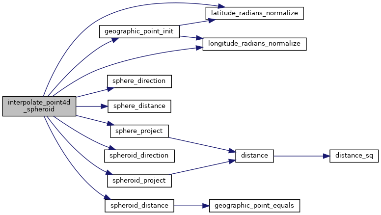
◆ interpolate_point4d_spheroid()
|
static |
Find interpolation point p between geography points p1 and p2 so that the len(p1,p) == len(p1,p2) f and p falls on p1,p2 segment.
Definition at line 60 of file lwgeodetic_measures.c.
double longitude_radians_normalize(double lon)
Convert a longitude to the range of -PI,PI.
Definition: lwgeodetic.c:50
double latitude_radians_normalize(double lat)
Convert a latitude to the range of -PI/2,PI/2.
Definition: lwgeodetic.c:78
int sphere_project(const GEOGRAPHIC_POINT *r, double distance, double azimuth, GEOGRAPHIC_POINT *n)
Given a starting location r, a distance and an azimuth to the new point, compute the location of the ...
Definition: lwgeodetic.c:1320
void geographic_point_init(double lon, double lat, GEOGRAPHIC_POINT *g)
Initialize a geographic point.
Definition: lwgeodetic.c:180
double sphere_distance(const GEOGRAPHIC_POINT *s, const GEOGRAPHIC_POINT *e)
Given two points on a unit sphere, calculate their distance apart in radians.
Definition: lwgeodetic.c:948
double sphere_direction(const GEOGRAPHIC_POINT *s, const GEOGRAPHIC_POINT *e, double d)
Given two points on a unit sphere, calculate the direction from s to e.
Definition: lwgeodetic.c:979
double spheroid_distance(const GEOGRAPHIC_POINT *a, const GEOGRAPHIC_POINT *b, const SPHEROID *spheroid)
Computes the shortest distance along the surface of the spheroid between two points,...
Definition: lwspheroid.c:79
int spheroid_project(const GEOGRAPHIC_POINT *r, const SPHEROID *spheroid, double distance, double azimuth, GEOGRAPHIC_POINT *g)
Given a location, an azimuth and a distance, computes the location of the projected point.
Definition: lwspheroid.c:128
double spheroid_direction(const GEOGRAPHIC_POINT *r, const GEOGRAPHIC_POINT *s, const SPHEROID *spheroid)
Computes the forward azimuth of the geodesic joining two points on the spheroid, using the inverse ge...
Definition: lwspheroid.c:105
References geographic_point_init(), GEOGRAPHIC_POINT::lat, latitude_radians_normalize(), GEOGRAPHIC_POINT::lon, longitude_radians_normalize(), LW_SUCCESS, rad2deg, s, sphere_direction(), sphere_distance(), sphere_project(), spheroid_direction(), spheroid_distance(), spheroid_project(), POINT4D::x, and POINT4D::y.
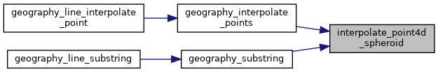
Referenced by geography_interpolate_points(), and geography_substring().
Here is the call graph for this function:
Here is the caller graph for this function: