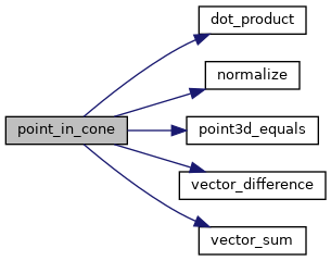
PostGIS  3.4.0dev-r@@SVN_REVISION@@

◆ point_in_cone()

static int point_in_cone ( const POINT3D A1,
const POINT3D A2,
const POINT3D P 
)
static

Utility function for checking if P is within the cone defined by A1/A2.

Definition at line 3458 of file lwgeodetic.c.

3459 {
3460  POINT3D AC; /* Center point of A1/A2 */
3461  double min_similarity, similarity;
3462 
3463  /* Boundary case */
3464  if (point3d_equals(A1, P) || point3d_equals(A2, P))
3465  return LW_TRUE;
3466 
3467  /* The normalized sum bisects the angle between start and end. */
3468  vector_sum(A1, A2, &AC);
3469  normalize(&AC);
3470 
3471  /* The projection of start onto the center defines the minimum similarity */
3472  min_similarity = dot_product(A1, &AC);
3473 
3474  /* If the edge is sufficiently curved, use the dot product test */
3475  if (fabs(1.0 - min_similarity) > 1e-10)
3476  {
3477  /* The projection of candidate p onto the center */
3478  similarity = dot_product(P, &AC);
3479 
3480  /* If the projection of the candidate is larger than */
3481  /* the projection of the start point, the candidate */
3482  /* must be closer to the center than the start, so */
3483  /* therefor inside the cone */
3484  if (similarity > min_similarity)
3485  {
3486  return LW_TRUE;
3487  }
3488  else
3489  {
3490  return LW_FALSE;
3491  }
3492  }
3493  else
3494  {
3495  /* Where the edge is very narrow, the dot product test */
3496  /* fails, but we can use the almost-planar nature of the */
3497  /* problem space then to test if the vector from the */
3498  /* candidate to the start point in a different direction */
3499  /* to the vector from candidate to end point */
3500  /* If so, then candidate is between start and end */
3501  POINT3D PA1, PA2;
3502  vector_difference(P, A1, &PA1);
3503  vector_difference(P, A2, &PA2);
3504  normalize(&PA1);
3505  normalize(&PA2);
3506  if (dot_product(&PA1, &PA2) < 0.0)
3507  {
3508  return LW_TRUE;
3509  }
3510  else
3511  {
3512  return LW_FALSE;
3513  }
3514  }
3515  return LW_FALSE;
3516 }
#define LW_FALSE
Definition: liblwgeom.h:94
#define LW_TRUE
Return types for functions with status returns.
Definition: liblwgeom.h:93
void normalize(POINT3D *p)
Normalize to a unit vector.
Definition: lwgeodetic.c:615
static void vector_difference(const POINT3D *a, const POINT3D *b, POINT3D *n)
Calculate the difference of two vectors.
Definition: lwgeodetic.c:476
static double dot_product(const POINT3D *p1, const POINT3D *p2)
Convert cartesian coordinates on unit sphere to lon/lat coordinates static void cart2ll(const POINT3D...
Definition: lwgeodetic.c:446
void vector_sum(const POINT3D *a, const POINT3D *b, POINT3D *n)
Calculate the sum of two vectors.
Definition: lwgeodetic.c:465
static int point3d_equals(const POINT3D *p1, const POINT3D *p2)
Utility function for ptarray_contains_point_sphere()
Definition: lwgeodetic.c:42

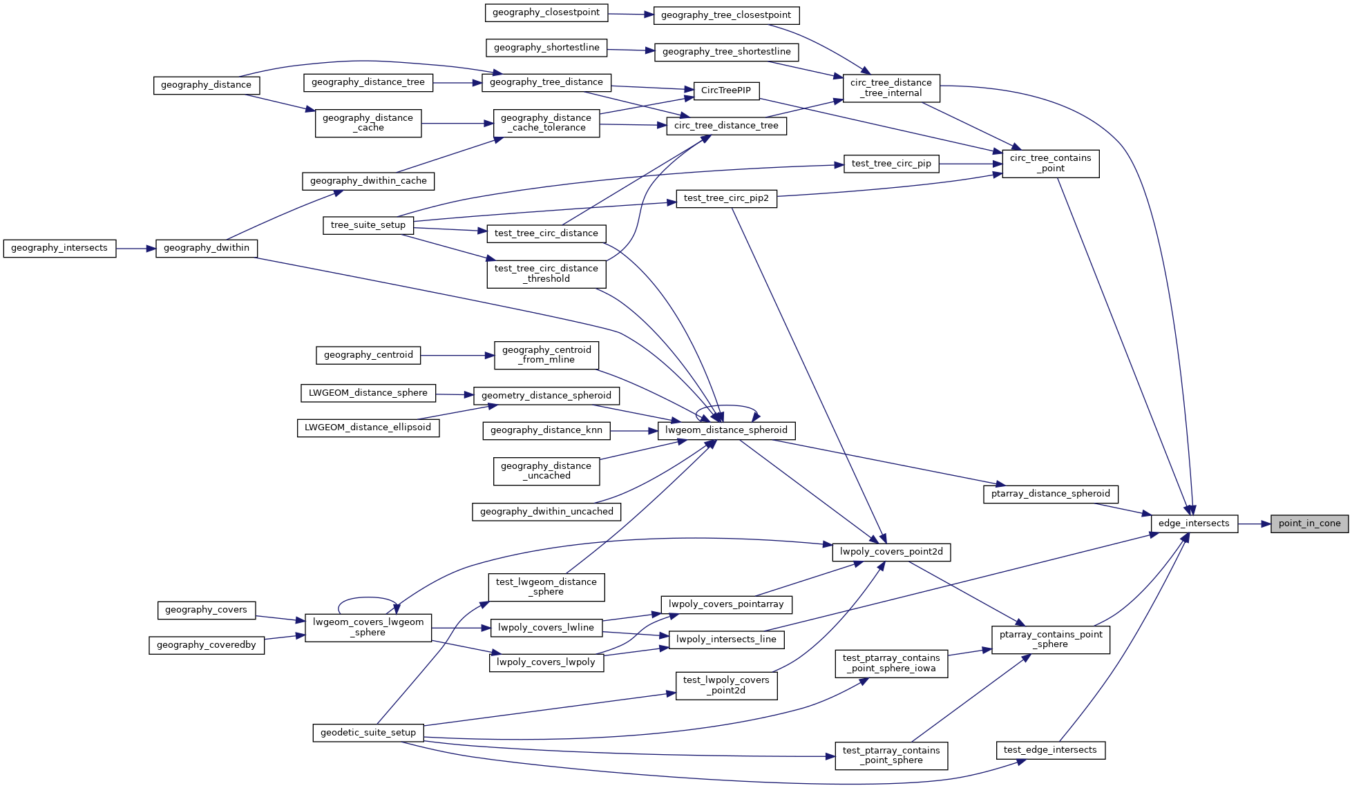
References dot_product(), LW_FALSE, LW_TRUE, normalize(), point3d_equals(), vector_difference(), and vector_sum().

Referenced by edge_intersects().

Here is the call graph for this function:
Here is the caller graph for this function: