PostGIS  3.3.9dev-r@@SVN_REVISION@@

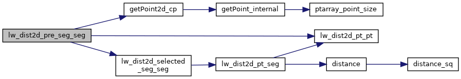
◆ lw_dist2d_pre_seg_seg()

int lw_dist2d_pre_seg_seg ( POINTARRAY l1,
POINTARRAY l2,
LISTSTRUCT list1,
LISTSTRUCT list2,
double  k,
DISTPTS dl 
)

preparation before lw_dist2d_seg_seg.

Definition at line 2170 of file measures.c.

2171 {
2172  const POINT2D *p1, *p2, *p3, *p4, *p01, *p02;
2173  int pnr1, pnr2, pnr3, pnr4, n1, n2, i, u, r, twist;
2174  double maxmeasure;
2175  n1 = l1->npoints;
2176  n2 = l2->npoints;
2177 
2178  LWDEBUG(2, "lw_dist2d_pre_seg_seg is called");
2179 
2180  p1 = getPoint2d_cp(l1, list1[0].pnr);
2181  p3 = getPoint2d_cp(l2, list2[0].pnr);
2182  lw_dist2d_pt_pt(p1, p3, dl);
2183  maxmeasure = sqrt(dl->distance * dl->distance + (dl->distance * dl->distance * k * k));
2184  twist = dl->twisted; /*to keep the incoming order between iterations*/
2185  for (i = (n1 - 1); i >= 0; --i)
2186  {
2187  /*we break this iteration when we have checked every point closer to our perpendicular "checkline" than
2188  * our shortest found distance*/
2189  if (((list2[0].themeasure - list1[i].themeasure)) > maxmeasure)
2190  break;
2191  /*because we are not iterating in the original point order we have to check the segment before and after
2192  * every point*/
2193  for (r = -1; r <= 1; r += 2)
2194  {
2195  pnr1 = list1[i].pnr;
2196  p1 = getPoint2d_cp(l1, pnr1);
2197  if (pnr1 + r < 0)
2198  {
2199  p01 = getPoint2d_cp(l1, (n1 - 1));
2200  if ((p1->x == p01->x) && (p1->y == p01->y))
2201  pnr2 = (n1 - 1);
2202  else
2203  pnr2 = pnr1; /* if it is a line and the last and first point is not the same we
2204  avoid the edge between start and end this way*/
2205  }
2206 
2207  else if (pnr1 + r > (n1 - 1))
2208  {
2209  p01 = getPoint2d_cp(l1, 0);
2210  if ((p1->x == p01->x) && (p1->y == p01->y))
2211  pnr2 = 0;
2212  else
2213  pnr2 = pnr1; /* if it is a line and the last and first point is not the same we
2214  avoid the edge between start and end this way*/
2215  }
2216  else
2217  pnr2 = pnr1 + r;
2218 
2219  p2 = getPoint2d_cp(l1, pnr2);
2220  for (u = 0; u < n2; ++u)
2221  {
2222  if (((list2[u].themeasure - list1[i].themeasure)) >= maxmeasure)
2223  break;
2224  pnr3 = list2[u].pnr;
2225  p3 = getPoint2d_cp(l2, pnr3);
2226  if (pnr3 == 0)
2227  {
2228  p02 = getPoint2d_cp(l2, (n2 - 1));
2229  if ((p3->x == p02->x) && (p3->y == p02->y))
2230  pnr4 = (n2 - 1);
2231  else
2232  pnr4 = pnr3; /* if it is a line and the last and first point is not the
2233  same we avoid the edge between start and end this way*/
2234  }
2235  else
2236  pnr4 = pnr3 - 1;
2237 
2238  p4 = getPoint2d_cp(l2, pnr4);
2239  dl->twisted = twist;
2240  if (!lw_dist2d_selected_seg_seg(p1, p2, p3, p4, dl))
2241  return LW_FALSE;
2242 
2243  if (pnr3 >= (n2 - 1))
2244  {
2245  p02 = getPoint2d_cp(l2, 0);
2246  if ((p3->x == p02->x) && (p3->y == p02->y))
2247  pnr4 = 0;
2248  else
2249  pnr4 = pnr3; /* if it is a line and the last and first point is not the
2250  same we avoid the edge between start and end this way*/
2251  }
2252 
2253  else
2254  pnr4 = pnr3 + 1;
2255 
2256  p4 = getPoint2d_cp(l2, pnr4);
2257  dl->twisted = twist; /*we reset the "twist" for each iteration*/
2258  if (!lw_dist2d_selected_seg_seg(p1, p2, p3, p4, dl))
2259  return LW_FALSE;
2260  /*here we "translate" the found mindistance so it can be compared to our "z"-values*/
2261  maxmeasure = sqrt(dl->distance * dl->distance + (dl->distance * dl->distance * k * k));
2262  }
2263  }
2264  }
2265 
2266  return LW_TRUE;
2267 }
char * r
Definition: cu_in_wkt.c:24
#define LW_FALSE
Definition: liblwgeom.h:109
#define LW_TRUE
Return types for functions with status returns.
Definition: liblwgeom.h:108
#define LWDEBUG(level, msg)
Definition: lwgeom_log.h:83
static const POINT2D * getPoint2d_cp(const POINTARRAY *pa, uint32_t n)
Returns a POINT2D pointer into the POINTARRAY serialized_ptlist, suitable for reading from.
Definition: lwinline.h:101
int lw_dist2d_selected_seg_seg(const POINT2D *A, const POINT2D *B, const POINT2D *C, const POINT2D *D, DISTPTS *dl)
This is the same function as lw_dist2d_seg_seg but without any calculations to determine intersection...
Definition: measures.c:2275
int lw_dist2d_pt_pt(const POINT2D *thep1, const POINT2D *thep2, DISTPTS *dl)
Compares incoming points and stores the points closest to each other or most far away from each other...
Definition: measures.c:2413
int twisted
Definition: measures.h:55
double distance
Definition: measures.h:51
int pnr
Definition: measures.h:62
double y
Definition: liblwgeom.h:405
double x
Definition: liblwgeom.h:405
uint32_t npoints
Definition: liblwgeom.h:442

References DISTPTS::distance, getPoint2d_cp(), lw_dist2d_pt_pt(), lw_dist2d_selected_seg_seg(), LW_FALSE, LW_TRUE, LWDEBUG, POINTARRAY::npoints, LISTSTRUCT::pnr, r, DISTPTS::twisted, POINT2D::x, and POINT2D::y.

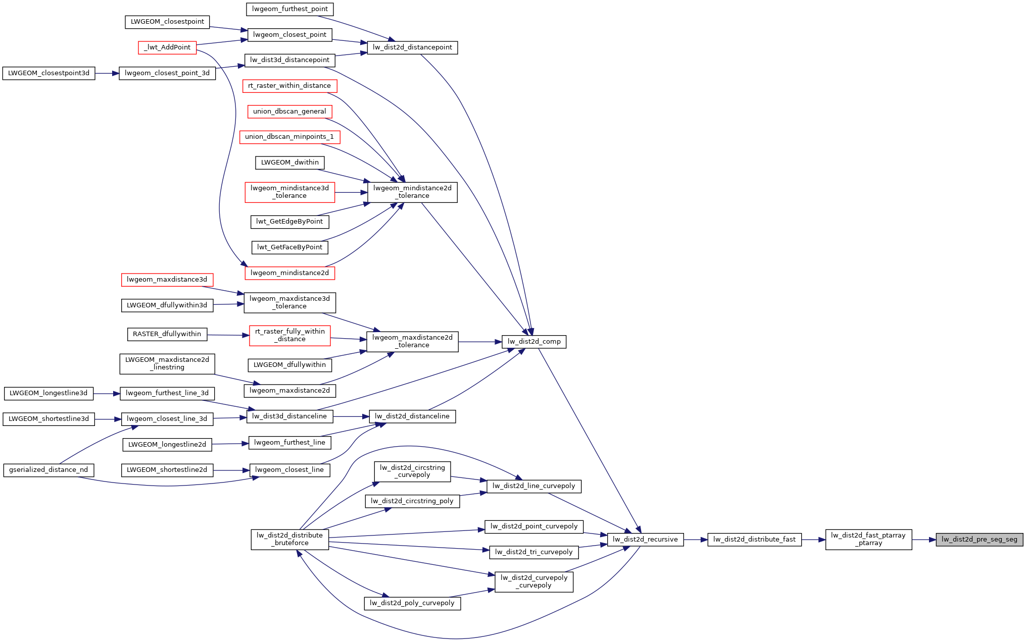
Referenced by lw_dist2d_fast_ptarray_ptarray().

Here is the call graph for this function:
Here is the caller graph for this function: