PostGIS  3.2.2dev-r@@SVN_REVISION@@

◆ lwgeom_reduceprecision()

LWGEOM* lwgeom_reduceprecision ( const LWGEOM geom,
double  gridSize 
)

Definition at line 966 of file liblwgeom/lwgeom_geos.c.

967 {
968 #if POSTGIS_GEOS_VERSION < 30900
969  lwerror("Precision reduction requires GEOS-3.9 or higher");
970  return NULL;
971 #else
972 
973  LWGEOM* result;
974  int32_t srid = RESULT_SRID(geom);
975  uint8_t is3d = FLAGS_GET_Z(geom->flags);
976  GEOSGeometry *g1, *g3;
977 
978  if (srid == SRID_INVALID) return NULL;
979 
980  if (lwgeom_is_empty(geom))
981  return lwgeom_clone_deep(geom);
982 
983  initGEOS(lwnotice, lwgeom_geos_error);
984 
985  if (!(g1 = LWGEOM2GEOS(geom, AUTOFIX))) GEOS_FAIL();
986 
987  g3 = GEOSGeom_setPrecision(g1, gridSize, 0);
988 
989  if (!g3) GEOS_FREE_AND_FAIL(g1);
990  GEOSSetSRID(g3, srid);
991 
992  if (!(result = GEOS2LWGEOM(g3, is3d)))
993  GEOS_FREE_AND_FAIL(g1);
994 
995  GEOS_FREE(g1, g3);
996 
997  return result;
998 #endif
999 }
char result[OUT_DOUBLE_BUFFER_SIZE]
Definition: cu_print.c:267
#define GEOS_FREE(...)
#define AUTOFIX
#define RESULT_SRID(...)
#define GEOS_FAIL()
#define GEOS_FREE_AND_FAIL(...)
GEOSGeometry * LWGEOM2GEOS(const LWGEOM *lwgeom, uint8_t autofix)
LWGEOM * GEOS2LWGEOM(const GEOSGeometry *geom, uint8_t want3d)
void lwgeom_geos_error(const char *fmt,...)
#define SRID_INVALID
Definition: liblwgeom.h:233
LWGEOM * lwgeom_clone_deep(const LWGEOM *lwgeom)
Deep clone an LWGEOM, everything is copied.
Definition: lwgeom.c:512
#define FLAGS_GET_Z(flags)
Definition: liblwgeom.h:179
void lwerror(const char *fmt,...)
Write a notice out to the error handler.
Definition: lwutil.c:190
void lwnotice(const char *fmt,...)
Write a notice out to the notice handler.
Definition: lwutil.c:177
static int lwgeom_is_empty(const LWGEOM *geom)
Return true or false depending on whether a geometry is an "empty" geometry (no vertices members)
Definition: lwinline.h:203
lwflags_t flags
Definition: liblwgeom.h:475

References AUTOFIX, LWGEOM::flags, FLAGS_GET_Z, GEOS2LWGEOM(), GEOS_FAIL, GEOS_FREE, GEOS_FREE_AND_FAIL, lwerror(), LWGEOM2GEOS(), lwgeom_clone_deep(), lwgeom_geos_error(), lwgeom_is_empty(), lwnotice(), result, RESULT_SRID, and SRID_INVALID.

Referenced by ST_ReducePrecision().

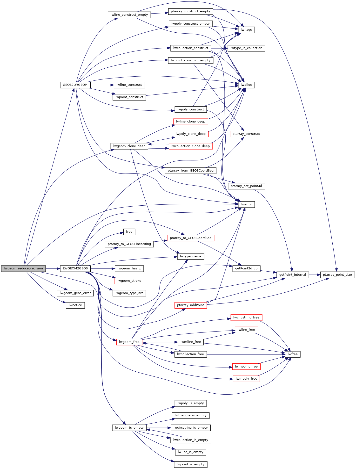
Here is the call graph for this function:
Here is the caller graph for this function: