◆ edge_distance_to_point()
| double edge_distance_to_point | ( | const GEOGRAPHIC_EDGE * | e, |
| const GEOGRAPHIC_POINT * | gp, | ||
| GEOGRAPHIC_POINT * | closest | ||
| ) |
Definition at line 1218 of file lwgeodetic.c.
void vector_scale(POINT3D *n, double scale)
Scale a vector out by a factor.
Definition: lwgeodetic.c:487
void cart2geog(const POINT3D *p, GEOGRAPHIC_POINT *g)
Convert cartesian coordinates on unit sphere to spherical coordinates.
Definition: lwgeodetic.c:414
int edge_point_in_cone(const GEOGRAPHIC_EDGE *e, const GEOGRAPHIC_POINT *p)
Returns true if the point p is inside the cone defined by the two ends of the edge e.
Definition: lwgeodetic.c:788
void robust_cross_product(const GEOGRAPHIC_POINT *p, const GEOGRAPHIC_POINT *q, POINT3D *a)
Computes the cross product of two vectors using their lat, lng representations.
Definition: lwgeodetic.c:634
static void vector_difference(const POINT3D *a, const POINT3D *b, POINT3D *n)
Calculate the difference of two vectors.
Definition: lwgeodetic.c:476
double sphere_distance(const GEOGRAPHIC_POINT *s, const GEOGRAPHIC_POINT *e)
Given two points on a unit sphere, calculate their distance apart in radians.
Definition: lwgeodetic.c:948
static double dot_product(const POINT3D *p1, const POINT3D *p2)
Convert cartesian coordinates on unit sphere to lon/lat coordinates static void cart2ll(const POINT3D...
Definition: lwgeodetic.c:446
void geog2cart(const GEOGRAPHIC_POINT *g, POINT3D *p)
Convert spherical coordinates to cartesian coordinates on unit sphere.
Definition: lwgeodetic.c:404
int geographic_point_equals(const GEOGRAPHIC_POINT *g1, const GEOGRAPHIC_POINT *g2)
Definition: lwgeodetic.c:170
Definition: liblwgeom.h:415
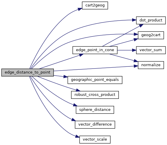
References cart2geog(), dot_product(), edge_point_in_cone(), GEOGRAPHIC_EDGE::end, geog2cart(), geographic_point_equals(), normalize(), robust_cross_product(), sphere_distance(), GEOGRAPHIC_EDGE::start, vector_difference(), and vector_scale().
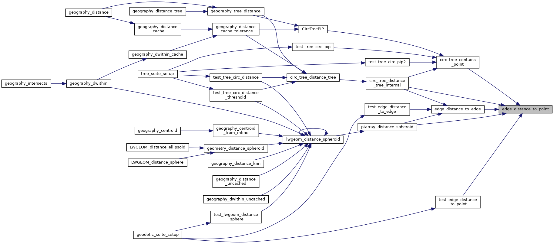
Referenced by circ_tree_contains_point(), circ_tree_distance_tree_internal(), edge_distance_to_edge(), ptarray_distance_spheroid(), and test_edge_distance_to_point().
Here is the call graph for this function:
Here is the caller graph for this function: