PostGIS  3.1.6dev-r@@SVN_REVISION@@

◆ _lwt_FetchAllEdges()

static LWT_ISO_EDGE* _lwt_FetchAllEdges ( LWT_TOPOLOGY topo,
int *  numedges 
)
static

Definition at line 6271 of file lwgeom_topo.c.

6272 {
6273  LWT_ISO_EDGE *edge;
6274  int fields = LWT_COL_EDGE_ALL;
6275  uint64_t nelems = 1;
6276 
6277  edge = lwt_be_getEdgeWithinBox2D( topo, NULL, &nelems, fields, 0);
6278  *numedges = nelems;
6279  if (nelems == UINT64_MAX)
6280  {
6281  lwerror("Backend error: %s", lwt_be_lastErrorMessage(topo->be_iface));
6282  return NULL;
6283  }
6284  return edge;
6285 }
#define LWT_COL_EDGE_ALL
void lwerror(const char *fmt,...)
Write a notice out to the error handler.
Definition: lwutil.c:190
const char * lwt_be_lastErrorMessage(const LWT_BE_IFACE *be)
Definition: lwgeom_topo.c:119
static LWT_ISO_EDGE * lwt_be_getEdgeWithinBox2D(const LWT_TOPOLOGY *topo, const GBOX *box, uint64_t *numelems, int fields, uint64_t limit)
Definition: lwgeom_topo.c:178
const LWT_BE_IFACE * be_iface

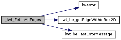
References LWT_TOPOLOGY_T::be_iface, lwerror(), lwt_be_getEdgeWithinBox2D(), lwt_be_lastErrorMessage(), and LWT_COL_EDGE_ALL.

Referenced by lwt_Polygonize().

Here is the call graph for this function:
Here is the caller graph for this function: