128 HeapTupleData tmptup,
131 bool needsep =
false;
133 StringInfo props = makeStringInfo();
134 bool geom_column_found =
false;
136 sep = use_line_feeds ?
",\n " :
", ";
138 td = DatumGetHeapTupleHeader(composite);
141 tupType = HeapTupleHeaderGetTypeId(td);
142 tupTypmod = HeapTupleHeaderGetTypMod(td);
143 tupdesc = lookup_rowtype_tupdesc(tupType, tupTypmod);
146 tmptup.t_len = HeapTupleHeaderGetDatumLength(td);
150 appendStringInfoString(
result,
"{\"type\": \"Feature\", \"geometry\": ");
152 for (i = 0; i < tupdesc->natts; i++)
159 Form_pg_attribute att = TupleDescAttr(tupdesc, i);
160 bool is_geom_column =
false;
162 if (att->attisdropped)
165 attname = NameStr(att->attname);
167 if (geom_column_name)
168 is_geom_column = (strcmp(attname, geom_column_name) == 0);
170 is_geom_column = (att->atttypid == geom_oid || att->atttypid == geog_oid);
172 if ((!geom_column_found) && is_geom_column)
175 geom_column_found =
true;
177 val = heap_getattr(tuple, i + 1, tupdesc, &isnull);
187 Int32GetDatum(maxdecimaldigits))));
191 appendStringInfoString(
result,
"{\"type\": null}");
197 appendStringInfoString(props, sep);
200 escape_json(props, attname);
201 appendStringInfoString(props,
": ");
203 val = heap_getattr(tuple, i + 1, tupdesc, &isnull);
208 outfuncoid = InvalidOid;
213 datum_to_json(val, isnull, props, tcategory, outfuncoid,
false);
217 if (!geom_column_found)
219 (errcode(ERRCODE_INVALID_PARAMETER_VALUE),
220 errmsg(
"geometry column is missing")));
222 appendStringInfoString(
result,
", \"properties\": {");
223 appendStringInfo(
result,
"%s", props->data);
225 appendStringInfoString(
result,
"}}");
226 ReleaseTupleDesc(tupdesc);
char result[OUT_DOUBLE_BUFFER_SIZE]
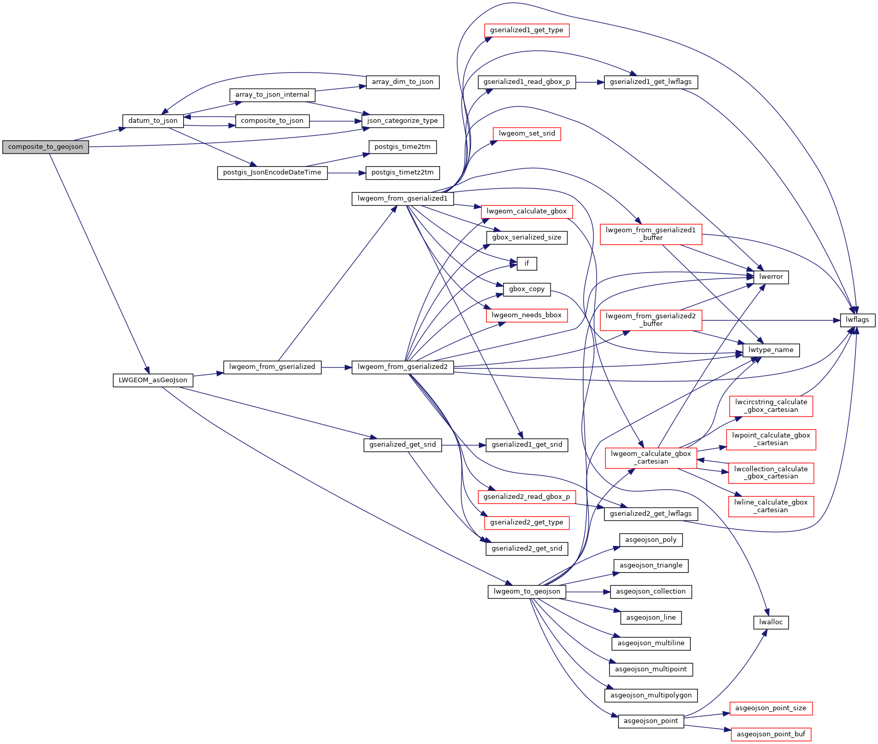
static void json_categorize_type(Oid typoid, JsonTypeCategory *tcategory, Oid *outfuncoid)
Datum LWGEOM_asGeoJson(PG_FUNCTION_ARGS)
static void datum_to_json(Datum val, bool is_null, StringInfo result, JsonTypeCategory tcategory, Oid outfuncoid, bool key_scalar)