◆ coveredby()
| Datum coveredby | ( | PG_FUNCTION_ARGS | ) |
Definition at line 2180 of file postgis/lwgeom_geos.c.
2263 POSTGIS_DEBUGF(3, "CoveredBy: type1: %d, type2: %d", gserialized_get_type(geom1), gserialized_get_type(geom2));
int gbox_contains_2d(const GBOX *g1, const GBOX *g2)
Return LW_TRUE if the first GBOX contains the second on the 2d plane, LW_FALSE otherwise.
Definition: gbox.c:339
void gserialized_error_if_srid_mismatch(const GSERIALIZED *g1, const GSERIALIZED *g2, const char *funcname)
Definition: gserialized.c:404
int gserialized_get_gbox_p(const GSERIALIZED *g, GBOX *gbox)
Read the box from the GSERIALIZED or calculate it if necessary.
Definition: gserialized.c:65
LWGEOM * lwgeom_from_gserialized(const GSERIALIZED *g)
Allocate a new LWGEOM from a GSERIALIZED.
Definition: gserialized.c:239
int gserialized_is_empty(const GSERIALIZED *g)
Check if a GSERIALIZED is empty without deserializing first.
Definition: gserialized.c:152
uint32_t gserialized_get_type(const GSERIALIZED *g)
Extract the geometry type from the serialized form (it hides in the anonymous data area,...
Definition: gserialized.c:89
int lwpoint_is_empty(const LWPOINT *point)
RTREE_POLY_CACHE * GetRtreeCache(FunctionCallInfo fcinfo, SHARED_GSERIALIZED *g1)
Checks for a cache hit against the provided geometry and returns a pre-built index structure (RTREE_P...
Definition: lwgeom_rtree.c:432
static int pip_short_circuit(RTREE_POLY_CACHE *poly_cache, LWPOINT *point, const GSERIALIZED *gpoly)
Definition: postgis/lwgeom_geos.c:142
GEOSGeometry * POSTGIS2GEOS(const GSERIALIZED *pglwgeom)
Definition: postgis/lwgeom_geos.c:2844
Definition: liblwgeom.h:366
Definition: liblwgeom.h:457
Definition: liblwgeom.h:471
Definition: liblwgeom.h:545
Definition: liblwgeom.h:483
The tree structure used for fast P-i-P tests by point_in_multipolygon_rtree()
Definition: lwgeom_rtree.h:59
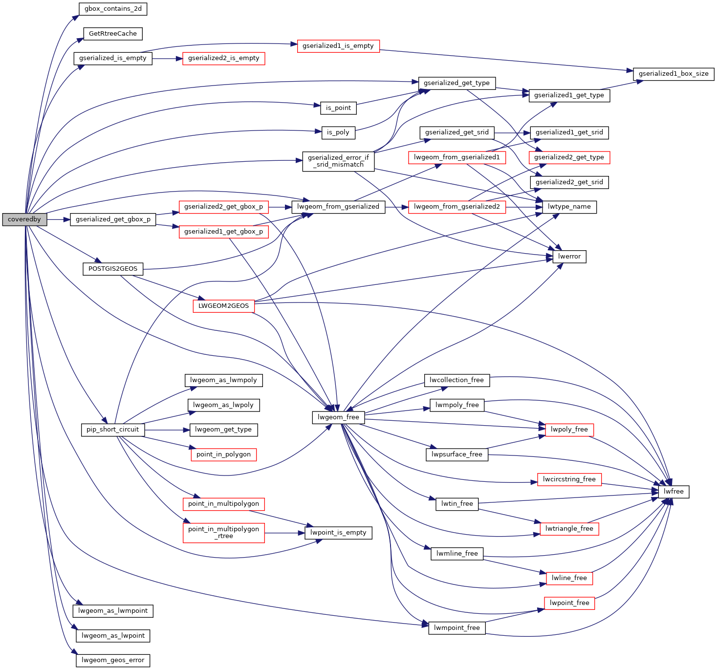
References gbox_contains_2d(), LWMPOINT::geoms, GetRtreeCache(), gserialized_error_if_srid_mismatch(), gserialized_get_gbox_p(), gserialized_get_type(), gserialized_is_empty(), HANDLE_GEOS_ERROR, is_point(), is_poly(), LW_FALSE, LW_TRUE, lwgeom_as_lwmpoint(), lwgeom_as_lwpoint(), lwgeom_free(), lwgeom_from_gserialized(), lwgeom_geos_error(), lwmpoint_free(), lwpoint_is_empty(), MULTIPOINTTYPE, LWMPOINT::ngeoms, pip_short_circuit(), POINTTYPE, POSTGIS2GEOS(), and result.
Referenced by rt_raster_coveredby().
Here is the call graph for this function:

Here is the caller graph for this function:
