Loading...
Searching...
No Matches
◆ parse_gml_poslist()
|
static |
Parse gml:posList.
Definition at line 844 of file lwgeom_in_gml.c.
845{
846 xmlChar *dimension, *gmlposlist;
847 char *poslist, *p;
848 int dim, gml_dim;
849 POINTARRAY *dpa;
850 POINT4D pt = {0, 0, 0, 0};
851 bool digit;
852
853 /* Retrieve gml:srsDimension attribute if any */
855 if (dimension == NULL) /* in GML 3.0.0 it was dimension */
857 if (dimension == NULL) dim = 2; /* We assume that we are in common 2D */
858 else
859 {
860 dim = atoi((char *) dimension);
861 xmlFree(dimension);
863 }
864 if (dim == 2) *hasz = false;
865
866 /* Retrieve gml:posList string */
867 gmlposlist = xmlNodeGetContent(xnode);
868 poslist = (char *) gmlposlist;
869
870 /* HasZ?, !HasM, 1 point */
871 dpa = ptarray_construct_empty(1, 0, 1);
872
873 /* gml:posList pattern: x1 y1 x2 y2
874 * x1 y1 z1 x2 y2 z2
875 */
876 while (isspace(*poslist)) poslist++; /* Eat extra whitespaces if any */
877 for (p=poslist, gml_dim=0, digit=false ; *poslist ; poslist++)
878 {
879 if (isdigit(*poslist)) digit = true;
880 if (digit && (*poslist == ' ' || *(poslist+1) == '\0'))
881 {
882 if (*poslist == ' ') *poslist = '\0';
883
884 gml_dim++;
888
889 if (gml_dim == dim)
890 {
893 gml_dim = 0;
894 }
895 else if (*(poslist+1) == '\0')
897
898 p = poslist+1;
899 digit = false;
900 }
901 }
902
903 xmlFree(gmlposlist);
904
905 return dpa; /* ptarray_clone_deep(dpa); */
906}
POINTARRAY * ptarray_construct_empty(char hasz, char hasm, uint32_t maxpoints)
Create a new POINTARRAY with no points.
Definition ptarray.c:59
int ptarray_append_point(POINTARRAY *pa, const POINT4D *pt, int allow_duplicates)
Append a point to the end of an existing POINTARRAY If allow_duplicate is LW_FALSE,...
Definition ptarray.c:147
static xmlChar * gmlGetProp(xmlNodePtr xnode, const char *charProp)
Retrieve a GML property from a node or NULL otherwise Respect namespaces if presents in the node elem...
Definition lwgeom_in_gml.c:205
static double parse_gml_double(char *d, bool space_before, bool space_after)
Parse a string supposed to be a double.
Definition lwgeom_in_gml.c:533
static void gml_lwpgerror(char *msg, __attribute__((__unused__)) int error_code)
Definition lwgeom_in_gml.c:82
Definition liblwgeom.h:399
Definition liblwgeom.h:412
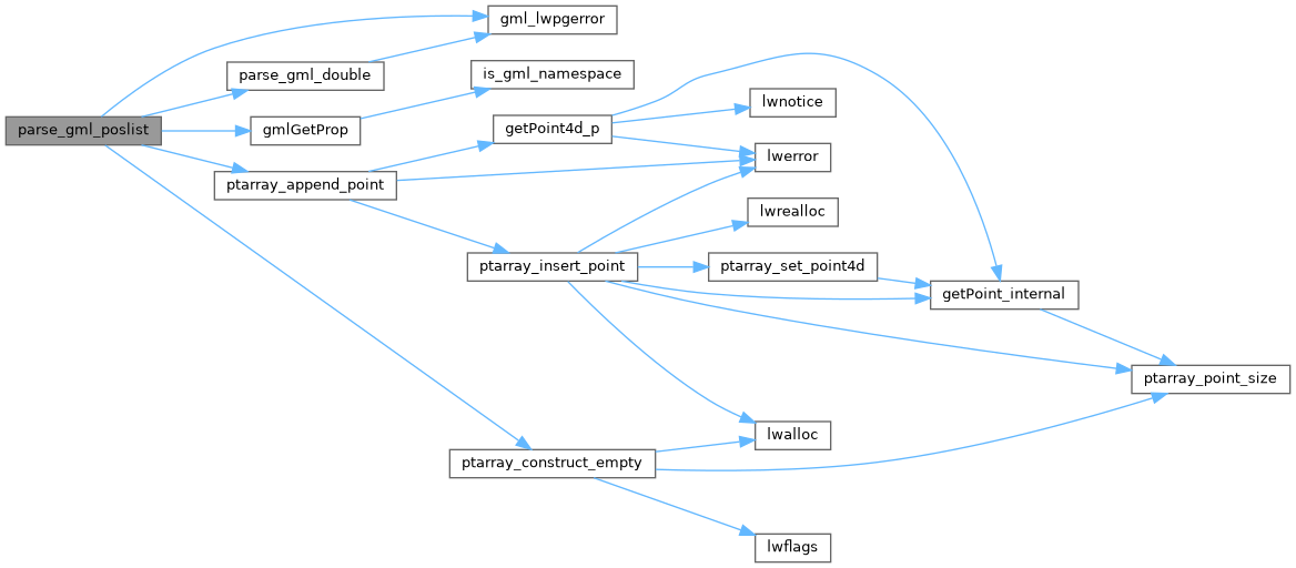
References gml_lwpgerror(), gmlGetProp(), LW_FALSE, POINT4D::m, parse_gml_double(), ptarray_append_point(), ptarray_construct_empty(), POINT4D::x, POINT4D::y, and POINT4D::z.
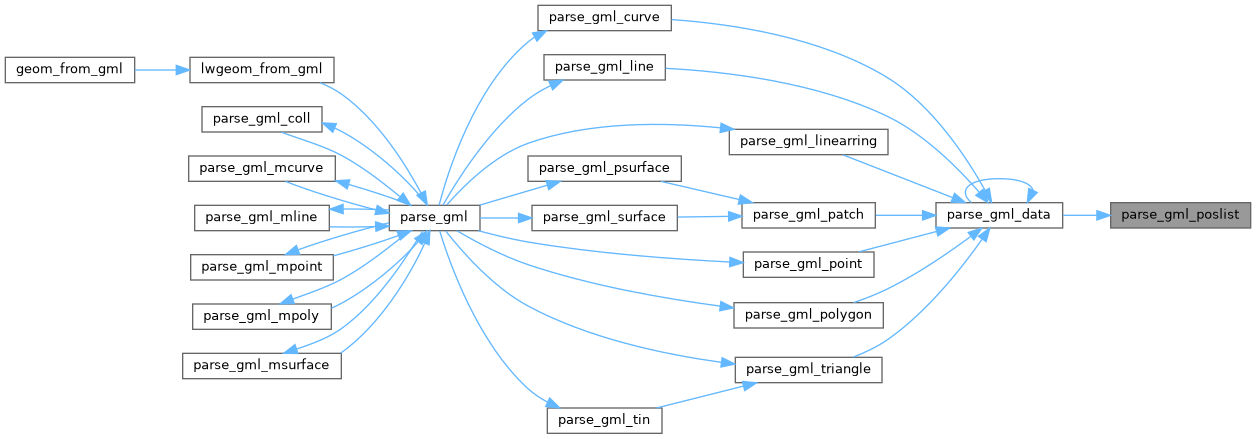
Referenced by parse_gml_data().
Here is the call graph for this function:
Here is the caller graph for this function: