Loading...
Searching...
No Matches
◆ box2df_penalty()
|
inlinestatic |
Definition at line 1152 of file gserialized_gist_2d.c.
1153{
1154 float b1xmin = b1->xmin, b1xmax = b1->xmax;
1155 float b1ymin = b1->ymin, b1ymax = b1->ymax;
1156 float b2xmin = b2->xmin, b2xmax = b2->xmax;
1157 float b2ymin = b2->ymin, b2ymax = b2->ymax;
1158
1159 float box_union_xmin = Min(b1xmin, b2xmin), box_union_xmax = Max(b1xmax, b2xmax);
1160 float box_union_ymin = Min(b1ymin, b2ymin), box_union_ymax = Max(b1ymax, b2ymax);
1161
1162 float b1dx = b1xmax - b1xmin, b1dy = b1ymax - b1ymin;
1163 float box_union_dx = box_union_xmax - box_union_xmin, box_union_dy = box_union_ymax - box_union_ymin;
1164
1165 float box_union_area = box_union_dx * box_union_dy, box1area = b1dx * b1dy;
1166 float box_union_edge = box_union_dx + box_union_dy, box1edge = b1dx + b1dy;
1167
1168 float area_extension = box_union_area - box1area;
1169 float edge_extension = box_union_edge - box1edge;
1170
1171 /* REALM 1: Area extension is nonzero, return it */
1172 if (area_extension > FLT_EPSILON)
1174 /* REALM 0: Area extension is zero, return nonzero edge extension */
1175 else if (edge_extension > FLT_EPSILON)
1177
1178 return 0;
1179}
static float pack_float(const float value, const uint8_t realm)
Definition gserialized_gist_2d.c:1132
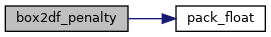
References pack_float().
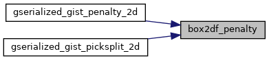
Referenced by gserialized_gist_penalty_2d(), and gserialized_gist_picksplit_2d().
Here is the call graph for this function:
Here is the caller graph for this function: