PostGIS  3.0.6dev-r@@SVN_REVISION@@

◆ ST_MinimumBoundingRadius()

Datum ST_MinimumBoundingRadius ( PG_FUNCTION_ARGS  )

Definition at line 1118 of file lwgeom_functions_analytic.c.

1119 {
1120  GSERIALIZED* geom;
1121  LWGEOM* input;
1122  LWBOUNDINGCIRCLE* mbc = NULL;
1123  LWGEOM* lwcenter;
1124  GSERIALIZED* center;
1125  TupleDesc resultTupleDesc;
1126  HeapTuple resultTuple;
1127  Datum result;
1128  Datum result_values[2];
1129  bool result_is_null[2];
1130  double radius = 0;
1131 
1132  if (PG_ARGISNULL(0))
1133  PG_RETURN_NULL();
1134 
1135  geom = PG_GETARG_GSERIALIZED_P(0);
1136 
1137  /* Empty geometry? Return POINT EMPTY with zero radius */
1138  if (gserialized_is_empty(geom))
1139  {
1141  }
1142  else
1143  {
1144  input = lwgeom_from_gserialized(geom);
1145  mbc = lwgeom_calculate_mbc(input);
1146 
1147  if (!(mbc && mbc->center))
1148  {
1149  lwpgerror("Error calculating minimum bounding circle.");
1150  lwgeom_free(input);
1151  PG_RETURN_NULL();
1152  }
1153 
1154  lwcenter = (LWGEOM*) lwpoint_make2d(input->srid, mbc->center->x, mbc->center->y);
1155  radius = mbc->radius;
1156 
1158  lwgeom_free(input);
1159  }
1160 
1161  center = geometry_serialize(lwcenter);
1162  lwgeom_free(lwcenter);
1163 
1164  get_call_result_type(fcinfo, NULL, &resultTupleDesc);
1165  BlessTupleDesc(resultTupleDesc);
1166 
1167  result_values[0] = PointerGetDatum(center);
1168  result_is_null[0] = false;
1169  result_values[1] = Float8GetDatum(radius);
1170  result_is_null[1] = false;
1171 
1172  resultTuple = heap_form_tuple(resultTupleDesc, result_values, result_is_null);
1173 
1174  result = HeapTupleGetDatum(resultTuple);
1175 
1176  PG_RETURN_DATUM(result);
1177 }
int32_t gserialized_get_srid(const GSERIALIZED *g)
Extract the SRID from the serialized form (it is packed into three bytes so this is a handy function)...
Definition: gserialized.c:126
LWGEOM * lwgeom_from_gserialized(const GSERIALIZED *g)
Allocate a new LWGEOM from a GSERIALIZED.
Definition: gserialized.c:239
int gserialized_is_empty(const GSERIALIZED *g)
Check if a GSERIALIZED is empty without deserializing first.
Definition: gserialized.c:152
LWPOINT * lwpoint_construct_empty(int32_t srid, char hasz, char hasm)
Definition: lwpoint.c:151
#define LW_FALSE
Definition: liblwgeom.h:108
LWPOINT * lwpoint_make2d(int32_t srid, double x, double y)
Definition: lwpoint.c:163
void lwgeom_free(LWGEOM *geom)
Definition: lwgeom.c:1138
LWBOUNDINGCIRCLE * lwgeom_calculate_mbc(const LWGEOM *g)
void lwboundingcircle_destroy(LWBOUNDINGCIRCLE *c)
GSERIALIZED * geometry_serialize(LWGEOM *lwgeom)
POINT2D * center
Definition: liblwgeom.h:1756
int32_t srid
Definition: liblwgeom.h:446
double y
Definition: liblwgeom.h:376
double x
Definition: liblwgeom.h:376

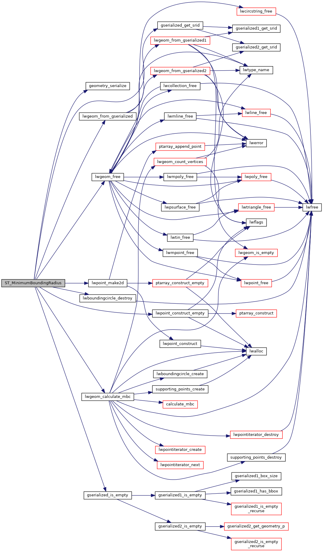
References LWBOUNDINGCIRCLE::center, geometry_serialize(), gserialized_get_srid(), gserialized_is_empty(), LW_FALSE, lwboundingcircle_destroy(), lwgeom_calculate_mbc(), lwgeom_free(), lwgeom_from_gserialized(), lwpoint_construct_empty(), lwpoint_make2d(), LWBOUNDINGCIRCLE::radius, LWGEOM::srid, POINT2D::x, and POINT2D::y.

Here is the call graph for this function: