◆ ST_MinimumBoundingCircle()
| Datum ST_MinimumBoundingCircle | ( | PG_FUNCTION_ARGS | ) |
Definition at line 1186 of file lwgeom_functions_analytic.c.
1222 lwcircle = lwpoly_as_lwgeom(lwpoly_construct_circle(input->srid, mbc->center->x, mbc->center->y, mbc->radius, segs_per_quarter, LW_TRUE));
int32_t gserialized_get_srid(const GSERIALIZED *g)
Extract the SRID from the serialized form (it is packed into three bytes so this is a handy function)...
Definition: gserialized.c:126
LWGEOM * lwgeom_from_gserialized(const GSERIALIZED *g)
Allocate a new LWGEOM from a GSERIALIZED.
Definition: gserialized.c:239
int gserialized_is_empty(const GSERIALIZED *g)
Check if a GSERIALIZED is empty without deserializing first.
Definition: gserialized.c:152
LWPOINT * lwpoint_construct_empty(int32_t srid, char hasz, char hasm)
Definition: lwpoint.c:151
LWPOLY * lwpoly_construct_circle(int32_t srid, double x, double y, double radius, uint32_t segments_per_quarter, char exterior)
Definition: lwpoly.c:120
LWBOUNDINGCIRCLE * lwgeom_calculate_mbc(const LWGEOM *g)
Definition: lwboundingcircle.c:237
void lwboundingcircle_destroy(LWBOUNDINGCIRCLE *c)
Definition: lwboundingcircle.c:230
GSERIALIZED * geometry_serialize(LWGEOM *lwgeom)
Definition: liblwgeom.h:429
Definition: liblwgeom.h:1755
Definition: liblwgeom.h:443
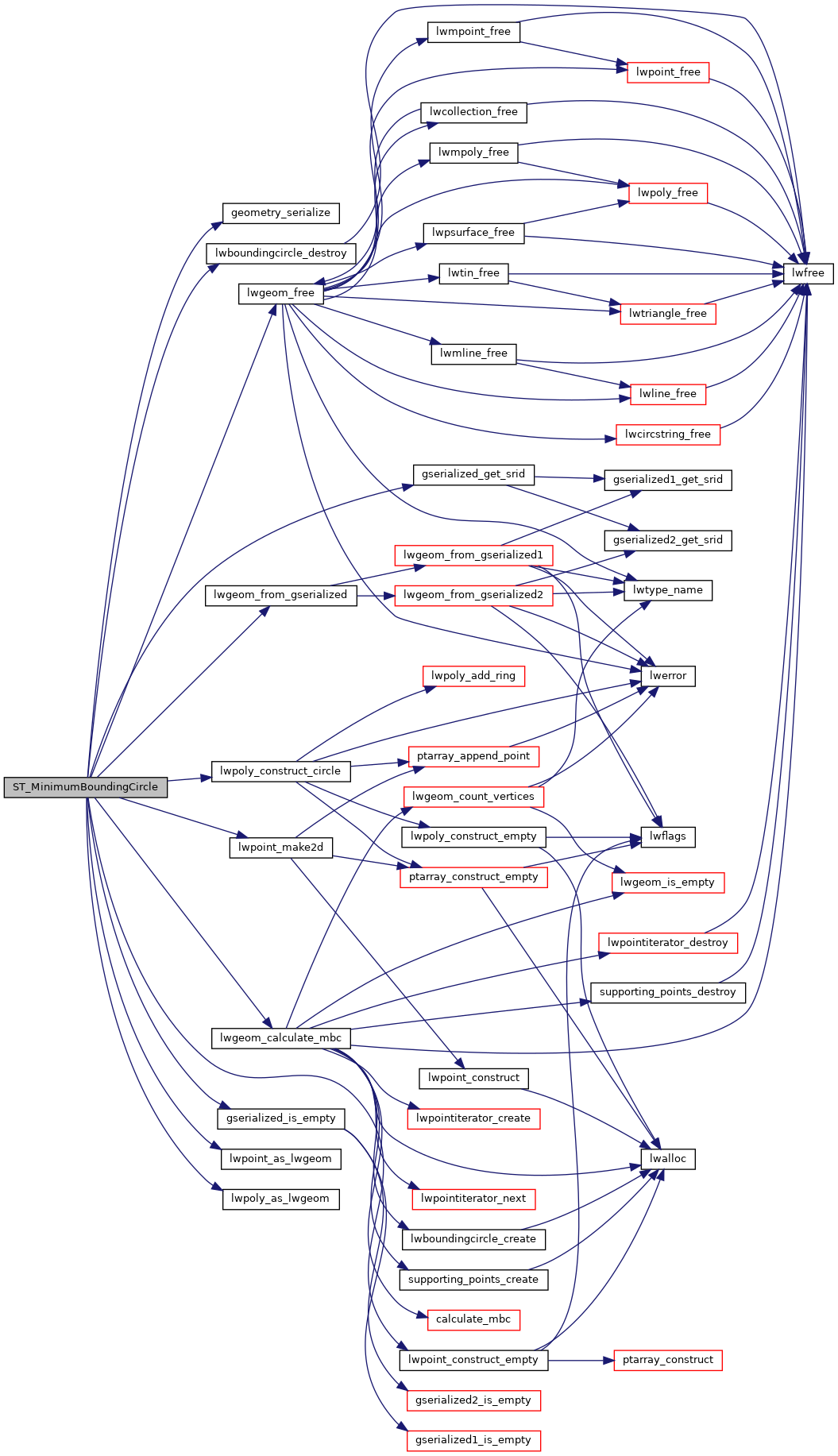
References LWBOUNDINGCIRCLE::center, geometry_serialize(), gserialized_get_srid(), gserialized_is_empty(), LW_FALSE, LW_TRUE, lwboundingcircle_destroy(), lwgeom_calculate_mbc(), lwgeom_free(), lwgeom_from_gserialized(), lwpoint_as_lwgeom(), lwpoint_construct_empty(), lwpoint_make2d(), lwpoly_as_lwgeom(), lwpoly_construct_circle(), LWBOUNDINGCIRCLE::radius, LWGEOM::srid, POINT2D::x, and POINT2D::y.
Here is the call graph for this function:
