◆ wkt_pointarray_dimensionality()
|
static |
Read the dimensionality from a flag, if provided.
Then check that the dimensionality matches that of the pointarray. If the dimension counts match, ensure the pointarray is using the right "Z" or "M".
Definition at line 183 of file lwin_wkt.c.
References POINTARRAY::flags, FLAGS_GET_M, FLAGS_GET_Z, FLAGS_NDIMS, FLAGS_SET_M, FLAGS_SET_Z, LW_FALSE, LW_TRUE, and LWDEBUGF.
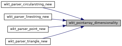
Referenced by wkt_parser_circularstring_new(), wkt_parser_linestring_new(), wkt_parser_point_new(), and wkt_parser_triangle_new().
Here is the caller graph for this function:
