Loading...
Searching...
No Matches
◆ asgeojson_multipoint_size()
|
static |
Multipoint Geometry.
Definition at line 382 of file lwout_geojson.c.
383{
384 LWPOINT * point;
385 int size;
386 uint32_t i;
387
388 size = sizeof("{'type':'MultiPoint',");
391 size += sizeof("'coordinates':[]}");
392
394 {
395 point = mpoint->geoms[i];
397 }
398 size += sizeof(",") * i;
399
400 return size;
401}
static size_t pointArray_geojson_size(POINTARRAY *pa, int precision)
Returns maximum size of rendered pointarray in bytes.
Definition lwout_geojson.c:776
static size_t asgeojson_bbox_size(int hasz, int precision)
Handle Bbox.
Definition lwout_geojson.c:127
Definition liblwgeom.h:455
References asgeojson_bbox_size(), asgeojson_srs_size(), LWMPOINT::flags, FLAGS_GET_Z, LWMPOINT::geoms, LWMPOINT::ngeoms, LWPOINT::point, pointArray_geojson_size(), and precision.
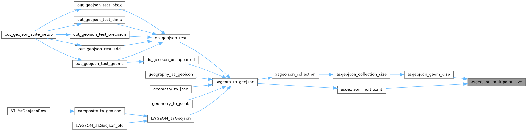
Referenced by asgeojson_geom_size(), and asgeojson_multipoint().
Here is the call graph for this function:
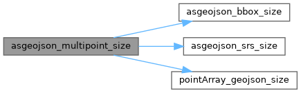
Here is the caller graph for this function: