Loading...
Searching...
No Matches
◆ combine_geometries()
|
static |
Uses a UNIONFIND to identify the set with which each input geometry is associated, and groups the geometries into GeometryCollections.
Supplied geometry array may be of either LWGEOM* or GEOSGeometry*; is_lwgeom is used to identify which. Caller is responsible for freeing input geometry array but not the items contained within it.
Definition at line 546 of file lwgeom_geos_cluster.c.
547{
548 size_t i, j, k;
549
550 /* Combine components of each cluster into their own GeometryCollection */
551 *num_clusters = uf->num_clusters;
553
555 uint32_t* ordered_components = UF_ordered_by_cluster(uf);
556 for (i = 0, j = 0, k = 0; i < num_geoms; i++)
557 {
558 geoms_in_cluster[j++] = geoms[ordered_components[i]];
559
560 /* Is this the last geometry in the component? */
561 if ((i == num_geoms - 1) ||
563 {
565 /* Should not get here - it means that we have more clusters than uf->num_clusters thinks we should. */
567 }
568
569 if (is_lwgeom)
570 {
573 (*clusterGeoms)[k++] = lwcollection_construct(COLLECTIONTYPE, components[0]->srid, NULL, j, (LWGEOM**) components);
574 }
575 else
576 {
577 int srid = GEOSGetSRID(((GEOSGeometry**) geoms_in_cluster)[0]);
578 GEOSGeometry* combined = GEOSGeom_createCollection(GEOS_GEOMETRYCOLLECTION, (GEOSGeometry**) geoms_in_cluster, j);
579 GEOSSetSRID(combined, srid);
580 (*clusterGeoms)[k++] = combined;
581 }
582 j = 0;
583 }
584 }
585
586 lwfree(geoms_in_cluster);
587 lwfree(ordered_components);
588
590}
LWCOLLECTION * lwcollection_construct(uint8_t type, int32_t srid, GBOX *bbox, uint32_t ngeoms, LWGEOM **geoms)
Definition lwcollection.c:42
Definition liblwgeom.h:443
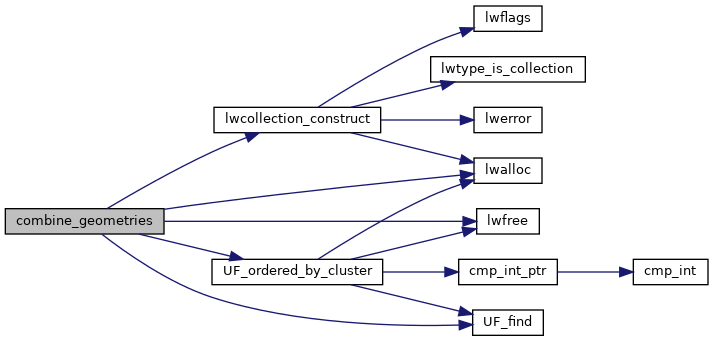
References COLLECTIONTYPE, LW_FAILURE, LW_SUCCESS, lwalloc(), lwcollection_construct(), lwfree(), UNIONFIND::num_clusters, UF_find(), and UF_ordered_by_cluster().
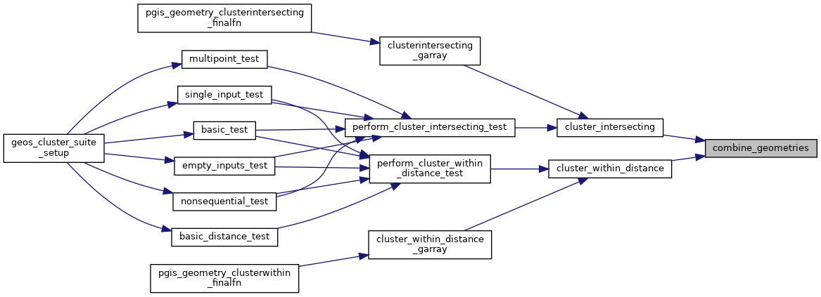
Referenced by cluster_intersecting(), and cluster_within_distance().
Here is the call graph for this function:

Here is the caller graph for this function:
